Essential Planning Guide
Traill's Pass Expedition — Complete Guide (2026)
Introduction
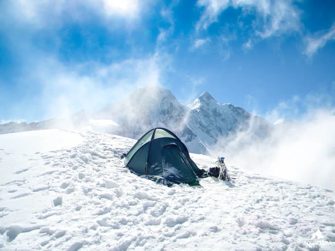
Traill's Pass (17,427 ft) is not a trek; it is one of the most notoriously dangerous glaciated crossings in the Indian Himalayas. Named after George William Traill, the British Commissioner of Kumaon who first crossed it in 1830, the pass acts as a high-altitude saddle between Nanda Devi and Nanda Kot. It connects the deeply forested Pindari glacier valley with the desolate, trans-Himalayan Milam glacier valley (Gori Ganga). Because the pass approach consists of near-vertical ice walls and highly unstable crevassed glaciers on both flanks, successful crossings are exceedingly rare in modern times, often going years without a single team making it over. The trek begins as the standard Pindari Glacier route from Loharkhet, but at Zero Point, it transforms into a sheer technical alpine climb requiring fixed ropes, crampons, ice pitons, and immense psychological resolve.
Ready to book? Compare verified operators for Traill's Pass Expedition — transparent pricing, no paid rankings.
Quick Facts
Duration
Max Altitude
Difficulty
Best Time
Trek Distance
Trail Atmosphere
Stargazing
Class 1 Dark Sky
Scent Profile
Silence Level
~10 dB
Vertigo Factor
5 / 10
Primarily a cumulative fatigue and joint & muscle impact challenge
An elite-level undertaking with extreme cumulative fatigue, joint & muscle impact, and altitude exposure. This route will push every dimension of your physical and mental endurance to the limit.
Iconic Spots
The Summit Saddle
Getting There
Route to Base
Train to Kathgodam, jeep to Bageshwar, then Loharkhet
Base Village
Loharkhet (Entry) / Munsiyari (Exit)
5,700 ft
Nearest Railhead
Kathgodam Railway Station (KGM)
Nearest Airport
Pantnagar Airport (PGH) / Bareilly (BEK)
Last ATM
Bageshwar
Nearest Medical Facility
Requires Heli-Evac. Otherwise, Munsiyari or Bageshwar (days away).
Mobile Signal
Total dark zone for 12 straight days.
Water Sources
On the glacier, you must melt snow using white-gas stoves. Hydration is entirely manual.
Charging
Zero charging.
For Drivers
Road Condition
Standard hill drives on both entry and exit legs.
Bageshwar / Munsiyari
Trail Culinary & Diet
Don't miss the N/A
Buy specialized diet items at Bageshwar
The Content & Remote Hub
No DronesStrictly illegal due to border exits.Top Vlog Spots
Video Calls
none
Est. 0 Mbps
UPI Reliability
1/10
Base WiFi Available
Guide Wisdom
Caution
If the snow bridges look soft at 4:00 AM on the icefall, turn around and abort the expedition. Falling into a glacial crevasse here is completely un-survivable.
Explore In Detail
Day by Day Itinerary
15-day route reaching 17,428ft. Covers 65km of varied terrain.
→ See full itinerary with altitude profileDifficulty & Fitness
Rated extreme. Extreme. You are walking on shifting glaciers, jumping over hidden crevasses, and ascending 60+ degree ice walls using ropes.
→ See difficulty breakdown and fitness guideCost & Pricing
Packages range from ₹60,000 to ₹90,000. Inclusions and hidden costs vary by operator tier.
→ See full cost breakdownPermits and Regulations
Heavily restricted dual-valley permit required. You must obtain clearance from the Forest Department in Bageshwar (entry) and the SDM at Munsiyari (ILP for exit). Indian Mountaineering Foundation (IMF) expedition guidelines strictly apply.
Learn more about how we vet operators and ensure transparency on our why MountRoutes page.
Packing List
High-Alpine Technical Climbing
- 12-point crampons (Absolutely mandatory. You cannot step onto the Pindari icefall without them)
- Ice Axe & Ascender/Jumar
- Climbing Harness & multiple carabiners
Extreme Weather Gear
- Premium Expedition Grade Sleeping Bag (-25°C comfort rating minimum)
- Double-layer mountaineering boots (Plastic shelled)
- Gore-Tex Hardshell suit (Wind speeds on the saddle frequently exceed 80km/h)
Navigation & Medical
- Diamox & Dexamethasone (For immediate HACE intervention)
- Category 4 Glacier Glasses
- Multiple 50m static ropes (Operator should supply, but critical to verify)
Flora & Fauna
Flora
Fauna
George Traill crossed it out of obsession rather than necessity. Locals largely believed the pass was cursed due to its massive casualty rate over the centuries.
— Local folklore
Spiritual & Cultural Significance
Deep mythology ties the pass to the divine presence of Goddess Nanda.
🕐 Shrine Timings: N/A
Temple Protocols
Frequently Asked Questions
Is Traill's Pass a trekking route?
No. It is an extreme alpine climbing expedition crossing. You will spend days walking on crevassed ice fields and ascending 60-degree ice walls.
Can I do this if I've done Roopkund or Goechala?
No. You need certified mountaineering training (Basic/Advanced Mountaineering Course) and direct experience using ice axes, crampons, and roped-up glacier travel.
Why is it considered so dangerous?
The Pindari icefall leading up to the pass is heavily broken with hidden crevasses. Snow bridges collapse frequently. Furthermore, the descent into the Lawan/Milam valley is a sheer, avalanche-prone ice drop.
Where does the expedition start?
It starts exactly like the Pindari Glacier trek at Loharkhet, moving up through Khati and Dwali to Phurkia.
How many days does it take?
Usually 14 to 16 days. The weather above zero point is incredibly unpredictable, demanding multiple buffer days for storm pin-downs.
Will I need to carry my own heavy gear?
Yes. Mules cannot cross the Pindari zero point. High Altitude Porters (HAPs) will carry the main expedition tents and ropes, but you must carry your heavy personal technical load on the ice.
Is mobile network available?
Complete dark zone after entering the Pindari valley, lasting for nearly 12 days until you exit towards Munsiyari.
What is the peak altitude?
The technical saddle of Traill's Pass sits at 17,427 ft (5,312m).
Are permits difficult to get?
Extremely. Because it exits into the Milam/Lawan valley near the Tibetan border, the Inner Line Permit (ILP) process is intensely scrutinized by the ITBP.
What happens if we can't cross?
This is highly common. If the ice walls are too unstable or weather turns, the expedition leader will abort. You will retrace your steps back down the Pindari valley.
Other Expeditions Guides
Still deciding?
Compare routes side-by-side to find the perfect match for your fitness, dates, and budget.
Everything you need to know, in one place. Someone else in your group needs to see this.
Planning Traill's Pass Expedition?
Get route conditions, operator updates, and season windows before booking.
No spam. Only useful updates.
Ready to walk this route?
You’ve read the guide, now find the perfect local team to take you there. Compare our verified list of operators.
Compare verified operators