Essential Planning Guide
Lamkhaga Pass Expedition — Complete Guide (2026)
Introduction
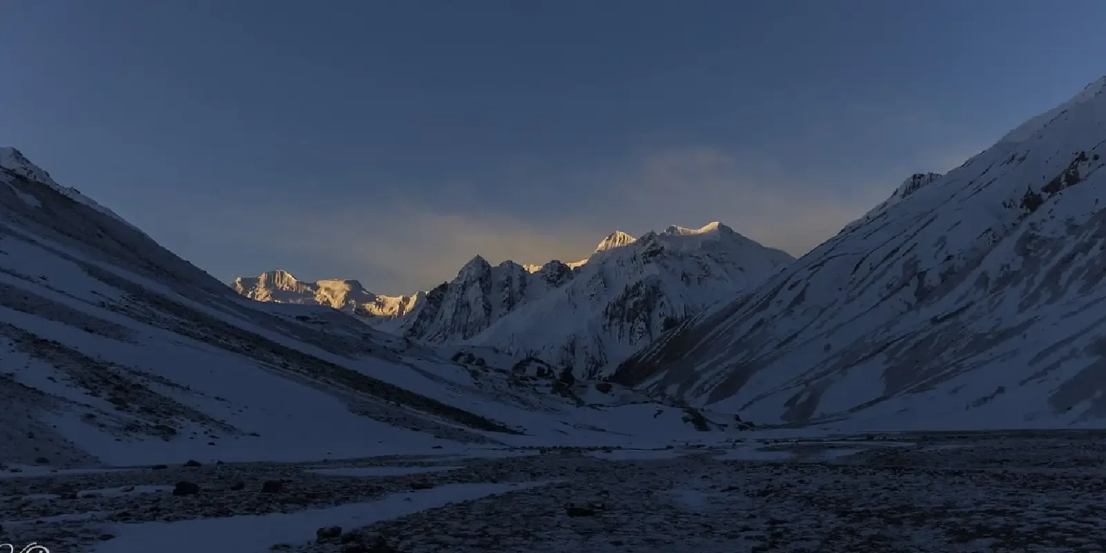
The Lamkhaga Pass is not just a trek; it is a full-scale expedition through the most isolated glacial wilderness of the Indo-Tibetan border. Linking the lush Harsil valley of Garhwal with the remote Baspa valley of Kinnaur, this 17,320 ft pass is as legendary as it is lethal. The trail traverses massive glaciers, avoids deep crevasses, and climbs vertical walls of ice and scree. Historically an obscure shepherd route, it was brought to the attention of the world by early 20th-century explorers. Today, it stands as the ''Holy Grail'' for serious trekkers—a journey of absolute self-sufficiency through a landscape where the mountains are giants and the silence is deafening. It is a true trans-Himalayan traverse, shifting from the dense cedar forests of Uttarakhand to the arid, high-altitude desert spires of Himachal.
Ready to book? Compare verified operators for Lamkhaga Pass Expedition — transparent pricing, no paid rankings.
Quick Facts
Duration
Max Altitude
Difficulty
Best Time
Trek Distance
Trail Atmosphere
Scent Profile
Vertigo Factor
5 / 10
Primarily a joint & muscle impact and cumulative fatigue challenge
A demanding expedition with extreme joint & muscle impact, cumulative fatigue, and altitude exposure. This route will push every dimension of your physical and mental endurance to the limit.
Iconic Spots
Nelang Valley Overlook
The Chitkul Wall
Getting There
Route to Base
Drive from Uttarkashi (UK) or Shimla (HP)
Base Village
Harsil / Chitkul
8,400 ft
Nearest Railhead
Chandigarh Railway Station (IXC)
Nearest Airport
Kullu-Manali Airport, Bhuntar (KUU) / Chandigarh (IXC)
Last ATM
Bhatwari (UK) or Sangla (HP).
Nearest Medical Facility
Government Hospital Uttarkashi or Reckong Peo.
Mobile Signal
Jio Airtel till Harsil only,BSNL in Harsil and Chitkul village
Water Sources
Glacier melt streams (purification mandatory)Filtered supply at Kyarkoti
Charging
Zero on trail. Solar chargers essential for expedition electronics.
For Drivers
Trail Culinary & Diet
The Content & Remote Hub
No DronesVideo Calls
none
UPI Reliability
1/10
The Crossover Legend
Key point
The wind on top of Lamkhaga is so strong it can push a full-grown trekker off their feet. Stay low and use your ice axe for stability on the summit ridge.
Explore In Detail
Day by Day Itinerary
10-day route reaching 17,329ft. Covers 78km of varied terrain.
→ See full itinerary with altitude profileDifficulty & Fitness
Rated challenging. Moving over highly unstable moraine and crevassed glaciers. The final 300m climb to the pass is a 60-degree ice/snow incline.
→ See difficulty breakdown and fitness guideCost & Pricing
Packages range from ₹25,000 – ₹40,000. Inclusions and hidden costs vary by operator tier.
→ See full cost breakdownPermits and Regulations
Special Inner Line Permits (ILP) and Forest Permits are required from both the Uttarkashi (UK) and Kinnaur (HP) administrations. Every trekker must sign a risk-waiver and register at ITBP posts at Nelang/Harsil and Chitkul. Professional expedition guides are mandatory.
Learn more about how we vet operators and ensure transparency on our why MountRoutes page.
Packing List
Technical Hardware (Mandatory)
- Crampons or high-quality Microspikes
- Assorted rope / Slings (for group safety on glacier)
- Sturdy mountaineering boots (Grade B3)
- Technical ice axe (one per group guide is mandatory)
- Category 4 Glacier Goggles (UV Protection essential)
Clothing
- Expedition-grade down jacket (-25°C rated)
- Gore-Tex outer shell (Wind and Waterproof)
- 4 pairs of technical mountaineering socks
- Insulated Balaclava and buff
- Waterproof and windproof technical gloves (2 pairs)
Flora & Fauna
Flora
Fauna
Local shepherds believe the pass belongs to the ''Van-Devi'' (Forest Goddess) and a small prayer at Rani Kanda is essential for safe passage.
— Local folklore
Spiritual & Cultural Significance
🕐 Shrine Timings: N/A
Temple Protocols
- •Respect border post protocols
- •Don''t photograph ITBP installations
Frequently Asked Questions
Is there any phone network on the pass?
Absolutely zero. The last network is at Harsil and the next one at Chitkul. You are out of contact for 7-8 days. A satellite phone (legal permitting) or VHF radio is highly recommended for expedition groups.
Can beginners attempt this?
No. This is an expert-only trek. You must have prior experience in 16,000+ ft pass crossings and basic understanding of glacier movement.
Are ropes and crampons really necessary?
Yes, absolutely. You will be traversing the Jalandhari glacier and climbing a 60-degree ice wall to the pass. Attempting this without technical gear and a roped team is extremely dangerous.
How hard is the river crossing?
The river crossings, especially the Baspa river on the descent towards Chitkul, can be deadly. They must be crossed early in the morning before the glacial melt swells the water level.
Other Expeditions Guides
Still deciding?
Compare routes side-by-side to find the perfect match for your fitness, dates, and budget.
Everything you need to know, in one place. Someone else in your group needs to see this.
Planning Lamkhaga Pass Expedition?
Get route conditions, operator updates, and season windows before booking.
No spam. Only useful updates.
Ready to walk this route?
You’ve read the guide, now find the perfect local team to take you there. Compare our verified list of operators.
Compare verified operators