Detailed Route
Traill's Pass Expedition Itinerary — Day by Day Route & Camps
Connects the Pindari Valley to the Milam Valley over a highly volatile glaciated saddle.
Standard RouteThis is the standard mountain pacing for this trek. Specific operators may add an acclimatization day or alter the starting point. Check individual operator schedules for their exact logistics.
Duration
15 Days
Total Distance
65 KM
Max Altitude
17,428 FT
Trek Type
linear
Permits Required Before You Go
Permit Cost
Foreigner Process
Expedition clearance from IMF Delhi required. Very complex.
Nearest Embassy Hub
New Delhi
Day by Day Breakdown
Drive Kathgodam to Loharkhet
Long drive into the Kumaon Himalayas to the start of the Pindari glacier trail.
Key Landmarks
Staying At
Trek Loharkhet to Dhakuri
Steep climb through oak forests to the Dhakuri pass.
Key Landmarks
Staying At
Trek Dhakuri to Khati
Descent into the Pindar valley to reach Khati village.
Key Landmarks
Staying At
Trek Khati to Dwali
Follow the Pindar river upstream.
Key Landmarks
Staying At
Trek Dwali to Phurkia
Short climb leaving the tree line behind.
Key Landmarks
Staying At
Trek Phurkia to Pindari Base Camp
Reach the snout of the Pindari glacier.
Key Landmarks
Staying At
Acclimatization & Load Ferry to ABC
Crucial day. Ferry loads up the glacier and return to sleep low.
Key Landmarks
Staying At
Move to Advanced Base Camp (ABC)
Move camp onto the glacier.
Key Landmarks
Staying At
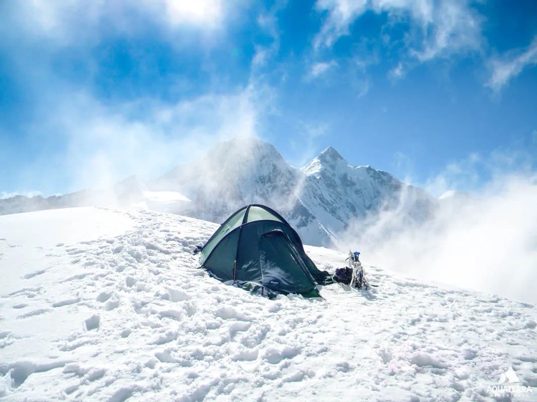
Trek ABC to Traill's Pass Base Camp
Navigate the heavily crevassed icefall to the base of the pass.
Key Landmarks
Staying At
Rope Fixing & Route Opening
Guides fix ropes on the steep approach.
Key Landmarks
Staying At
Pass Day: BC to Traill's Pass to Lawan BC
The monstrous 70-degree ice wall descent requires absolute focus and fixed ropes.
Key Landmarks
Staying At
Reserve Day for Bad Weather
Buffer day in case of whiteouts on the pass.
Staying At
Trek Lawan BC to Martoli
Descend the Lawan valley to the abandoned village.
Key Landmarks
Staying At
Trek Martoli to Bugdiyar
Follow the Gori Ganga river downstream.
Key Landmarks
Staying At
Trek Bugdiyar to Munsiyari
Final trek to the roadhead.
Key Landmarks
Staying At
Trek Extensions & Add-ons
Nanda Devi East Base Camp Detour
+2 DaysAfter descending into Lawan, push slightly up the adjacent valley to view the Nanda Devi East base camp before turning towards Milam.
Also on this trek
Ready to book? Compare verified operators for Traill's Pass Expedition — transparent pricing, no paid rankings.
Still deciding?
Compare routes side-by-side to find the perfect match for your fitness, dates, and budget.
Day by day, camp by camp. Send this to your group so everyone's on the same page.
Love this itinerary?
Find operators who follow this exact route with verified acclimatization days.
Find matching operators