Essential Planning Guide
Satopanth Bhagirath Kharak Traverse Expedition — Complete Guide (2026)
Introduction
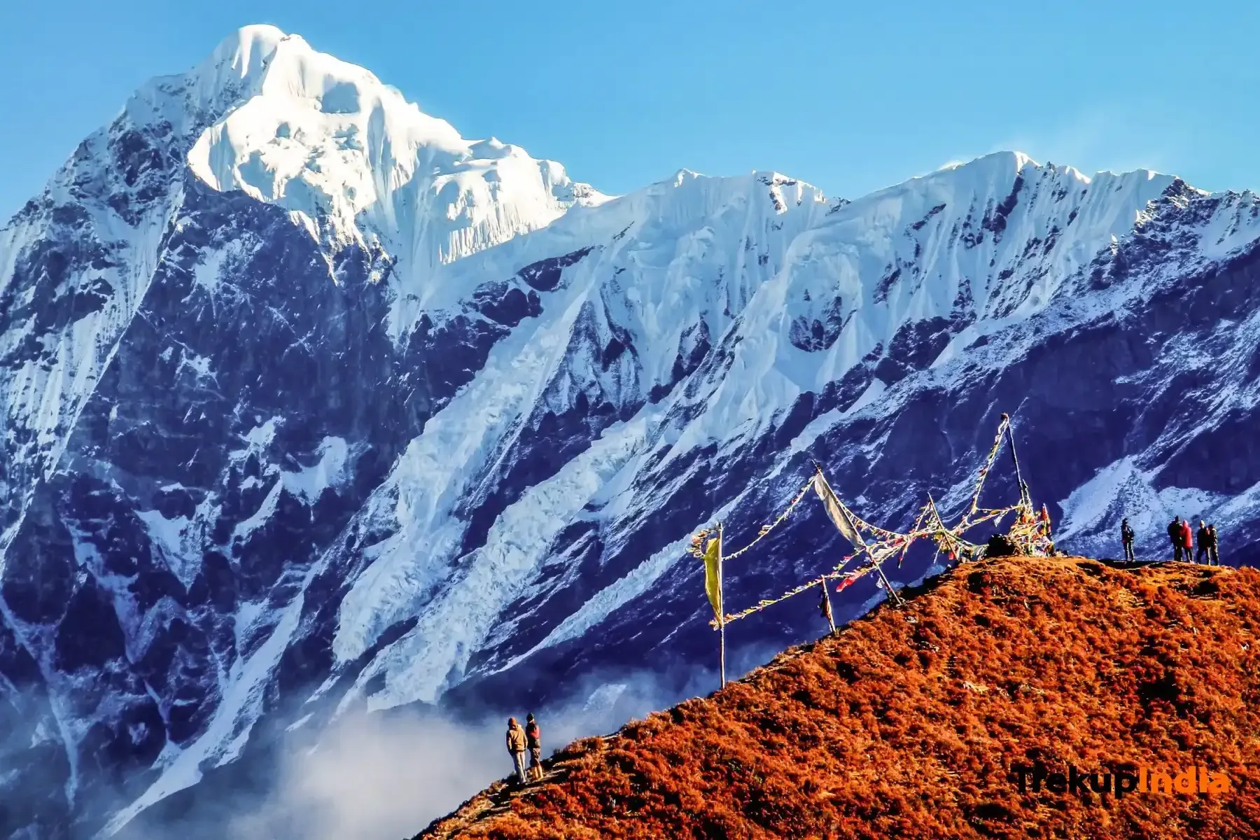
The Satopanth Bhagirath Kharak Traverse is one of the most spiritually and physically profound journeys in the Garhwal Himalayas. Starting from the sacred town of Badrinath, the trail follows the Alaknanda River to its source at the Alkapuri glacier, before ascending into the massive glacial basin of Bhagirath Kharak. The destination, Satopanth Tal (15,100 ft), is a triangular, emerald-green lake where the Hindu Trinity (Brahma, Vishnu, Mahesh) is believed to meditate on each corner. Surrounded by the towering spires of Neelkanth, Swargarohini, and Chaukhamba, the trek is a crossing of high-altitude moraines and permanent ice fields. It is a raw, jagged landscape of moving glaciers and falling stones, traditionally known as the ''Swargarohini'' path—the stairway to heaven.
Ready to book? Compare verified operators for Satopanth Bhagirath Kharak Traverse Expedition — transparent pricing, no paid rankings.
Quick Facts
Duration
Max Altitude
Difficulty
Best Time
Trek Distance
Trail Atmosphere
Scent Profile
Vertigo Factor
4 / 10
Primarily a cardio demand and cumulative fatigue challenge
A capable trekker's route with extreme cardio demand, cumulative fatigue, and joint & muscle impact. This route will push every dimension of your physical and mental endurance to the limit.
Iconic Spots
Satopanth Tal
Neelkanth Ridge
Getting There
Route to Base
Drive from Rishikesh (300 km) via Joshimath
Base Village
Badrinath / Mana
10,300 ft
Nearest Railhead
Dehradun (DDN) / Haridwar (HW)
Nearest Airport
Jolly Grant Airport, Dehradun (DED)
Last ATM
Badrinath (multiple ATMs). Cash is king beyond Mana.
Nearest Medical Facility
Government Hospital Badrinath / Army Hospital Joshimath.
Mobile Signal
Jio and Airtel till Badrinath, BSNL limited till Mana Village
Water Sources
Alkapuri Glacier StreamFiltered glacier melt at campsSatopanth Lake (Ritual use only)
Charging
Last point at Badrinath. No electricity on the trail.
For Drivers
Trail Culinary & Diet
The Content & Remote Hub
No DronesVideo Calls
none
UPI Reliability
1/10
The Silent Peaks
Key point
It is said that Sage Vyasa and King Yudhisthira walked this exact moraine. The silence at Satopanth is unlike any other lake in Garhwal.
Explore In Detail
Day by Day Itinerary
8-day route reaching 15,397ft. Covers 53km of varied terrain.
→ See full itinerary with altitude profileDifficulty & Fitness
Rated moderate. Brittle, unstable glacial moraine. Crossing the debris of the Bhagirath Kharak glacier requires excellent balance and constant alertness for rockfall.
→ See difficulty breakdown and fitness guideCost & Pricing
Packages range from ₹20,000 – ₹35,000. Inclusions and hidden costs vary by operator tier.
→ See full cost breakdownPermits and Regulations
Forest Permit is mandatory from the DFO office in Joshimath. Every trekker must have a medical fitness certificate. Solo trekking is strictly prohibited due to the unpredictable nature of the Bhagirath Kharak glacier. Professional guides are mandatory.
Learn more about how we vet operators and ensure transparency on our why MountRoutes page.
Packing List
Glacial Protection
- Heavy-duty mountaineering boots (B2/B3 grade recommended)
- Gaiters (essential for scree and snow)
- Microspikes (for icy moraine sections)
- Trekking poles with snow baskets
- Category 4 Glacier Goggles
Clothing
- High-altitude down jacket (-15°C rated)
- Windproof and Waterproof shell
- Thermal base layers (merino wool)
- Fleece mid-layers
- Insulated gloves and Balaclava
Flora & Fauna
Flora
Fauna
The ''Swargarohini'' massif nearby is believed to be the only peak where a mortal (Yudhisthira) could enter heaven without dying.
— Local folklore
Spiritual & Cultural Significance
🕐 Shrine Timings: Sunrise to Sunset
Temple Protocols
- •Modest clothing
- •No leather on many trail sections
- •Ask before filming Sadhus
Frequently Asked Questions
is the lake always triangular?
Yes, its distinct three-cornered shape is natural and remains clearly visible unless the lake is completely buried under heavy winter snow.
Can we see the Swargarohini steps?
From the lake shore, you can see the Swargarohini massif. One of its ridges looks remarkably like a set of gigantic, snow-covered stairs, giving rise to the ''Stairway to Heaven'' legend.
Other Expeditions Guides
Still deciding?
Compare routes side-by-side to find the perfect match for your fitness, dates, and budget.
Everything you need to know, in one place. Someone else in your group needs to see this.
Planning Satopanth Bhagirath Kharak Traverse Expedition?
Get route conditions, operator updates, and season windows before booking.
No spam. Only useful updates.
Ready to walk this route?
You’ve read the guide, now find the perfect local team to take you there. Compare our verified list of operators.
Compare verified operators