Detailed Route
Satopanth Bhagirath Kharak Traverse Expedition Itinerary — Day by Day Route & Camps
Starts from Badrinath, tracking the origins of the Alaknanda river up to the sacred Satopanth Tal and beyond.
Standard RouteThis is the standard mountain pacing for this trek. Specific operators may add an acclimatization day or alter the starting point. Check individual operator schedules for their exact logistics.
Duration
8 Days
Total Distance
53 KM
Max Altitude
15,397 FT
Trek Type
linear
Permits Required Before You Go
Permit Cost
Where to Get
Joshimath / Badrinath
Documents
Passport/Aadhar, Medical Fitness Certificate, Passport size photos
Foreign Nationals
Foreigners need additional clearance from the District Magistrate, Chamoli.
Day by Day Breakdown
Arrive in Badrinath & Acclimatization
Spend the day in Badrinath. Visit the temple and dip in the Tapt Kund (hot springs) to prepare.
Key Landmarks
Staying At
Trek: Badrinath to Mana & Laxmiban
Enter the valley beyond the last village. Trek past the thundering Vasudhara Falls to camp in the birch forest of Laxmiban.
Key Landmarks
Staying At
Trek: Laxmiban to Chakratirth
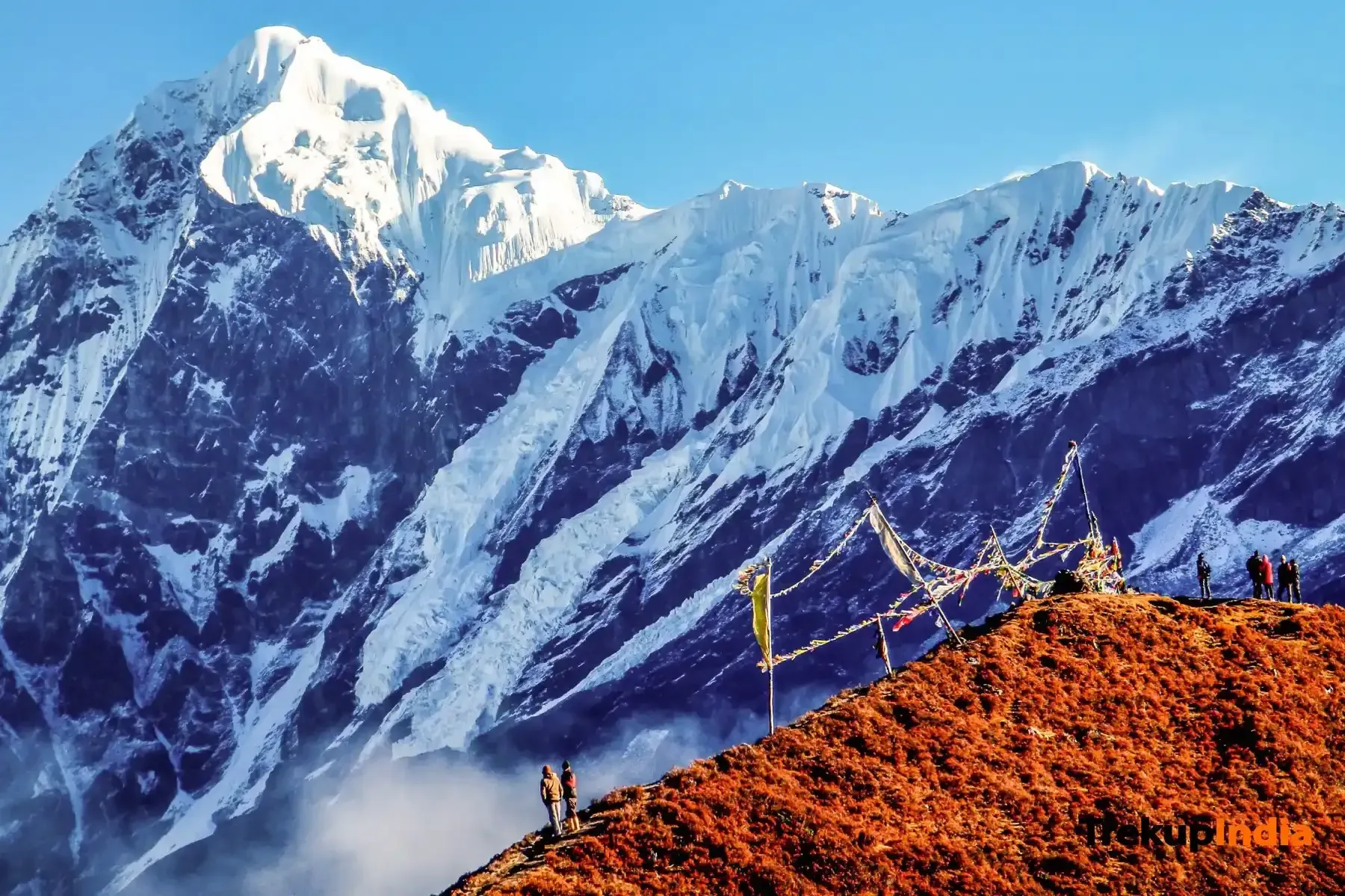
The trail gets tougher, walking over the terminal moraine of the Dhano Glacier. Huge peaks like Chaukhamba start revealing themselves.
Key Landmarks
Staying At
Trek: Chakratirth to Satopanth Tal
A short but demanding walk over the maze of the Satopanth glacier to reach the sacred triangular lake.
Key Landmarks
Staying At
Explore: Bhagirathi Kharak Glacier
Traverse the difficult glacial divide toward Bhagirathi Kharak glacier. Explore the snout and return to camp or camp nearby.
Key Landmarks
Staying At
Descent: Bhagirathi Kharak / Satopanth to Chakratirth
Begin the return journey, retracing your steps over the moraine back to the meadows of Chakratirth.
Key Landmarks
Staying At
Descent: Chakratirth to Mana and Badrinath
A long descent crossing Laxmiban, passing Vasudhara falls, and ending the trek at Mana village before driving to Badrinath.
Key Landmarks
Staying At
Drive: Badrinath to Dehradun
Long 11-hour drive back to the plains.
Key Landmarks
Staying At
Trek Extensions & Add-ons
Also on this trek
Ready to book? Compare verified operators for Satopanth Bhagirath Kharak Traverse Expedition — transparent pricing, no paid rankings.
Still deciding?
Compare routes side-by-side to find the perfect match for your fitness, dates, and budget.
Day by day, camp by camp. Send this to your group so everyone's on the same page.
Love this itinerary?
Find operators who follow this exact route with verified acclimatization days.
Find matching operators