Essential Planning Guide
Pin Parvati Pass Expedition — Complete Guide (2026)
Introduction
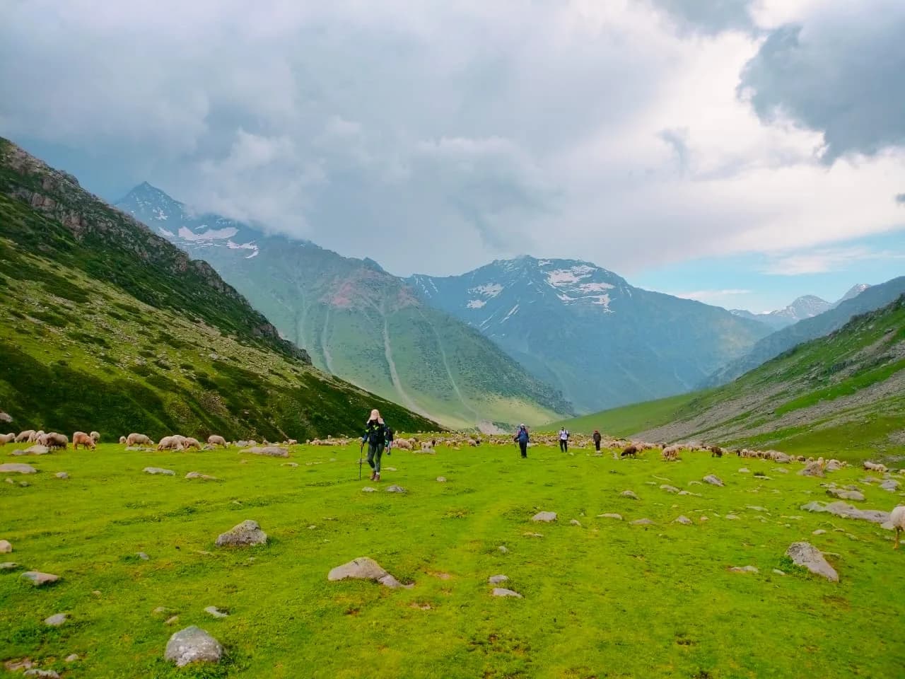
Pin Parvati Pass is the most dramatic geographical crossover in the Indian Himalayas. It is a 17,500 ft glaciated pass that connects the lush, green Parvati Valley of Kullu with the stark, bone-dry moon-scape of Spiti. In a single crossing, you transition from monsoon-soaked forests and hot springs to a cold, Buddhist high-desert where rain is a once-a-year event. The trek is an 11-day expedition that starts from Barshaini (near Kasol) and ends at Mudh village in the Pin Valley. It passes through the entire ecological pyramid of the Himalayas — from sub-tropical, to temperate, to alpine, to glacial, to trans-Himalayan desert. The pass itself is a technical challenge: a crevassed glacier, steep ice walls, and 17,500 ft of altitude where oxygen is at 57%. This is not a trek — it is an expedition. It is the jewel in the crown of Himalayan trekking and the gold standard by which all other high passes are measured.
Ready to book? Compare verified operators for Pin Parvati Pass Expedition — transparent pricing, no paid rankings.
Quick Facts
Duration
Max Altitude
Difficulty
Best Time
Trek Distance
Trail Atmosphere
Stargazing
Class 1 Dark Sky
Scent Profile
Silence Level
~10 dB
Vertigo Factor
5 / 10
Primarily a cumulative fatigue and joint & muscle impact challenge
An elite-level undertaking with extreme cumulative fatigue, joint & muscle impact, and altitude exposure. This route will push every dimension of your physical and mental endurance to the limit.
Iconic Spots
Mantalai Glacial Pool
Pin Glacier Spire
Pin Valley Desert Colors
Getting There
Route to Base
Fly to Bhuntar or take overnight Volvo from Delhi to Kullu
Base Village
Barshaini (Start) / Mudh-Kaza (End)
6,500 ft
Nearest Railhead
Pathankot / Chandigarh
Nearest Airport
Bhuntar (Kullu)
Last ATM
Bhuntar (Start). Kaza (End). Zero banking on trail.
Nearest Medical Facility
Kullu District Hospital
Mobile Signal
Zero connectivity for 95% of the trek. Signal only at Barsheni entry and intermittent BSNL at Kaza/Mud exit.
Water Sources
Follows the Parvati and Pin rivers. Natural glacial streams are the primary source; filtration is mandatory due to silt and livestock presence.
Charging
Zero electricity on the entire trail. Last reliable charging at Barsheni (Start) and Mud village (End).
For Drivers
Road Condition
Winding mountain roads to Barshaini. Spiti side exit (Kaza) is more remote with 10-hr drive back to Manali.
Kullu / Kaza
Trail Culinary & Diet
Don't miss the Thukpa at Mud Village
Buy specialized diet items at Kasol / Kaza
The Content & Remote Hub
No DronesStrictly prohibited within National Park core zones.Top Vlog Spots
Video Calls
none
Est. 0 Mbps
UPI Reliability
1/10
Base WiFi Available
The Great Divide
Key point
Pin Parvati is the only trek in India where you walk from a monsoon-soaked forest to a rain-shadow desert in a single crossing. The ecological contrast is without parallel.
Key point
Mantalai Lake — the source of the Parvati River — is one of the holiest lakes in Hinduism. Reaching it feels like arriving at the beginning of time.
Explore In Detail
Day by Day Itinerary
11-day route reaching 17,451ft. Covers 110km of varied terrain.
→ See full itinerary with altitude profileDifficulty & Fitness
Rated extreme. Forest (Days 2-3), moraine (Days 4-6), glacier (Days 7-8), desert (Days 9-10). The glacier is the crux — crevasses, ice walls, and extreme altitude.
→ See difficulty breakdown and fitness guideCost & Pricing
Packages range from ₹28,000 – ₹43,000. Inclusions and hidden costs vary by operator tier.
→ See full cost breakdownPermits and Regulations
Dual-zone permits required. The Parvati Valley side requires a permit from the Kullu Forest Division. The Pin Valley (Spiti) side is inside the Pin Valley National Park — a separate GHNP/Pin NP permit is needed, issued at the Kaza Forest Office or at the Mudh checkpoint. Indian nationals need a photo ID and a medical fitness certificate (mandatory for the expedition grade). Foreigners need Inner Line Permits as parts of the trail border restricted zones. ITBP registration may be required at the Parvati Valley entry point. Technical gear (ropes, ice axes, crampons) is mandatory for the glacier crossing and is verified at checkpoints.
Learn more about how we vet operators and ensure transparency on our why MountRoutes page.
Packing List
Expedition Clothing
- Heavy down jacket rated to -20°C
- 3 Thermal base layers
- 2 Fleece layers
- Waterproof hardshell jacket and pants
- Balaclava and woolen cap
- Expedition gloves (waterproof, insulated)
- Woolen socks (5 pairs)
Technical Gear
- Mountaineering boots (crampon-compatible, mandatory)
- Crampons (12-point, mandatory)
- Ice axe (mandatory for pass section)
- Climbing harness and carabiners
- Gaiters (snow-rated)
- Rope (provided by operator usually)
Camp Gear
- 4-season sleeping bag rated to -20°C
- Sleeping mat (R-value 4+)
- Headlamp with spare batteries
- UV400 Category 4 Glacier Sunglasses
- Sunscreen SPF 50+
- Power bank 20000mAh
- 3L Water capacity
- Personal medical kit (Diamox, Kneecaps, ORS, Blister tape)
Flora & Fauna
Flora
Fauna
Sacred crossing between the lush, fertile abode of Parvati and the stark spiritual desert of Spiti. Mantalai Lake is highly revered as a source of energy.
— Local folklore
Spiritual & Cultural Significance
Crossing between Shiva's valley and Buddhist Spiti.
🕐 Shrine Timings: N/A
Temple Protocols
- •Nanda Devi Yatra rules apply at Mantalai
Festivals & Dates
Frequently Asked Questions
Can a beginner do Pin Parvati?
Absolutely not. This is a very difficult trek that requires previous high-altitude (15,000 ft+) experience and high physical endurance.
What is the "Ice Wall"?
On the Parvati side of the pass, there is a very steep glacier climb (often called the ice wall) that requires fixed ropes and careful step-cutting.
How is the vegetation different on both sides?
The Parvati side (Kullu) is lush green with thick pine forests, while the Pin side (Spiti) is a high-altitude desert with no trees.
What happens if we get stuck at Mantalai?
Teams must wait for a weather window or retreat. The crossing is not attempted in heavy fog or snowstorms.
Are there any river crossings on the Spiti side?
Yes, crossing the Pin river shortly after the pass can be challenging if the water level is high; it usually requires a rope-line.
What is the highest point?
The Pin Parvati Pass at 17,457 ft is the summit highlight.
Is satellite phone available?
Local guides often carry satellite phones, but personal devices are not allowed under Indian border regulations.
Where is the last ATM?
Bhuntar (Kullu) is the last reliable point. Carry all required cash from there.
What is the recommended age limit?
Generally 16 to 55 years, provided the individual is highly fit and acclimatized.
Other Expeditions Guides
Still deciding?
Compare routes side-by-side to find the perfect match for your fitness, dates, and budget.
Everything you need to know, in one place. Someone else in your group needs to see this.
Planning Pin Parvati Pass Expedition?
Get route conditions, operator updates, and season windows before booking.
No spam. Only useful updates.
Ready to walk this route?
You’ve read the guide, now find the perfect local team to take you there. Compare our verified list of operators.
Compare verified operators