Essential Planning Guide
Dhumdhar Kandi Pass Expedition — Complete Guide (2026)
Introduction
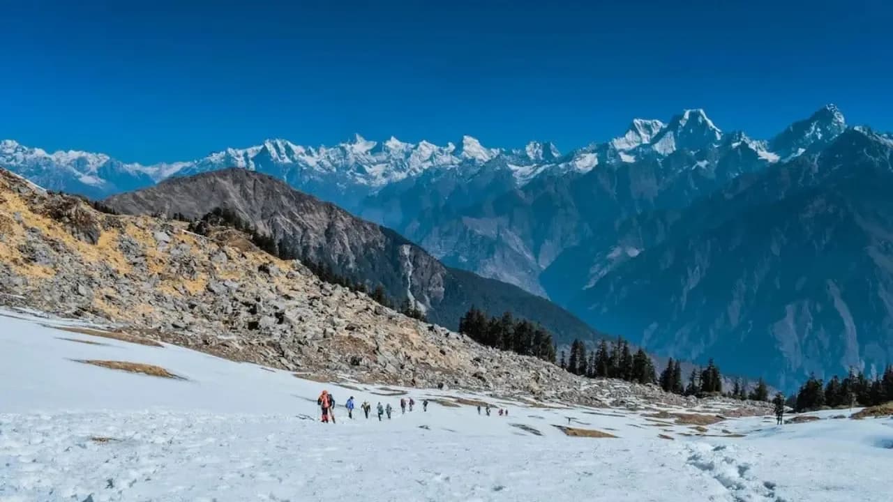
Dhumdhar Kandi is one of the most forgotten, terrifying, and formidable passes in the Indian Himalayas. Originally crossed by ancient traders and legendary explorers like James Baillie Fraser in the 1820s, it functions as a massive, heavily glaciated high-altitude bridge connecting the Bhagirathi valley (near Jhala/Harsil) directly to the remote reaches of the Tons and Yamuna valleys via the Ruinsara Lake. Situated at an intimidating 18,000 ft, passing directly over the highly crevassed Jhala and Kalanag glaciers, it is an extreme mountaineering challenge matching the difficulty of Auden's Col. Trekkers navigate dense, bear-infested alpine woods, trackless steep scree, and huge vertical ice walls. The route runs incredibly close to Mt. Swargarohini, Black Peak (Kalanag), and Bandarpoonch, offering arguably the wildest and most isolated glacial expedition in Uttarakhand.
Ready to book? Compare verified operators for Dhumdhar Kandi Pass Expedition — transparent pricing, no paid rankings.
Quick Facts
Duration
Max Altitude
Difficulty
Best Time
Trek Distance
Trail Atmosphere
Stargazing
Class 1 Dark Sky
Scent Profile
Silence Level
~10 dB
Vertigo Factor
5 / 10
Primarily a joint & muscle impact and cumulative fatigue challenge
A demanding expedition with extreme joint & muscle impact, cumulative fatigue, and altitude exposure. This route will push every dimension of your physical and mental endurance to the limit.
Iconic Spots
The Kalanag Ice Descent
Getting There
Route to Base
Drive from Dehradun via Mussoorie to Uttarkashi, then further up to Jhala
Base Village
Jhala (Entry) / Sankri (Exit)
8,000 ft
Nearest Railhead
Dehradun Railway Station (DDN)
Nearest Airport
Jolly Grant Airport, Dehradun (DED)
Last ATM
Uttarkashi
Nearest Medical Facility
Uttarkashi Main Hospital (Days away by foot)
Mobile Signal
Total dark zone for 9 days.
Water Sources
On the glacier, snow must be melted by stoves.
Charging
Zero charging after Jhala.
For Drivers
Road Condition
Standard mountain roads on entry to Jhala and exit from Sankri.
Uttarkashi / Purola
Trail Culinary & Diet
Don't miss the N/A
Buy specialized diet items at Uttarkashi
The Content & Remote Hub
No DronesExpedition clearance heavily scrutinizes drone usage.Top Vlog Spots
Video Calls
none
Est. 0 Mbps
UPI Reliability
1/10
Base WiFi Available
Guide Wisdom
Caution
The descent off Dhumdhar requires immense ice-axe proficiency. You are descending the very glacier that creates the sacred Ruinsara river; respect its volatility.
Explore In Detail
Day by Day Itinerary
12-day route reaching 18,012ft. Covers 80km of varied terrain.
→ See full itinerary with altitude profileDifficulty & Fitness
Rated challenging. A completely broken, trackless route requiring intense scree navigation, rope-fixing on the pass, and jumping over active, open crevasses.
→ See difficulty breakdown and fitness guideCost & Pricing
Packages range from ₹50,000 to ₹75,000. Inclusions and hidden costs vary by operator tier.
→ See full cost breakdownPermits and Regulations
Strictly regulated. Requires DFO permits from Uttarkashi, Inner Line Permits, and clearance from the Indian Mountaineering Foundation (IMF). An expedition leader with formal MOAC/AMC certification is legally mandatory.
Learn more about how we vet operators and ensure transparency on our why MountRoutes page.
Packing List
Extreme Technical gear
- 12-point crampons (Essential for the Kalanag glacier crossing)
- Ice Axe and climbing harness
- Jumar and locking carabiners
High-Altitude Clothing
- Premium Expedition Grade Sleeping Bag (-20°C comfort rating minimum)
- Expedition Down Jacket (Crucial for the Base Camp at 15,800 ft)
- Double-layer mountaineering boots (Plastic or highly insulated)
Survival & Logistics
- Glacier glasses (Category 4 UV to prevent snow blindness on the pass)
- Diamox & Dexamethasone for emergency HACE interventions
- Personal distress beacon/Garmin InReach (Recommended for the expedition leader)
Flora & Fauna
Flora
Fauna
The pass traces its roots to ancient herders. The local myth says if the mountain gods are angered, the Kalanag glacier will swallow the expedition entirely.
— Local folklore
Spiritual & Cultural Significance
Ruinsara lake is sacred, but the pass itself is primarily a historic trade/herding route.
🕐 Shrine Timings: N/A
Temple Protocols
Frequently Asked Questions
How does this compare to Auden's Col?
It is in the exact same risk and difficulty upper-echelon. Both involve 18,000 ft altitudes, massive active glaciers, and technical rope usage. Dhumdhar is arguably less trafficked, meaning no preexisting trails exist.
Can regular trekkers do this?
Absolutely not. This is a technical expedition. You need verified mountaineering training (AMC/BMC) and prior exposure to ropes and crampons.
Is there mobile connectivity?
You lose all network shortly after leaving Jhala. You will remain in a total dark zone for 9 days until you reach the Har Ki Dun/Sankri region on the descent.
Are mules used?
Mules cannot cross the Kalanag glacier. You must rely entirely on specialized High Altitude Porters (HAPs) to carry expedition tents and ropes over the pass.
What is the peak altitude?
The saddle of Dhumdhar Kandi Pass sits at approximately 18,000 ft (5,500m).
What if the weather turns bad?
You turn back. Trying to force Dhumdhar Kandi in a blizzard guarantees fatalities. You must pack buffer days specifically to outwait storms at Base Camp.
Can I do this from Sankri to Jhala instead?
Yes, it can be crossed from either direction, but the Jhala to Sankri route is more common as it allows a slightly better acclimatization profile in the Siyan Gad gorge.
Do I see the Har Ki Dun valley?
Yes, upon descending from the pass into the Ruinsara valley, you eventually merge with the established paths leading from Har Ki Dun down to Taluka.
Which peaks are visible?
You get impossibly close to the Swargarohini massif and Kalanag (Black Peak). Bandarpoonch is also clearly visible.
Why is it so rarely done?
Because the approach is incredibly harsh, the glacier is heavily broken with hidden crevasses, and permits are hard to organize for a dual-valley crossing.
Other Expeditions Guides
Still deciding?
Compare routes side-by-side to find the perfect match for your fitness, dates, and budget.
Everything you need to know, in one place. Someone else in your group needs to see this.
Planning Dhumdhar Kandi Pass Expedition?
Get route conditions, operator updates, and season windows before booking.
No spam. Only useful updates.
Ready to walk this route?
You’ve read the guide, now find the perfect local team to take you there. Compare our verified list of operators.
Compare verified operators