Dhumdhar Kandi Pass Expedition Itinerary — Day by Day Route

Detailed Route

Dhumdhar Kandi Pass Expedition Itinerary — Day by Day Route & Camps

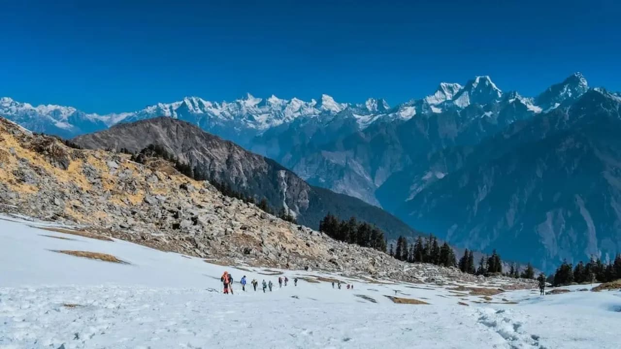
A grueling multi-day traverse through some of the most isolated terrain in the Garhwal Himalayas.

Standard RouteThis is the standard mountain pacing for this trek. Specific operators may add an acclimatization day or alter the starting point. Check individual operator schedules for their exact logistics.

Duration

12 Days

Total Distance

80 KM

Max Altitude

18,000 FT

Trek Type

linear

Altitude Profile

👆 Interactive Route: Tap map to explore segment insights

10,000 ft · Caution Zone14,000 ft · High Altitude ZoneD1D2D3D4D5D6D7D8D916,000 ft18,011 ft2,100 ft
ROUTE / CAMP
ACCLIMATIZATION
VEHICLE SEGMENT
BUFFER / OPTIONAL

Points show end-of-day camp altitude. Summit days show peak altitude reached.

Permits Required Before You Go

Permit Cost

1500

Foreigner Process

Expedition clearance from IMF Delhi required. Complex.

Nearest Embassy Hub

New Delhi

One-Way Traverse Logistics

Day by Day Breakdown

Day 1
9 Hrs
220 KM
drive
8,500 FT
DehradunJhala

Drive Dehradun to Jhala

Long drive to the starting point of the trek near Harsil.

Key Landmarks

Bhagirathi RiverHarsil

Staying At

Jhala Camp
Day 2
6 Hrs
8 KM
trek
11,800 FT
JhalaJhala Kyark

Trek Jhala to Jhala Kyark

Steep climb through dense pine forests to the first meadow.

Key Landmarks

Pine Forests

Staying At

Jhala Kyark Tents
Day 3
7 Hrs
10 KM
trek
13,500 FT
Jhala KyarkSian Gad

Trek Jhala Kyark to Sian Gad / Kyarkoti

Trek through boulder zones towards the Sian Gad stream.

Key Landmarks

Sian Gad Valley

Staying At

Sian Gad Tents
Day 4
6 Hrs
8 KM
trek
15,500 FT
Sian GadDK Base

Trek Sian Gad to Dhumdhar Kandi Base

Enter the moraine zone. First views of the massive Kalanag glacier.

Key Landmarks

Kalanag Glacier Snout

Staying At

DK Base Tents
Day 5
3 Hrs
2 KM
acclimatization
15,500 FT
DK BaseDK Base

Acclimatization / Rope Practice

Rest day. Essential rope and crampon practice on the lower glacier.

Key Landmarks

Lower Icefall

Staying At

DK Base Tents
Day 6⚡ Summit Day
12 Hrs
14 KM
trek
11,800 FT
DK BaseRuinsara Tal

Pass Day: DK Base to Pass to Ruinsara Tal

Start at 2 AM. Heavy crevasse navigation to the 18,011ft pass. Steep descent over the Ruinsara glacier to the lake.

Key Landmarks

Dhumdhar Kandi Pass (18,011ft)Ruinsara Tal

Staying At

Ruinsara Tal Tents
Day 7
6 Hrs
14 KM
trek
8,500 FT
Ruinsara TalOsla

Trek Ruinsara Tal to Osla

Relaxed descent through beautiful pine forests following the Ruinsara Gad to the remote village of Osla.

Key Landmarks

Ruinsara GadOsla Village

Staying At

Osla Homestay / Tents
Day 8
5 Hrs
13 KM
trek
6,400 FT
OslaSankri

Trek Osla to Taluka, Drive to Sankri

Final trek to Taluka roadhead, followed by a short jeep ride to Sankri.

Key Landmarks

Supin RiverTaluka

Staying At

Sankri Hotel
Day 9
9 Hrs
200 KM
drive
2,100 FT
SankriDehradun

Drive Sankri to Dehradun

Long drive back to Dehradun.

Key Landmarks

Mussorie

Staying At

None

Trek Extensions & Add-ons

Har Ki Dun Excursion

+2 Days

After reaching Seema, hike up into the beautiful Har Ki Dun saucer valley before returning to Taluka.

Camp-by-Camp Details

C0

Start Town

Navigation & Route Data

GPX Track Available

Contact your operator for download link

Critical Navigation Notes

Moraine tracking is tricky.

Day by day, camp by camp. Send this to your group so everyone's on the same page.

Love this itinerary?

Find operators who follow this exact route with verified acclimatization days.

Find matching operators

Knowledge Integrity

Help us keep this data ground-truth accurate.

This encyclopedia entry for Dhumdhar Kandi Pass Expedition is curated from a mix of public survey records, first-hand climber accounts, and official permit logs. However, mountains are dynamic. If you have been on this route recently and noticed a change in terrain, water availability, or local regulations, we want to hear from you.

Community Vetted

Last Verified: May 2026

EXPEDITION DATABASE