
Explore
Intelligence
Essential Planning Guide
Black Peak (Kalanag) Expedition — Complete Guide (2026)
Vibe & Scenery
The Experience
Introduction
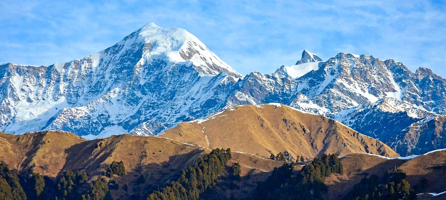
Rising to 6,387 m (20,955 ft), Black Peak—locally known as Kalanag or "Black Cobra"—is the highest summit of the Saraswati Range in the Garhwal Himalayas. Named after the distinctive black rock formation near its summit that resembles a cobra's hood, it has become one of India's premier 6,000-meter expedition peaks.
The expedition approaches through the legendary Har Ki Dun and Ruinsara Tal valleys before establishing base camp beneath the mountain's expansive glacier system. Climbers ascend crevassed glaciers, negotiate steep snow slopes, and tackle sustained ice sections that can exceed 60–70 degrees depending on seasonal conditions. Strong rope-team discipline, glacier travel proficiency, and efficient acclimatization are essential throughout the climb.
The summit rewards climbers with magnificent views of Bandarpunch, Swargarohini, Bali Pass, and the upper Garhwal Himalayas. Black Peak is widely regarded as one of India's finest progression climbs for experienced mountaineers aiming toward more technical Himalayan objectives.
Quick Facts
Duration
Max Altitude
Difficulty
Best Time
Trek Distance
Trail Atmosphere
Stargazing
Class 1 Dark Sky
Scent Profile
Silence Level
~20 dB
Vertigo Factor
9 / 10
Iconic Spots
Ruinsara Tal
Kyarkoti Meadow
Summit Headwall
Environment
Nature & Culture
Flora & Fauna
Flora
Fauna
The peak is shaped like the hood of a black cobra (Kalanag), a sacred entity in local mythology.
— Local folklore
Spiritual & Cultural Significance
Revered by locals in the Tons Valley.
Temple Protocols
- •Someshwar Devta Temple at Osla: Respect local customs, no leather inside.
Technical Details
Challenge & Preparation
Primarily a cardio demand and altitude exposure challenge
An elite-level undertaking with extreme cardio demand, altitude exposure, and terrain ruggedness. This route will push every dimension of your physical and mental endurance to the limit.
Personal Readiness
Am I ready?
Planning
Logistics & Trail Intel
Getting There
Base Village
Sankri
6,300 ft
Nearest Railhead
Dehradun Railway Station (DDN)
Nearest Airport
Jolly Grant Airport, Dehradun (DED)
Nearest Medical Facility
Mori PHC (22 km) / Uttarkashi District Hospital
Mobile Signal
BSNL/Jio spotty at Sankri. None beyond.
Water Sources
Rivers and streams up to BC. Glacial meltwater above BC.
Charging
Sankri only. Solar chargers/power banks mandatory.
For Drivers
Road Condition
Rough mountain roads from Purola to Sankri.
Purola
Trail Culinary & Diet
Don't miss the Rajma Chawal at Osla
Buy specialized diet items at Dehradun
The Content & Remote Hub
UPI Reliability
1/10
Permits and Regulations
Expedition permits are required from the Indian Mountaineering Foundation (IMF). Local forest permits from Govind Pashu Vihar National Park are also required.
Learn more about how we vet operators and ensure transparency on our why MountRoutes page.
Packing List
Technical Mountaineering Gear
- Mountaineering boots (Double boots / B3 rated)
- Crampons (12-point, step-in or hybrid)
- Ice Axe (Mountaineering piolet with leash)
- Climbing Harness (Alpine style)
- Jumar (Ascender) and Descender (Figure 8 or ATC Guide)
- 2 Locking Carabiners and 2 Non-locking Carabiners
- UIAA Certified Climbing Helmet
- Prusik loops (2x 6mm) and 1x 120cm Dyneema sling
Expedition Clothing
- Heavy Down Jacket (Rated for -20°C to -30°C)
- Gore-Tex Hardshell Jacket and Pants
- 3 pairs Thermal Base Layers (Merino wool preferred)
- 2 Mid-layer Fleece Jackets
- Waterproof Insulated Climbing Gloves & thin liner gloves
- Balaclava, Neck Gaiter (Buff), and Woolen Beanie
- 4 pairs heavy woolen Mountaineering socks
- Gaiters (High-calf, waterproof)
Base Camp & Survival Gear
- Four-season Sleeping Bag (Rated to -20°C minimum)
- Inflatable Insulated Sleeping Pad
- UV400 Glacier Glasses (Category 4 protection)
- Headlamp with lithium batteries (cold resistant)
- High-capacity Power Bank (30,000mAh+)
- 1L Thermos Flask and 1L Nalgene bottle
- Personal First Aid and AMS Kit (Diamox, Dexamethasone)
- SPF 50+ Sunscreen and SPF lip balm
Deep Dives
Explore Further
Editor's Notes
The final 400m requires synchronized jumaring on a 75-degree face.
Do not attempt without proficiency in crevasse rescue and self-arrest techniques.
Explore In Detail
Day by Day Itinerary
15-day route reaching 20,955ft. Covers 94km of varied terrain.
→ See full itinerary with altitude profileDifficulty & Fitness
Rated extreme. Involves negotiating a massive ice-fall, crevassed glaciers, and a near-vertical final 400m ascent to the summit.
→ See difficulty breakdown and fitness guideCost & Pricing
Packages range from ₹60,000 – ₹1,20,000. Inclusions and hidden costs vary by operator tier.
→ See full cost breakdownFrequently Asked Questions
Is Black Peak (Kalanag) suitable for beginners?
Absolutely not. Black Peak is a technical mountaineering expedition. The final 400-meter push to the summit involves a near-vertical ice wall (70-75 degrees). It requires prior high-altitude experience and proficiency in using ice axes, crampons, and jumars on fixed ropes.
Do I need to complete a mountaineering course (BMC/AMC) to attempt it?
While not strictly enforced by law, reputable operators require you to have completed at least an Advanced Mountaineering Course (AMC) or possess verifiable experience climbing a technical 6,000m peak. Your life depends on your rope skills.
What is the summit success rate?
The success rate hovers around 60%. The primary reasons for turning back are unpredictable weather near the summit crest and physical exhaustion on the steep headwall above Camp 1.
What is the best time to attempt Black Peak?
There are two main windows: Pre-monsoon (mid-May to late June) and Post-monsoon (September to early October). June offers the best, most consolidated snow conditions. September offers clearer skies but the ice wall is much harder and more exposed.
Where is the Base Camp located?
The base camp is set up at Kyarkoti, a beautiful expansive meadow situated at approximately 12,460 feet. The approach trek via Ruinsara Tal is stunning and acts as a great acclimatization phase.
How cold does it get at the higher camps?
At Summit Camp (approx. 18,000 ft), night temperatures can plummet to -20°C or lower. High wind chill on the summit ridge can make it feel significantly colder. Heavy expedition-grade down gear is mandatory.
Is there mobile network connectivity?
No. The last reliable mobile network (usually BSNL or Jio) is at Sankri or Purola. Beyond Sankri, you will be completely disconnected. Expedition teams rely on VHF radios and Satellite phones for emergencies.
Are fixed ropes used on the route?
Yes. The lead climbing team (Guides and Sherpas) will fix dynamic ropes on the heavily crevassed glacier sections and static lines on the final 400m summit face. You must know how to ascend using a Jumar.
What is the most dangerous part of the climb?
The route between Advance Base Camp (ABC) and Camp 1 involves navigating a heavily crevassed glacier. Additionally, the summit push involves crossing a massive bergschrund before committing to the steep ice wall.
Can I rent technical gear at Sankri?
Gear rental in Sankri is highly limited and mostly catered to basic treks like Kedarkantha. You must arrange for B3 boots, technical crampons, and climbing hardware in Dehradun, Uttarkashi, or bring your own.
What permits are required for the expedition?
You need an official expedition permit from the Indian Mountaineering Foundation (IMF) in Delhi, as well as local forest entry permits for the Govind Pashu Vihar National Park. Your operator usually handles this.
How does the evacuation process work in case of an emergency?
Helicopter rescues are incredibly difficult above Base Camp due to terrain and weather. If an emergency occurs at high camps, the team must execute a manual rope-assisted rescue to lower the casualty to Kyarkoti Base Camp, where a heli-evac or manual stretcher carry can be arranged.
Route Intelligence
Routes With Similar Character
Routes that share the character of Black Peak (Kalanag) Expedition.
Bandarpunch Peak Expedition
Both are designed around reaching a high-altitude summit. They share multiple characteristics.
Friendship Peak Expedition
Both are designed around reaching a high-altitude summit.
Hanuman Tibba Expedition
Both are designed around reaching a high-altitude summit.
Still deciding?
Compare routes side-by-side to find the perfect match for your fitness, dates, and budget.
Everything you need to know, in one place. Someone else in your group needs to see this.
Planning Black Peak (Kalanag) Expedition?
Get route conditions, operator updates, and season windows before booking.
Don't miss out! Follow us for route updates@mountroutes|LinkedIn
No spam. Only useful trek updates.
Ready to walk this route?
You’ve read the guide, now find the perfect local team to take you there. Compare our verified list of operators.
Compare verified operators