
Explore
Intelligence
Essential Planning Guide
Har Ki Dun Trek — Complete Guide (2026)
Vibe & Scenery
The Experience
Introduction
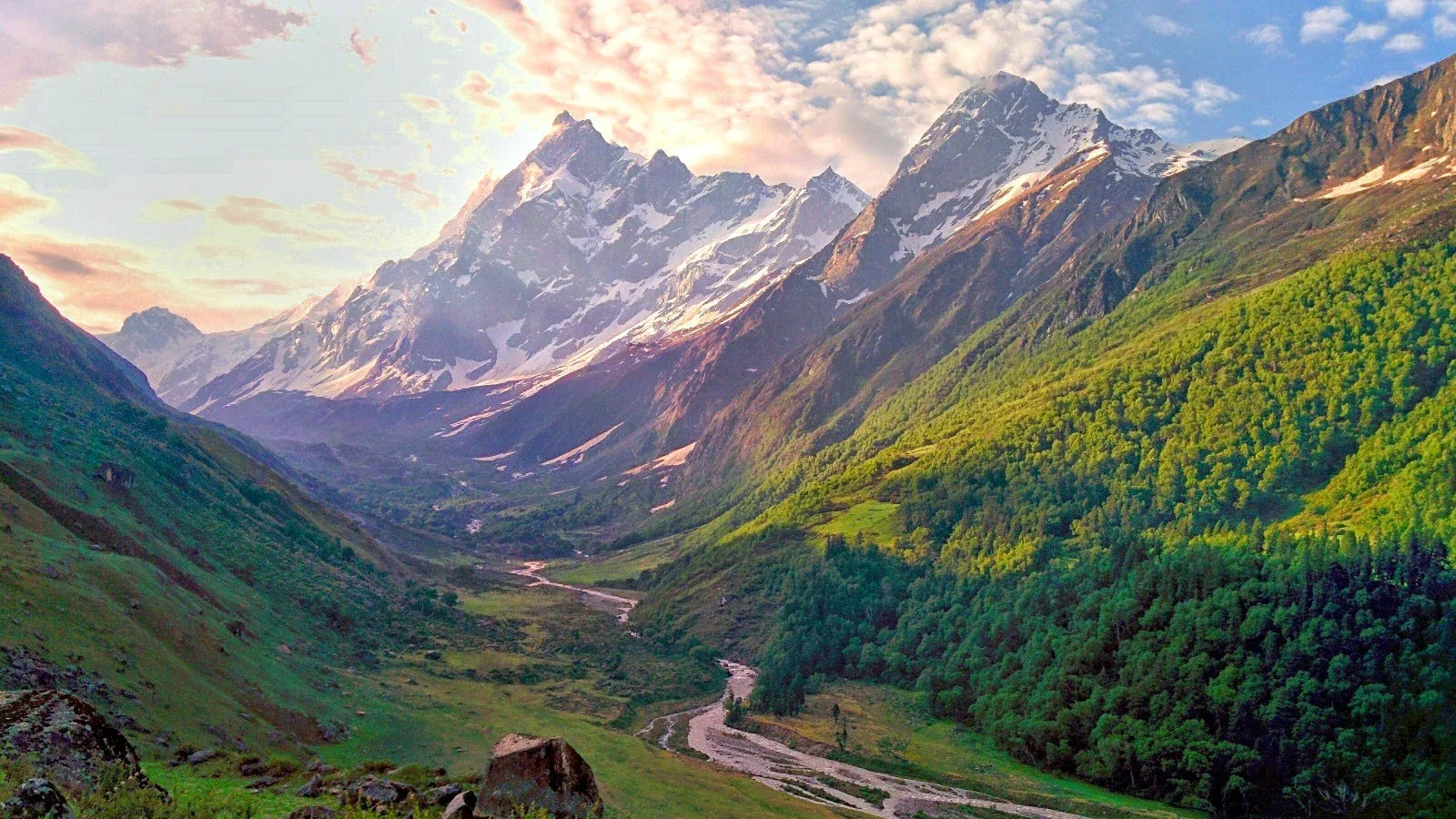
The Har Ki Dun Trek explores one of the oldest inhabited valleys in the Garhwal Himalayas, following the Supin River through the Govind Pashu Vihar National Park to the cradle-shaped Valley of Gods. Surrounded by the Swargarohini massif, the valley is deeply woven into local mythology, where legend associates the nearby peaks with the Pandavas' ascent to heaven.
The trail passes through centuries-old villages such as Osla and Gangad, where traditional wooden architecture, ancient temples, and enduring mountain culture remain central to everyday life. Dense forests gradually give way to alpine meadows and wide glacial valleys framed by towering Himalayan peaks.
Suitable for trekkers of moderate fitness, Har Ki Dun is one of Uttarakhand's most rewarding journeys for those seeking a blend of natural beauty, living culture, and Himalayan history.
Quick Facts
Duration
Max Altitude
Difficulty
Best Time
Trek Distance
Trail Atmosphere
Stargazing
Class 2 Dark Sky
Scent Profile
Silence Level
~35 dB
Vertigo Factor
1 / 10
Iconic Spots
Supin River Bend
Swargarohini Massif
Osla Village Architecture
Environment
Nature & Culture
Flora & Fauna
Flora
Fauna
The 'Valley of Gods'. Osla village has a 3000-year-old temple often confused with the Duryodhana temple; it is a Someshwar Mahadev shrine with legendary woodwork.
— Local folklore
Spiritual & Cultural Significance
Swargarohini peaks represent the path to heaven.
🕐 Shrine Timings: Daylight (Osla)
Temple Protocols
- •Permission required from Pujari for interior photos
Festivals & Dates
Technical Details
Challenge & Preparation
Primarily a cardio demand challenge
A capable trekker's route that balances cardio demand and cumulative fatigue.
Personal Readiness
Am I ready?
Planning
Logistics & Trail Intel
Getting There
Route to Base
10-hour drive from Dehradun to Sankri
**Taluka/Osla Extension:** While a rough road exists till Taluka (12km) and further toward Osla, these roads are temporary and frequently blocked by landslides
Operators use 4WD vehicles (Bolero/Camper) only when the trail is clear
Be prepared to walk these sections if the road is closed
Base Village
Sankri
6,400 ft
Nearest Railhead
Rishikesh
Nearest Airport
Jollygrant Airport
Last ATM
Purola / Mori. No ATMs at Sankri village. Highly unreliable beyond Purola.
Nearest Medical Facility
Purola CHC or Sankri PHC.
Mobile Signal
Airtel/BSNL strong at Sankri entry hub. Zero beyond Taluka; intermittent signal possible at Osla village high points.
Water Sources
Supin River follows the main valley route. High-quality glacial streams available at all major campsites. Reliable even in peak summer.
Charging
Electricity available at Sankri base. Some homestays in Osla village have solar charging for a fee.
For Drivers
Road Condition
Winding mountain roads; prone to landslides between Mussoorie and Mori in monsoon.
Mori
Trail Culinary & Diet
Don't miss the Garhwali Chainsoo
Buy specialized diet items at Sankri / Purola
The Content & Remote Hub
Top Vlog Spots
Video Calls
base-village-only
Est. 5 Mbps
UPI Reliability
3/10
Base WiFi Available
Permits and Regulations
Har Ki Dun is located within the Govind Pashu Vihar National Park. Entry permits are mandatory and are issued at the Netwar forest checkpost. Indian nationals require a valid Aadhar/Passport. Foreigners need passport/visa copies and pay a higher daily park fee. Most operators bundle these permits in the package.
Learn more about how we vet operators and ensure transparency on our why MountRoutes page.
Packing List
Winter Clothing
- Heavy down jacket rated to -15°C
- 3 thermal base layers (full sleeve)
- 2 fleece mid layers
- Hardshell waterproof outer layer
- Trekking pants (Water resistant)
- Heavyweight wool socks (4 pairs)
- Insulated waterproof gloves + liner gloves
- Balaclava and thermal cap
Footwear Snow Gear
- Insulated waterproof trekking boots (Vibram sole preferred)
- Micro-spikes (for winter months)
- Four-season gaiters
- Camp boots or slippers
Gear Safety
- Trekking poles (Mandatory for the long descents)
- Headlamp with spare batteries
- Sleeping bag rated -10°C minimum
- Sunglasses UV400
- Sunscreen SPF 50+
- Personal medical kit (Diamox, ORS, Knee supports)
Deep Dives
Explore Further
Editor's Notes
Locals believe this was the path taken by the Pandavas on their ascent to heaven via Swargarohini peaks.
Road Uncertainty: Although a road exists toward Osla, it is a 'Cut' road prone to slides. Most veterans prefer trekking from Taluka to enjoy the Supin forest.
Explore In Detail
Day by Day Itinerary
7-day route reaching 11,811ft. Covers 47km of varied terrain.
→ See full itinerary with altitude profileDifficulty & Fitness
Rated moderate. The trail is mostly consistent uphill. The first two days are through forests alongside the river. The section between Seema and Kalkatiyadhar is the steepest. Once in the valley, the terrain is flat.
→ See difficulty breakdown and fitness guideCost & Pricing
Packages range from ₹8,000 – ₹18,000. Inclusions and hidden costs vary by operator tier.
→ See full cost breakdownFrequently Asked Questions
Why is Har Ki Dun called the Valley of Gods?
It is believed to be the route taken by the Pandavas to reach heaven. The local villages like Osla also have unique temples dedicated to characters from the Mahabharata.
Can we see the Swargarohini glacier?
Yes, the Swargarohini I, II, and III massifs dominate the valley. While you cannot easily step on the glacier without technical gear, its terminal moraine is visible from the Har Ki Dun campsite.
Is it a good trek for children?
Yes, it is a moderate trek with a gradual incline, making it one of the best "long" treks for families and teenagers.
Who is Someshwar Devta?
He is the primary deity of the Har Ki Dun valley. You will see his beautiful wooden temple in Osla village. Please follow local protocols: do not touch the temple walls.
Is there mobile signal in Sankri?
Sankri has sporadic BSNL and Vi signal. Beyond Sankri, there is no mobile connectivity on the trail.
Are there any ATMs near the base?
Purola is the last reliable point for ATMs. Sankri has none; it is better to carry all required cash from Dehradun.
What wildlife can we spot?
The Govind Wildlife Sanctuary is home to Himalayan griffons, black bears, and if you are very lucky, the elusive snow leopard or blue sheep.
Is it possible to do Har Ki Dun in January?
Yes, it is a stunning winter trek. However, the section between Kalkatiyadhar and the valley floor can be buried in 4-5 feet of snow.
Route Intelligence
Routes With Similar Character
Routes that share the character of Har Ki Dun Trek.
Kuari Pass Trek
Both offer gentle gradients and rich biodiversity, suitable for mixed-experience groups. They share multiple characteristics.
Dayara Bugyal Trek
Both offer gentle gradients and rich biodiversity, suitable for mixed-experience groups. They share multiple characteristics.
Valley of Flowers Trek
Both offer gentle gradients and rich biodiversity, suitable for mixed-experience groups. They share multiple characteristics.
Still deciding?
Compare routes side-by-side to find the perfect match for your fitness, dates, and budget.
Everything you need to know, in one place. Someone else in your group needs to see this.
Planning Har Ki Dun Trek?
Get route conditions, operator updates, and season windows before booking.
Don't miss out! Follow us for route updates@mountroutes|LinkedIn
No spam. Only useful trek updates.
Ready to walk this route?
You’ve read the guide, now find the perfect local team to take you there. Compare our verified list of operators.
Compare verified operators