Explore
Intelligence
Difficulty & Readiness Guide
Is Har Ki Dun Trek Difficult? — Fitness & Altitude Guide
Endurance-focused; requires the stamina to comfortably hike 10-12 km daily for three consecutive days.
The Question
Can I do this trek?
Preparation Required
Intermediate
Prior Experience
Recommended: 1-2 easy Himalayan treks or regular hiking experience.
Expert Verdict
Highly technical trek requiring physical and mental preparation.
Route Knowledge
Why is it difficult?
Exertion Index
Primary Challenge
Route Identity
Sustained multi-day trek requiring high cumulative endurance across consecutive days across a trek featuring loose moraine.
Primary Drivers
- Grueling summit push with 2,861 ft of elevation gain
- 2 consecutive high-output trekking days
View Full Route Analysis
Physiological Demand
Challenging daily distances and steady climbs. Good cardiovascular fitness is required.
Comfortable pacing with good recovery options.
Rolling or gradual terrain with minimal harsh impact on joints.
Well-defined, stable trails with no technical maneuvers required.
Below the major effects of altitude sickness. Air remains relatively dense.
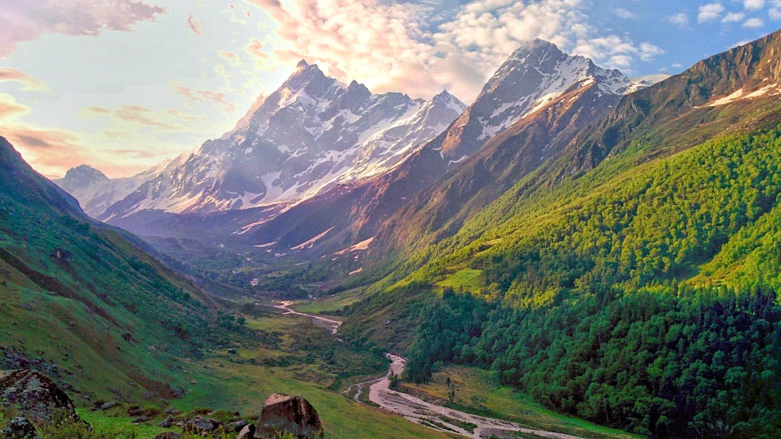
Terrain Breakdown
The trail is mostly consistent uphill. The first two days are through forests alongside the river. The section between Seema and Kalkatiyadhar is the steepest. Once in the valley, the terrain is flat.
Summit Day Notes
Har Ki Dun (11,811ft) exploration is an 8-hour day. While the altitude gain is manageable, the distance covered is the main challenge. Total 10-12km walking today.
The Descent
A long descent on Day 6 (14km). Use trekking poles to prevent knee strain on the rocky forest trail near Taluka.
Altitude Profile
Safe and steady gain. Sankri (6,400ft) to Har Ki Dun (11,811ft) over 4 days is a safe curve.
Run AMS Risk Audit →Trail Performance Data
Max Gradient
30%
Hydration
0.4L per km recommended
Loose Surface Sections
- •Taluka to Osla riverbed crossings
- •Final Har Ki Dun rise
Personal Readiness
Am I ready?
What this route demands
People who feel comfortable on this route can usually:
Who Can Do This Trek?
Min Age
9+
Max Age
60
Western Toilets at Base
Yes
Solo Female Travelers
High; well-populated village trail and friendly locals in Osla.
Hazard Profile
What goes wrong?
Common Mistakes on Har Ki Dun Trek
Most injuries and failures on this trail can be avoided by making smarter decisions early on.
Underestimating the 10km+ daily distances — basic leg stamina is crucial.
Not carrying enough water on the Kalkatiyadhar reach — sources are sparse between campsites.
Ignoring the Osla village visit — most groups rush past. The culture here is the trek’s highlight.
Poor layering — Har Ki Dun is the 'Sink' for cold winds from the glaciers. Mornings are freezing even in summer.
Assuming ATMS work at Sankri — the nearest reliable ATM is 25km away at Purola.
Safety & Medical Risks
Key Risks
Flash floods on the Supin river in monsoon
Exposure to freezing glacial winds in the Har Ki Dun valley
Long trekking distances (14km on Day 6) leading to exhaustion
Minor AMS risk at 11,811ft
AMS (Altitude Sickness)
Well-spaced gain. Hydration is the key on the Kalkatiyadhar section.
Evacuation Route
Fastest route is back to Taluka, then 4WD to Sankri/Purola hospital.
Solo Trekking
Extremely safe. The trail is well-defined, and the presence of villages like Osla and Gangaad along the route makes it safer than wilderness-only treks.
Common Trail Ailments
🏥 Nearest ICU: Max Hospital / Himalayan Hospital (Jolly Grant), Dehradun
Tactical Emergency Hub
> Requires 1-day trek back to Sankri or Mori roadheads for jeep evacuation. Sankri has an emergency transit helipad.
Auditability
How is this calculated?
Understand This Route Further
Before attempting this route:
Still deciding?
Compare routes side-by-side to find the perfect match for your fitness, dates, and budget.
Still think it's doable? Share this with your trek mate and see if they agree.
Step 2: Seasonal Safety
You know how demanding this route is.
Now find the safest and most reliable season to attempt it.
Check Best Time to Go