Essential Planning Guide
Chitkul Valley Trail Trek — Complete Guide (2026)
Introduction
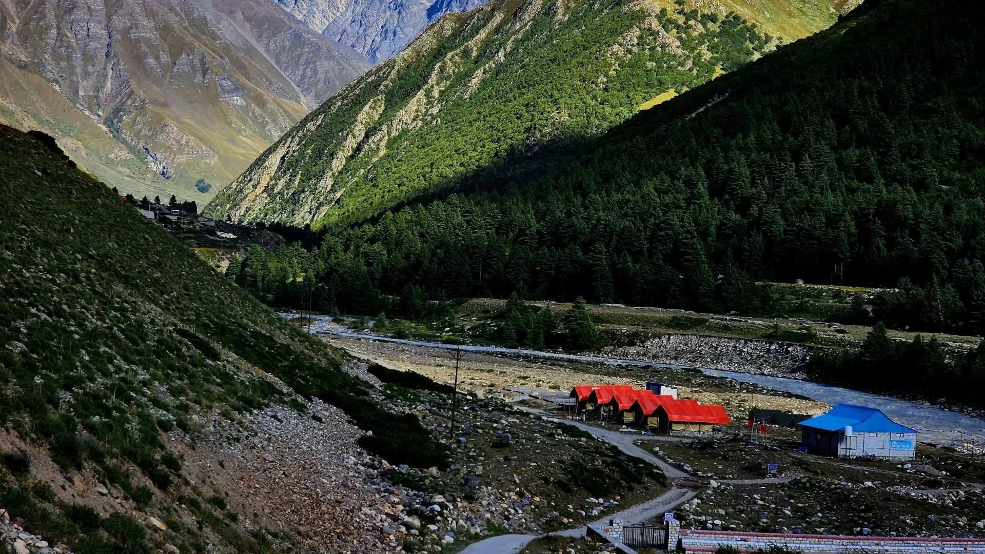
Chitkul is not just a destination; it''s the edge of an empire. Perched at 11,319 ft in the Baspa Valley, it is famously the last inhabited village on the Indo-Tibet border. The Chitkul Valley Trail is a journey through high-altitude deodar forests, vibrant alpine meadows, and along the crystal-clear waters of the Baspa River. This trek is uniquely positioned where the lush greenery of the lower Himalayas meets the stark, snow-capped giants of the Tibetan plateau. It offers a rare chance to walk right up to the ITBP outposts, explore centuries-old wooden architecture, and experience the warm hospitality of the Kinnauri people at the very frontier of the nation.
Ready to book? Compare verified operators for Chitkul Valley Trail — transparent pricing, no paid rankings.
Quick Facts
Duration
Max Altitude
Difficulty
Best Time
Trek Distance
Trail Atmosphere
Stargazing
Class 2 Dark Sky
Scent Profile
Silence Level
~40 dB
Vertigo Factor
1 / 10
Primarily a altitude exposure challenge
A capable trekker's route that balances altitude exposure and terrain ruggedness.
Iconic Spots
Mathi Devi Temple
The Last Post
Getting There
Route to Base
9-hour drive from Shimla via Sangla
Base Village
Chitkul
11,319 ft
Nearest Railhead
Shimla / Chandigarh
Nearest Airport
Shimla (Jubarhatti) / Chandigarh
Last ATM
Sangla (Reliability is low).
Nearest Medical Facility
Sangla Civil Hospital
Mobile Signal
BSNL/Jio have towers in the village. Signal becomes zero once you cross Nagasti toward the ridges.
Water Sources
Baspa river and multiple mountain springs. Mineral-rich and generally safe with basic filtration.
Charging
Electricity available at most homestays in Chitkul. Frequent power cuts mean power banks are essential.
For Drivers
Road Condition
Winding highway with narrow sections near Sangla. Prone to monsoon landslides.
Sangla
Trail Culinary & Diet
Don't miss the Chitkul Potato Curry and Rajma
Buy specialized diet items at Sangla
The Content & Remote Hub
No DronesStrictly restricted border zone. ITBP will confiscate drones immediately.Top Vlog Spots
Video Calls
patchy
Est. 5 Mbps
UPI Reliability
3/10
Base WiFi Available
Border Wisdom
Key point
The Mathi Devi temple is believed to protect the villagers from across the border. Always seek permission before photographing the temple interiors.
Explore In Detail
Day by Day Itinerary
4-day route reaching 12,500ft. Covers 28km of varied terrain.
→ See full itinerary with altitude profileDifficulty & Fitness
Rated moderate. Mostly well-defined dirt paths and riverbed boulders. Gentle gradients make it accessible for most ages.
→ See difficulty breakdown and fitness guideCost & Pricing
Packages range from ₹8,000 - ₹12,000. Inclusions and hidden costs vary by operator tier.
→ See full cost breakdownPermits and Regulations
Foreigners require Inner Line Permits (ILP) to stay in Chitkul. Indians must carry valid government ID. Respect ITBP protocols at checkposts. Do not photograph military installations.
Learn more about how we vet operators and ensure transparency on our why MountRoutes page.
Packing List
Standard Trekking Gear
- Medium down jacket (5°C to -5°C)
- Water-resistant trekking boots
- Full-sleeve thermal layers
- Sun-protection hat and UV sunglasses
- Lightweight fleece jacket
Border Exploration Items
- High-capacity power bank (Charging can be unreliable)
- Eco-friendly trash bags
- Sturdy walking stick or trekking poles
- Personal medications and first-aid kit
- Moisturizer and lip balm (Air is very dry)
Flora & Fauna
Flora
Fauna
Goddess Mathi, the presiding deity, traveled from Vrindavan to Chitkul and decided to stay here to protect the village from invaders.
— Local folklore
Spiritual & Cultural Significance
Mathi Devi temple is a major spiritual hub for the Baspa valley residents.
🕐 Shrine Timings: 7 AM - 6 PM
Temple Protocols
- •No photography inside temple
- •Modest attire required
Festivals & Dates
Frequently Asked Questions
Can we walk all the way to the Tibet border?
No. Civilians are allowed up to the Nagasti ITBP checkpost (approx. 3km from Chitkul). Beyond that, the trail is restricted for military use only. Any attempt to proceed beyond Nagasti without special military permits is strictly prohibited.
Is there snow in Chitkul in summer?
While the village and trail are usually clear from May to October, the surrounding peaks remain snow-capped year-round, offering spectacular vistas.
Other Treks Guides
Still deciding?
Compare routes side-by-side to find the perfect match for your fitness, dates, and budget.
Everything you need to know, in one place. Someone else in your group needs to see this.
Planning Chitkul Valley Trail?
Get route conditions, operator updates, and season windows before booking.
No spam. Only useful updates.
Ready to walk this route?
You’ve read the guide, now find the perfect local team to take you there. Compare our verified list of operators.
Compare verified operators