
Explore
Intelligence
Essential Planning Guide
Buran Ghati Trek — Complete Guide (2026)
Vibe & Scenery
The Experience
Introduction
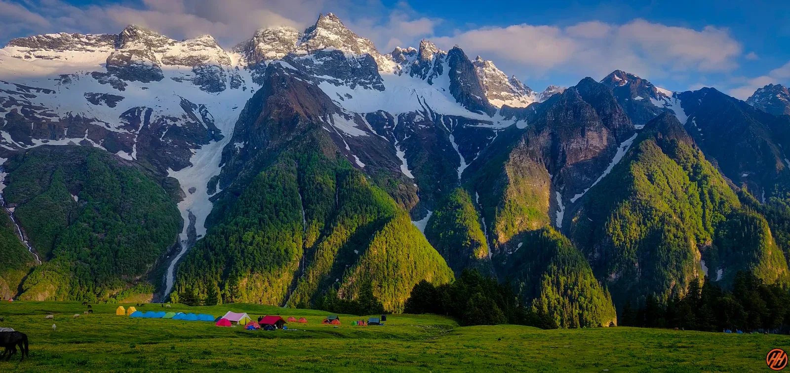
Buran Ghati is one of Himachal Pradesh's most diverse crossover treks, linking the lush forests of the Pabbar Valley with the rugged landscapes beyond Buran Pass. Throughout the journey, trekkers experience a remarkable progression of terrain—from traditional mountain villages and dense forests to flower-filled meadows, glacial campsites, and high snowfields.
A highlight of the expedition is the visit to the sacred Chandranahan Lake, regarded as the source of the Pabbar River. The final crossing of Buran Pass is followed by a steep snow descent which, depending on seasonal conditions, often requires fixed ropes and controlled rappelling under the supervision of trek leaders.
Its combination of varied landscapes, sustained altitude, and technical pass crossing makes Buran Ghati one of India's finest crossover treks for experienced trekkers.
Quick Facts
Duration
Max Altitude
Difficulty
Best Time
Trek Distance
Trail Atmosphere
Vertigo Factor
1 / 10
Iconic Spots
Chandranahan Lake
Buran Ghati Pass Wall
Barua Apple Orchards
Environment
Nature & Culture
Flora & Fauna
Flora
Fauna
Deep reverence for the Jakh Devta, who governs local life and weather. The sacred Chandranahan Lake is central to local myths and spiritual rituals.
— Local folklore
Spiritual & Cultural Significance
Temple Protocols
Technical Details
Challenge & Preparation
Primarily a joint & muscle impact and cardio demand challenge
A demanding expedition dominated by extreme joint & muscle impact.
Personal Readiness
Am I ready?
Planning
Logistics & Trail Intel
Getting There
Route to Base
8-hour drive from Shimla via Narkanda and Rohru
Last 20 km is rough
Base Village
Janglik (via Shimla/Rohru)
5,600 ft
Nearest Railhead
Rishikesh
Nearest Airport
Jollygrant Airport
Last ATM
Rohru. Carry cash from Shimla.
Nearest Medical Facility
Rohru Civil Hospital
Mobile Signal
Jio works sporadically.
For Drivers
Trail Culinary & Diet
The Content & Remote Hub
No DronesVideo Calls
none
UPI Reliability
1/10
Permits and Regulations
Forest permits are required from the Rohru Forest Division. The trek passes through restricted forest zones near Chandranahan. Indian nationals require a photo ID and a medical fitness certificate is recommended for the technical sections. The ice-wall descent requires that all trekkers use harnesses, ropes, and helmets — operators are mandated to provide these. Groups are limited in size to minimize environmental impact on the fragile Chandranahan ecosystem.
Learn more about how we vet operators and ensure transparency on our why MountRoutes page.
Packing List
Clothing
- Down jacket rated -15°C
- 2 Thermal base layers
- Fleece layer
- Waterproof shell jacket and pants
- Balaclava, woolen cap
- Waterproof gloves
- Woolen socks (3 pairs)
Footwear Gear
- High-ankle waterproof boots
- Microspikes (mandatory)
- Gaiters
- Camp slippers
Technical Gear
- Harness (usually provided by operator)
- Helmet (usually provided)
- 2 Trekking poles
- Headlamp
- UV400 Sunglasses
- Sunscreen SPF 50+
- Power bank 10000mAh
- 2L Water capacity
- Personal medical kit
Deep Dives
Explore Further
Editor's Notes
Buran Ghati is the only commercial trek in India that requires a technical rappel. The 70-degree ice-wall descent is the single most adrenaline-pumping moment in Indian adventure trekking.
The Chandranahan Lakes are often overlooked in Buran Ghati's shadow, but they are among the most sacred and beautiful glacial lakes in the Shimla region.
Explore In Detail
Day by Day Itinerary
7-day route reaching 15,000ft. Covers 48km of varied terrain.
→ See full itinerary with altitude profileDifficulty & Fitness
Rated challenging. Forest, meadows, snow fields, and the technical ice wall. The ice wall is the crux — 70-degree descent on ropes.
→ See difficulty breakdown and fitness guideCost & Pricing
Packages range from ₹16,000 – ₹24,000. Inclusions and hidden costs vary by operator tier.
→ See full cost breakdownFrequently Asked Questions
What is the "Slide" at Buran Ghati?
The highlight of the trek is a 400-meter steep snow slide from the pass on the Barua side. It is as exhilarating as it is steep.
Where do we start the trek?
The trek starts from Janglik, a beautiful heritage village in the Shimla district.
Is it a crossover trek?
Yes, you start from the Shimla district and end in the Sangla valley of Kinnaur.
What is the highest point?
The Buran Ghati Pass at 15,000 ft.
Can we see the Chandernahan lake?
Yes, most itineraries include a side-trip to the sacred seven-lake system of Chandernahan.
How is the forest on this route?
Some of the denseest oak and cedar forests in Himachal are found between Janglik and Dayara meadows.
Is it suitable for beginners?
It is moderate. A fit beginner can do it, but the pass crossing requires good physical courage and stamina.
How difficult is the Buran Ghati pass crossing?
The Buran Ghati pass is graded as difficult. The ascent to the pass involves traversing steep snow slopes, and the descent is a near-vertical 400-meter drop, often requiring a thrilling snow slide or rope assistance.
What is the best time to do the Buran Ghati trek?
The best time for Buran Ghati is from mid-May to June and September to October. Summer offers excellent snow sliding opportunities at the pass, while autumn provides spectacular clear views and autumn colors.
Does the Buran Ghati trek involve rappelling?
In early summer, the steep descent from the pass is usually done by sliding on the snow. However, if the snow has hardened into ice or melted exposing bare rock (in autumn), guides set up fixed ropes for safe rappelling/descent.
Route Intelligence
Routes With Similar Character
Routes that share the character of Buran Ghati Trek.
Bali Pass Trek
Trekkers frequently compare these. Both demand sustained performance above 14,000 ft where altitude becomes the primary challenge.
Hampta Pass Trek
Trekkers frequently compare these. Both routes are defined by crossing a major Himalayan pass, involving major terrain transitions.
Pin Bhabha Pass Trek
Both routes are defined by crossing a major Himalayan pass, involving major terrain transitions. They share multiple characteristics.
Still deciding?
Compare routes side-by-side to find the perfect match for your fitness, dates, and budget.
Everything you need to know, in one place. Someone else in your group needs to see this.
Planning Buran Ghati Trek?
Get route conditions, operator updates, and season windows before booking.
Don't miss out! Follow us for route updates@mountroutes|LinkedIn
No spam. Only useful trek updates.
Ready to walk this route?
You’ve read the guide, now find the perfect local team to take you there. Compare our verified list of operators.
Compare verified operators