Essential Planning Guide
UT Kangri Peak Expedition — Complete Guide (2026)
Introduction
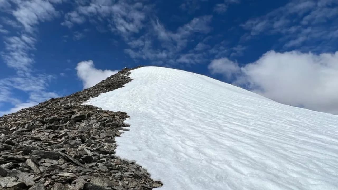
Standing at 6,070 m (19,914 ft), UT Kangri is one of Ladakh's most approachable 6,000 m summits. Located near Rumtse in the Trans-Himalayan cold desert, the mountain offers a high-altitude climbing experience without the extensive glacier systems found on many Himalayan expedition peaks. The ascent follows rugged scree slopes, snowfields, and broad summit ridges, demanding excellent acclimatization and physical endurance despite its relatively straightforward technical grade. Its proximity to Leh also makes logistics comparatively simple. Ideal for aspiring mountaineers, UT Kangri provides an excellent first expedition before progressing to more technical Himalayan objectives.
Ready to book? Compare verified operators for UT Kangri Peak Expedition — transparent pricing, no paid rankings.
Quick Facts
Duration
Max Altitude
Difficulty
Best Time
Trek Distance
Trail Atmosphere
Stargazing
Class 1 Dark Sky
Scent Profile
Silence Level
~10 dB
Vertigo Factor
8 / 10
Primarily a altitude exposure and joint & muscle impact challenge
A demanding expedition with extreme altitude exposure and joint & muscle impact.
Iconic Spots
Yunam Summit (20,046 ft)
Getting There
Route to Base
Fly to Leh
2 acclimatization days in Leh
Drive 2.5hrs on Leh-Manali highway to Rumtse
Trek 1 day to Base Camp
Base Village
Rumtse
14,270 ft
Nearest Railhead
Jammu Tawi (JAT)
Nearest Airport
Kushok Bakula Rimpochee Airport, Leh (IXL)
Last ATM
Leh
Nearest Medical Facility
SNM Hospital, Leh (~60km from Rumtse)
Mobile Signal
None.
Water Sources
Snow melting required at Base Camp.
Charging
Zero charging points after Keylong.
For Drivers
Road Condition
Manali to Darcha is excellent highway. Darcha to Bharatpur is steep, unpaved highway traversing sheer cliffs.
Keylong / Jispa
Trail Culinary & Diet
Don't miss the High altitude noodle soups for fast carb absorption
Buy specialized diet items at Manali
The Content & Remote Hub
No DronesStrictly banned due to extreme high altitude and proxy to military checkposts.Top Vlog Spots
Video Calls
none
Est. 0 Mbps
UPI Reliability
1/10
Guide Wisdom
Caution
The drive from Leh to Rumtse on Day 3 takes you from 3,500m to 4,350m in 2.5 hours. Do NOT trek to Base Camp on the same day — this is a common beginner mistake.
Explore In Detail
Day by Day Itinerary
9-day route reaching 19,915ft. Covers 30km of varied terrain.
→ See full itinerary with altitude profileDifficulty & Fitness
Rated challenging. Gentle snow and scree approach with a final rocky ridge to the summit. One of the most accessible 6,000m peaks in India.
→ See difficulty breakdown and fitness guideCost & Pricing
Packages range from ₹29,000 – ₹54,000. Inclusions and hidden costs vary by operator tier.
→ See full cost breakdownPermits and Regulations
IMF (Indian Mountaineering Foundation) peak booking fees apply because the altitude crosses 6000 meters. A heavily monitored police checkpoint at Darcha records all climber passport/Aadhar details.
Learn more about how we vet operators and ensure transparency on our why MountRoutes page.
Packing List
Expedition Clothing
- Summit Down Jacket (-25°C rating mandatory)
- Waterproof breathable alpine trousers
- Heavyweight thermal baselayers (Upper & Lower)
- Fleece mid-layers
- Balaclava/Face mask (To prevent frostbite from summit winds)
Footwear & Navigation
- Category C or D Expedition Boots (Must be extremely stiff-soled)
- Gaiters (For walking through the deep snow on the upper ridges)
- Micro-spikes (Operator usually provides crampons if ice is hard)
Wilderness Survival Gear
- Category 4 Glacier glasses (Mandatory)
- Trekking poles with snow baskets
- Heavy-duty expedition mitts (Not just gloves)
Flora & Fauna
Flora
Fauna
The high peaks of Lahaul are often seen as meditating ascetic monks by the locals, unbothered by the mortal world below.
— Local folklore
Spiritual & Cultural Significance
Low. Purely a mountaineering challenge.
🕐 Shrine Timings: N/A
Temple Protocols
Frequently Asked Questions
Is UT Kangri suitable for my first 6,000m peak?
Yes — it is one of the best first 6,000m objectives in India. The approach is short, the terrain is non-technical (F grade snow ramp), and the 9-day program includes a highly gradual acclimatization. Prior high-altitude trekking experience (15,000ft+) is recommended.
Why is UT Kangri cheaper than Kang Yatse or Stok Kangri?
UT Kangri benefits from a much shorter expedition duration (9 days vs 11-15 days), simpler transport logistics directly from Rumtse, and lower IMF royalty fees compared to highly popular peaks like Kang Yatse I.
What is the crux of the UT Kangri climb?
The crux of UT Kangri is the long summit day itself, which features an intensive 8-10 hour push over a massive snow and scree ramp. There are no technical ice walls or heavily crevassed sections, making cold and thin air the primary obstacles.
Do I need formal mountaineering training to climb UT Kangri?
No formal mountaineering certificate is mandatory, but you must be fully familiar with walking in 12-point crampons and using a trekking ice axe for balance and self-arrest. A 1-day safety training session is conducted at Base Camp by guides.
What is the best month/season to climb UT Kangri?
The best season is from July to mid-October. Being in the Ladakh rain shadow, the weather remains dry and stable. July is excellent for continuous snow cover, while September and October offer harder, firmer footing and stunning clear skies.
How cold does it get at UT Kangri Base Camp?
Base Camp sits at an altitude of approximately 5,030m. Night temperatures in August range between -2°C to -8°C, and can drop below -12°C in late September. An expedition-grade 4-season tent and a -15°C rated sleeping bag are mandatory.
What climbing gear is required for the summit push?
You need rigid B2/B3 double or semi-rigid mountaineering boots, steel crampons, a walking ice axe, a climbing harness, helmet, and safety slings. Standard trekking shoes do not support crampons and are not allowed.
Where is the Base Camp located, and how do we reach it?
The trek starts from Rumtse village on the Leh-Manali highway. We trek over two gradual days through beautiful pastures like Kyamar and Tisaling to establish the Base Camp at 5,030m directly below the peak.
What is the phone and internet connectivity on the route?
There is zero mobile connectivity after leaving Rumtse. The last reliable networks are Airtel and BSNL in Leh. We carry satellite communication devices or high-frequency radios for emergency coordination from Base Camp.
Is Diamox recommended for UT Kangri?
Yes. Because the approach from Rumtse climbs rapidly, Diamox is highly recommended to accelerate acclimatization, taken under medical guidance. A mandatory 3-day rest period in Leh before the trek is strictly enforced.
How are supplies and personal bags transported?
Heavy kitchen equipment, food, tents, and climbers' main duffels are carried by pack horses from Rumtse to Base Camp. Climbers only carry a standard 30L daypack containing hydration, fleece layers, and cameras.
Is helicopter rescue available for UT Kangri?
Yes, the valleys leading to the UT Kangri base are relatively wide, allowing standard rescue helicopters to land under favorable weather conditions, subject to immediate clearance from Leh military authorities.
Other Expeditions Guides
Still deciding?
Compare routes side-by-side to find the perfect match for your fitness, dates, and budget.
Everything you need to know, in one place. Someone else in your group needs to see this.
Planning UT Kangri Peak Expedition?
Get route conditions, operator updates, and season windows before booking.
No spam. Only useful updates.
Ready to walk this route?
You’ve read the guide, now find the perfect local team to take you there. Compare our verified list of operators.
Compare verified operators