Detailed Route
Panpatia Col Expedition Itinerary — Day by Day Route & Camps
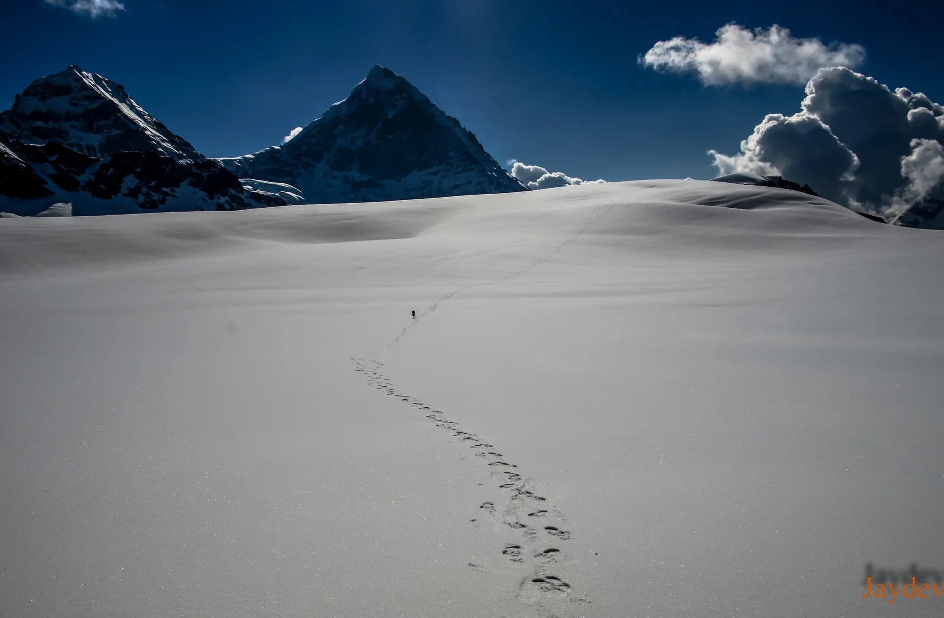
Traces an ancient, mythical priest route traversing massive glaciers, icefalls, and sheer rock walls.
Standard RouteThis is the standard mountain pacing for this trek. Specific operators may add an acclimatization day or alter the starting point. Check individual operator schedules for their exact logistics.
Duration
13 Days
Total Distance
36 KM
Max Altitude
17,257 FT
Trek Type
linear
Permits Required Before You Go
Permit Cost
Foreigner Process
KWS permit + additional clearance for glacier zone near strategic border area.
Nearest Embassy Hub
New Delhi
Day by Day Breakdown
Drive Joshimath to Badrinath
Drive to Badrinath.
Key Landmarks
Staying At
Acclimatization at Badrinath
Visit the temple and dip in the Tapt Kund.
Key Landmarks
Staying At
Trek Badrinath to Khirao
Trek to the last village.
Key Landmarks
Staying At
Trek Khirao to Snout Camp
Trek through dense forests to the glacier snout.
Key Landmarks
Staying At
Trek Snout Camp to Moraine Camp
Tough boulder hopping.
Key Landmarks
Staying At
Acclimatization & Load Ferry to BC
Ferry loads up the Parvati Gully.
Key Landmarks
Staying At
Trek Moraine Camp to Base Camp (Parvati Gully)
Steep climb through the infamous Parvati Gully.
Key Landmarks
Staying At
Pass Day: BC to Panpatia Col to Sujal Sarovar
Roped travel across the blinding Panpatia snowfield.
Key Landmarks
Staying At
Reserve Day / Weather Buffer
Buffer day.
Staying At
Trek Sujal Sarovar to Kachni Khal to Kachni Camp
Cross a smaller pass, Kachni Khal.
Key Landmarks
Staying At
Trek Kachni Camp to Madhyamaheshwar
Descent into the forests to the Panch Kedar shrine.
Key Landmarks
Staying At
Trek Madhyamaheshwar to Ransi
Final descent to the roadhead.
Key Landmarks
Staying At
Drive Ransi to Haridwar
Drive back to the plains.
Key Landmarks
Staying At
Trek Extensions & Add-ons
Satopanth Tal Connection
+2 DaysOn the Badrinath exit, visit Satopanth Tal (the Triangle Lake at 14,900 ft) — a sacred lake 2 days above Badrinath, adding 2 significant days of post-col spiritual geography.
Also on this trek
Ready to book? Compare verified operators for Panpatia Col Expedition — transparent pricing, no paid rankings.
Still deciding?
Compare routes side-by-side to find the perfect match for your fitness, dates, and budget.
Day by day, camp by camp. Send this to your group so everyone's on the same page.
Love this itinerary?
Find operators who follow this exact route with verified acclimatization days.
Find matching operators