Traverse Safety & Risk
Panpatia Col Expedition — Safety Guide
Altitude physiology, pass crossing go/no-go criteria, evacuation protocol, and insurance requirements.
Primary Hazards
HACE/HAPE at 17,000+ ft
Crevasse fall on glacier approach
Avalanche on steep col wall
Complete isolation on failure
AMS Protocol
3 nights at Kedarnath (11,755 ft) is non-negotiable minimum acclimatization.
Altitude Physiology — SpO₂ by Camp
Turn-Around Threshold
SpO₂ < 72%
Descend immediately if reading drops below this at rest
Diamox (Acetazolamide)
Recommended
Pass Crossing Protocol
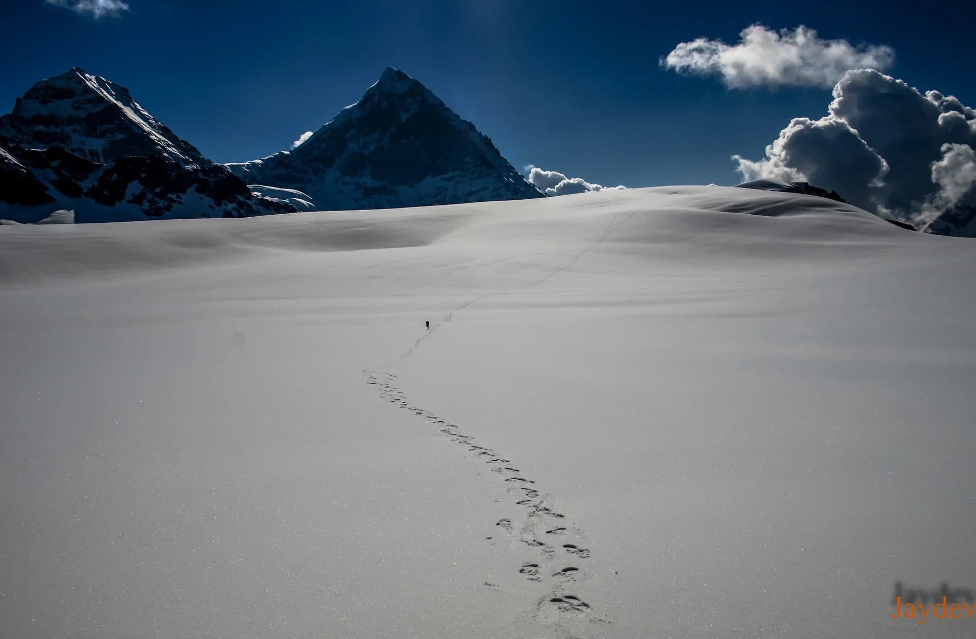
Glacier Hazards — Panpatia Snowfield
Crevasse Zone
Massive hidden crevasses on the plateau
Historical Safety Record
We publish verified incident records to help trekkers and operators make informed decisions. Names and personal identifiers are anonymized.
Documented
6
verified incidents
Fatalities
0
none recorded
Near Misses
3
logged
We have analysed 6 documented incidents for this expedition to extract critical safety lessons.
Due to the nature of mountaineering — where most non-fatal incidents go unreported — experts estimate 14+ total historical incidents on this route. Estimated historical fatalities: 3. We present the documented record as-is rather than speculate on undocumented cases.
Year
2022
Snow Blindness
Outcome
Led out by team members
Contributing Cause
UV-protective eyewear not worn on high snowfields
Key Safety Lesson
Always uV radiation on high-altitude snowfields is intense. Wear Category 4 sunglasses constantly.
Year
2021
Weather Stranding
Outcome
Self-recovered
Contributing Cause
Contributing factors not fully documented
Key Safety Lesson
Always pitch tents at least 50 meters above the riverbed to avoid sudden glacial surges.
Year
2020
HAPE — High Altitude Pulmonary Edema
Outcome
Assisted descent by team
Contributing Cause
Rapid ascent without adequate rest days
Key Safety Lesson
Always hAPE can strike suddenly. The only cure is immediate descent, regardless of the time of day.
Year
2019
Fall — Rocky Terrain
Outcome
Self-recovered
Contributing Cause
Loose scree and insufficient footwear traction
Key Safety Lesson
Always move quickly and quietly through steep gorges. Helmets must be worn at all times.
Year
2017
Crevasse Fall
Outcome
Rescue by external team
Contributing Cause
Unroped travel on glaciated terrain
Key Safety Lesson
Always panpatia Col is one of the most heavily crevassed snowfields in the region. Always rope up.
Year
2017
Crevasse Fall
Outcome
Rescue by external team
Contributing Cause
Contributing factors not fully documented
Key Safety Lesson
Always snow bridges weaken in the afternoon. Cross glaciers strictly between 3 AM and 8 AM.
Source: Public Records / News Reports
Why estimates differ from records: IMF and news sources only capture permitted expeditions and helicopter rescues. Non-fatal near-misses (AMS, frostbite, falls with self-rescue) are almost never filed. Peaks with multi-decade climbing histories compound these gaps significantly.
Emergency Contacts
Evacuation Route
Helicopter feasible from Kedarnath temple area. From high camp: retrace to base camp (1 day) then helicopter from Kedarnath. Badrinath side: descent to Mana village.
Solo Advisory
Extremely dangerous due to hidden crevasses on the snowfield.
Insurance Requirements
Heli Rescue
Required
Mandatory Operator Equipment
Verify this equipment is included before booking. Compare operator safety standards →
Compare Operators on Safety Standards
See which operators carry certified guides, satellite comms, and medical support for Panpatia Col Expedition.
View OperatorsStill deciding?
Compare routes side-by-side to find the perfect match for your fitness, dates, and budget.
Knowledge Integrity
Help us keep this data ground-truth accurate.
This encyclopedia entry for Panpatia Col Expedition is curated from a mix of public survey records, first-hand climber accounts, and official permit logs. However, mountains are dynamic. If you have been on this route recently and noticed a change in terrain, water availability, or local regulations, we want to hear from you.
Community Vetted
Last Verified: May 2026
EXPEDITION DATABASE