Essential Planning Guide
Deo Tibba Peak Expedition — Complete Guide (2026)
Introduction
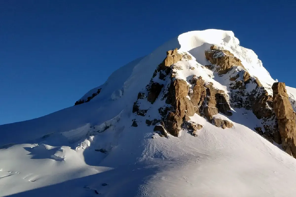
Standing at 6,001 m (19,688 ft), Mount Deo Tibba dominates the eastern skyline above the Kullu Valley and has long been regarded as one of Himachal Pradesh's premier expedition peaks. The mountain rises above expansive glaciers, high alpine meadows, and rugged granite ridges that define the upper Duhangan basin. The expedition follows the classic Jagatsukh approach through Seri meadows, Chhota Chandratal, and the Deo Tibba Base Camp before entering increasingly technical glacial terrain. Climbers encounter crevasses, fixed-rope sections, steep snow slopes, and the broad summit dome that demands sound alpine climbing techniques. Widely considered a milestone in Western Himalayan mountaineering, Mount Deo Tibba is the natural progression for climbers moving beyond trekking peaks toward fully technical expeditions.
Ready to book? Compare verified operators for Deo Tibba Peak Expedition — transparent pricing, no paid rankings.
Quick Facts
Duration
Max Altitude
Difficulty
Best Time
Trek Distance
Trail Atmosphere
Stargazing
Class 1 Dark Sky
Scent Profile
Silence Level
~10 dB
Vertigo Factor
8 / 10
Primarily a cardio demand and joint & muscle impact challenge
An elite-level undertaking with extreme cardio demand, joint & muscle impact, and cumulative fatigue. This route will push every dimension of your physical and mental endurance to the limit.
Iconic Spots
Yunam Summit (20,046 ft)
Getting There
Route to Base
Fly/drive to Manali
Drive 30 min to Jagatsukh (trek start)
2-day trek to Tainta Base Camp at 4,070m
Base Village
Jagatsukh
6,890 ft
Nearest Railhead
Chandigarh Railway Station (IXC)
Nearest Airport
Kullu-Manali Airport, Bhuntar (KUU) / Chandigarh (IXC)
Last ATM
Manali
Nearest Medical Facility
Lady Willingdon Hospital, Manali (~30km from Jagatsukh)
Mobile Signal
None.
Water Sources
Snow melting required at Base Camp.
Charging
Zero charging points after Keylong.
For Drivers
Road Condition
Manali to Darcha is excellent highway. Darcha to Bharatpur is steep, unpaved highway traversing sheer cliffs.
Keylong / Jispa
Trail Culinary & Diet
Don't miss the High altitude noodle soups for fast carb absorption
Buy specialized diet items at Manali
The Content & Remote Hub
No DronesStrictly banned due to extreme high altitude and proxy to military checkposts.Top Vlog Spots
Video Calls
none
Est. 0 Mbps
UPI Reliability
1/10
Guide Wisdom
Caution
The hanging glacier section is the crux. Speed is safety here — you must cross the serac zone before the sun softens the ice in mid-morning. Any delay above the bergschrund is dangerous.
Explore In Detail
Day by Day Itinerary
12-day route reaching 19,688ft. Covers 55km of varied terrain.
→ See full itinerary with altitude profileDifficulty & Fitness
Rated extreme. A complex technical peak with significant crevasse navigation on the Jagatsukh Glacier followed by steep ice on the summit dome.
→ See difficulty breakdown and fitness guideCost & Pricing
Packages range from ₹45,000 – ₹70,000. Inclusions and hidden costs vary by operator tier.
→ See full cost breakdownPermits and Regulations
IMF (Indian Mountaineering Foundation) peak booking fees apply because the altitude crosses 6000 meters. A heavily monitored police checkpoint at Darcha records all climber passport/Aadhar details.
Learn more about how we vet operators and ensure transparency on our why MountRoutes page.
Packing List
Expedition Clothing
- Summit Down Jacket (-25°C rating mandatory)
- Waterproof breathable alpine trousers
- Heavyweight thermal baselayers (Upper & Lower)
- Fleece mid-layers
- Balaclava/Face mask (To prevent frostbite from summit winds)
Footwear & Navigation
- Category C or D Expedition Boots (Must be extremely stiff-soled)
- Gaiters (For walking through the deep snow on the upper ridges)
- Micro-spikes (Operator usually provides crampons if ice is hard)
Wilderness Survival Gear
- Category 4 Glacier glasses (Mandatory)
- Trekking poles with snow baskets
- Heavy-duty expedition mitts (Not just gloves)
Flora & Fauna
Flora
Fauna
Deo Tibba means 'peak of the gods' in the local Kullu dialect. The Tainta meadows are considered sacred by Kullu villagers.
— Local folklore
Spiritual & Cultural Significance
Low. Purely a mountaineering challenge.
🕐 Shrine Timings: N/A
Temple Protocols
Frequently Asked Questions
Do I need a mountaineering course before Deo Tibba?
Strongly recommended. Deo Tibba has a hanging glacier with active serac hazards and requires competent fixed-rope vertical ascending technique. Completing a Basic Mountaineering Course (BMC) from an IMF institute is the minimum safety benchmark.
Why is Deo Tibba avoided in the monsoon months (July-August)?
Deo Tibba sits in the Kullu district, which receives intense monsoon rains. July and August bring heavy rain to the valleys and warm temperatures to the upper mountain, which destabilizes seracs on the hanging glacier, dramatically increasing rockfall and avalanche risk.
What is the crux of the Deo Tibba climb?
The crux is the steep 150-meter rock and ice gully known as the "Duhangan Col gully." This section is an 65° steep couloir requiring jumaring on fixed ropes, technical front-pointing with crampons, and careful management of rockfall from climbers ahead.
What is the summit dome of Deo Tibba like?
Unlike other pointed summits, the summit of Deo Tibba is a massive, flat, gently sloping snow dome. The environment is extremely open and exposed, requiring precise navigation in case of sudden cloud cover or whiteouts.
What is the best month/season to climb Deo Tibba?
The prime windows are pre-monsoon (May to June) and post-monsoon (September to early October). June offers solid snow bridges over crevasses, while September provides hard ice conditions requiring precise front-pointing.
Who made the first ascent of Mt. Deo Tibba?
Dr. J. de V. Graaff and his wife Clare, along with the legendary Sherpa Pasang Dawa Lama, made the first recorded ascent in 1952 via the Northwest Ridge from Duhangan Col.
What are the camp locations established on the mountain?
The standard camp setup features: Base Camp at Chikka (10,200 ft), Camp 1 at Tainta (13,000 ft), and a High Camp / Advance Camp at the foot of Duhangan Col (approx. 16,000 ft) from where the summit push is launched.
What climbing gear is mandatory for Deo Tibba?
You need rigid B3 double boots, a mountaineering harness, steel crampons, a technical ice axe, ascending devices (Jumars), safety sling/cowtails, descenders (figure-8 or ATC), a helmet, and specialized glacier sunglasses.
How cold does it get at the Advance Camp?
At Advance Camp (16,000 ft), night temperatures can drop to -15°C. During the early morning summit push, high winds and freezing temperatures can feel like -20°C, making high-quality insulated down gear mandatory.
Is helicopter rescue available for Deo Tibba?
Evacuation from the glaciated plateau and Duhangan Col is highly complex due to steep terrain and wind currents. While helicopter rescue is possible in emergency cases, ground evacuation down to Tainta or Jagatsukh is the primary rescue route.
How are baggages transported to Camp 1?
Horses and porters carry the heavy expedition gear, tents, and kitchen supplies up to Beas Kund/Tainta (Camp 1). Beyond Tainta, climbers are expected to carry their own personal high-altitude gear (approx. 10-12 kg duffels) to the Advance Camp.
How is drinking water managed at the glaciated high camp?
Climbers must collect and melt snow at the Advance Camp using high-efficiency multi-fuel stoves (like MSR Whisperlite). It is essential to filter and treat the melted snow water to prevent contamination or stomach issues.
Other Expeditions Guides
Still deciding?
Compare routes side-by-side to find the perfect match for your fitness, dates, and budget.
Everything you need to know, in one place. Someone else in your group needs to see this.
Planning Deo Tibba Peak Expedition?
Get route conditions, operator updates, and season windows before booking.
No spam. Only useful updates.
Ready to walk this route?
You’ve read the guide, now find the perfect local team to take you there. Compare our verified list of operators.
Compare verified operators