Detailed Route
Deo Tibba Peak Expedition Itinerary — Day by Day Route & Camps
12-day expedition from Manali via Jagatsukh and the beautiful Tainta meadows to the historic 6,001m summit first climbed in 1952.
Standard RouteThis is the standard mountain pacing for this trek. Specific operators may add an acclimatization day or alter the starting point. Check individual operator schedules for their exact logistics.
Duration
12 Days
Total Distance
55 KM
Max Altitude
19,688 FT
Trek Type
Standard
Permits Required Before You Go
Permit Cost
Foreigner Process
Expedition visa setup required if going via recognized bodies, though basic IMF peak fees act as a blanket cover for most commercial teams.
Nearest Embassy Hub
New Delhi
Day by Day Breakdown
Arrive Manali — Rest & Acclimatize
Arrive and rest at 2,050m. Good acclimatization starting point.
Key Landmarks
Gear Check & Drive to Jagatsukh
30-min drive to trek start. Acquire all permits.
Key Landmarks
Trek: Jagatsukh to Chika (Shikari Devi Meadows)
Through dense conifer forest into high meadows.
Key Landmarks
Trek: Chika to Tainta Base Camp
Classic Himalayan base camp at ~4,070m. Views of Deo Tibba and Indrasan emerge.
Key Landmarks
Acclimatization: Tainta to Chotta Chandratal
Day hike to the stunning glacial lake at ~4,480m. Return to Tainta for the night.
Key Landmarks
Technical Skills Training at Tainta
Full day of crampon, ice-axe, crevasse rescue, and fixed rope training on the glacier above camp.
Load Ferry: Tainta to Advance Camp (ABC)
Carry gear to ABC at ~5,100m near Duhangan Col. Return to Tainta to sleep — acclimatization rotation.
Key Landmarks
Rest at Tainta — Weather Assessment
Recovery. Final weather forecast review. Guide briefing on summit day protocol.
Move to Advance Camp
Establish at ABC near Duhangan Col at ~5,100m. Early dinner, sleep by 7 PM.
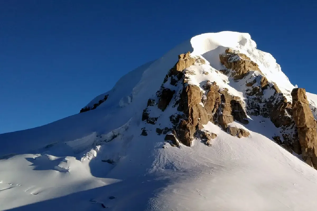
SUMMIT DAY: ABC to Deo Tibba Summit & back
Alpine start at 1–2 AM. Glacier traverse, hanging glacier ice section (fixed ropes), steep summit dome. Summit at 6,001m. Return to ABC then descend to Tainta.
Key Landmarks
Trek: Advance Camp to Jagatsukh & drive to Manali
Descent through the forest. Arrive Manali for celebration dinner.
Departure from Manali
End of expedition.
Trek Extensions & Add-ons
Suraj Tal Exploration
+0 DayOn Day 3, walk down to the nearby Suraj Tal, a stunning emerald green glacial lake right on the highway.
Also on this trek
Ready to book? Compare verified operators for Deo Tibba Peak Expedition — transparent pricing, no paid rankings.
Still deciding?
Compare routes side-by-side to find the perfect match for your fitness, dates, and budget.
Day by day, camp by camp. Send this to your group so everyone's on the same page.
Love this itinerary?
Find operators who follow this exact route with verified acclimatization days.
Find matching operators