Detailed Route
Kalindi Khal Expedition Itinerary — Day by Day Route & Camps
A 12-day savage crossing from the holy source of the Ganges at Gangotri to the sacred shrine of Badrinath, navigating the massive Chaturangi and Sweta glaciers.
Standard RouteThis is the standard mountain pacing for this trek. Specific operators may add an acclimatization day or alter the starting point. Check individual operator schedules for their exact logistics.
Duration
15 Days
Total Distance
99 KM
Max Altitude
19,521 FT
Trek Type
linear
Permits Required Before You Go
Permit Cost
Where to Get
IMF Delhi / DFO Uttarkashi
Documents
Extensive Mountaineering Resume, Specialized Alpine Insurance, Medical Clearances
Foreign Nationals
Extremely difficult. The route touches the sensitive Tibetan/Chinese border and requires X-Visa and Home Ministry clearance months in advance.
Foreigner Process
Requires intense Home Ministry and IMF clearance months in advance.
Nearest Embassy Hub
New Delhi
Day by Day Breakdown
Drive Dehradun to Gangotri
A massive 10-hour drive plunging deep into the Garhwal Himalayas. The town of Gangotri sits at 10,000ft, initiating the first stage of acclimatization.
Key Landmarks
Staying At
Trek Gangotri to Bhojbasa
Walk the relatively well-trodden pilgrim trail toward the source of the Ganges. The tree line vanishes after Chirbasa, placing you in a desolate high-altitude desert kind valley.
Key Landmarks
Staying At
Trek Bhojbasa to Nandanvan (via Gomukh)
The trail vanishes. You reach Gomukh (the ice cave birth of the Ganges) and step directly onto the massive Gangotri Glacier. Navigate hard ice, moraine and glacier debris to reach the Nandanvan meadow, camped directly beneath the terrifying spire of Mt. Shivling.
Key Landmarks
Staying At
Active Acclimatization at Nandanvan
Mandatory rest day. By climbing 500 feet up the ridges toward Tapovan and returning to camp, you force your body to build red blood cells.
Key Landmarks
Staying At
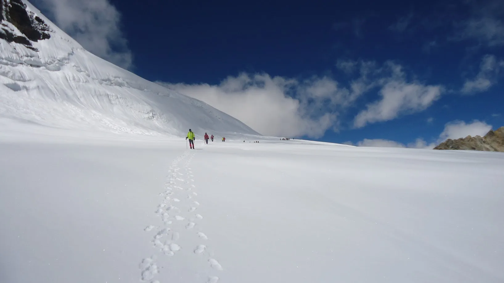
Trek Nandanvan to Vasuki Tal
A grueling traverse along the edge of the Chaturangi (Four-Colored) glacier. The air thins noticeably as you crash through the 16,000 ft barrier. Camp beside the half-frozen Vasuki Tal.
Key Landmarks
Staying At
Trek Vasuki Tal to Khara Pathar
A short but agonizing climb. The altitude reduces walking pace to a crawl. You are surrounded entirely by towering peaks of ice and rock; no vegetation exists.
Key Landmarks
Staying At
Trek Khara Pathar to Sweta Glacier
You now pitch tents directly on the frozen, crackling surface of the Sweta Glacier. This is extreme cold-weather camping where temperatures inside the tent drop well below -15°C.
Key Landmarks
Staying At
Trek Sweta Glacier to Kalindi Base Camp
The final push before the col. Ropes and crampons are triple-checked. The camp is set in a cirque surrounded by massive avalanche pathways.
Key Landmarks
Staying At
Summit Kalindi Khal (19,510 ft) & Descend to Raj Parav
The crucible. A 1:00 AM alpine start to beat the weather. Ascend the hyper-steep headwall to 19,500 ft. After witnessing the curvature of the earth and the towering Mt. Kamet, execute a terrifying, highly crevassed descent into the Arwa valley.
Key Landmarks
Staying At
Trek Raj Parav to Arwa Tal
Follow the Arwa stream down through heavily broken rock ravines. The air begins to thicken, and the lethal danger of the glacier is finally behind you.
Key Landmarks
Staying At
Trek Arwa Tal to Ghastoli
Trek all the way out to Ghastoli, where you merge with the Mana-Badrinath military road. Undergo security checks and some paperwork at the Indo-Tibetan Border Police camp.
Key Landmarks
Staying At
Drive Ghastoli to Badrinath
You may walk the military road or hitch a ride with a military truck to Badrinath temple, concluding one of the most savage treks on earth.
Key Landmarks
Staying At
Buffer Day 1
Mandatory buffer day built-in for bad weather delays at 18,000 ft.
Staying At
Buffer Day 2
Mandatory buffer day built-in for acclimatization adjustments or severe white-outs.
Staying At
Drive Badrinath to Dehradun
The incredibly long, winding highway descent out of the mountains, tracing the Alaknanda river back to civilization.
Key Landmarks
Staying At
Trek Extensions & Add-ons
Tapovan Excursion
+1 DayDuring the acclimatization at Nandanvan, traverse the glacier to visit the famous Tapovan meadows at the base of Mt. Shivling.
Also on this trek
Ready to book? Compare verified operators for Kalindi Khal Expedition — transparent pricing, no paid rankings.
Still deciding?
Compare routes side-by-side to find the perfect match for your fitness, dates, and budget.
Day by day, camp by camp. Send this to your group so everyone's on the same page.
Love this itinerary?
Find operators who follow this exact route with verified acclimatization days.
Find matching operators