Detailed Route
Kagbhushandi Tal Trek Itinerary — Day by Day Route & Camps
Standard RouteThis is the standard mountain pacing for this trek. Specific operators may add an acclimatization day or alter the starting point. Check individual operator schedules for their exact logistics.
Duration
7 Days
Total Distance
58 KM
Max Altitude
15,000 FT
Trek Type
linear
Permits Required Before You Go
Permit Cost
Where to Get
Govindghat / Joshimath DFO
Documents
Aadhar Card, Medical Fitness Certificate
Foreign Nationals
A bit tedious but permitted. Standard copies required.
Foreigner Process
Standard forest registration.
Nearest Embassy Hub
New Delhi
Day by Day Breakdown
Drive: Haridwar / Rishikesh to Govindghat
Long drive along the Alaknanda river passing all five Prayags. Last ATM at Joshimath — withdraw cash here. Night halt at Govindghat. Acclimatisation day.
Key Landmarks
Drive till Pulna and trek to Roopdhunga
Leave the commercial Valley of Flowers route entirely. Bushwhack sharply East through incredibly dense, steep forests (prime bear territory) to reach a small clearing at Roopdhunga.
Key Landmarks
Staying At
Trek Roopdhunga to Samdana Meadows
Climb steadily out of the forest onto high alpine meadows and broken rocky terrain. The shepherd trail becomes faint in sections as the terrain opens into a broad upper basin below Kankul Khal.
Key Landmarks
Staying At
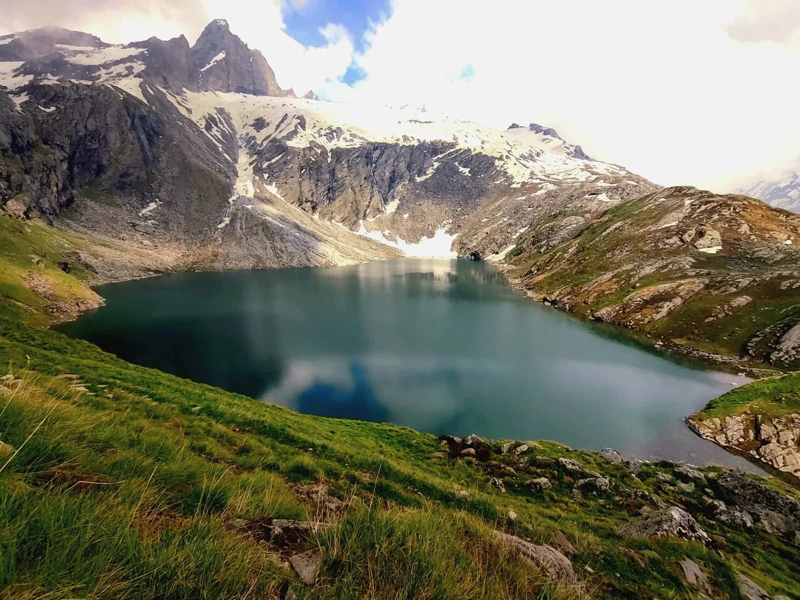
Cross Kankul Khal and Descend to Kagbhusandi Tal
Ascend steep rocky slopes and boulder sections to reach Kankul Khal (~15,000 ft). The terrain on both sides of the pass is rugged and route-finding can be difficult in poor visibility. Descend carefully into the Kagbhusandi Tal basin and camp near the lake area.
Key Landmarks
Staying At
Trek Kagbhusandi Tal to Garpak Meadows
Descend gradually from the Kagbhusandi basin through rocky alpine terrain into lower grazing meadows. Trails become clearer closer to seasonal grazing areas used by local shepherds.
Key Landmarks
Staying At
Trek Garpak to Painka and Drive to Joshimath
Descend through mixed forest and village trails toward the roadhead near Painka/Vishnuprayag. Drive onward to Joshimath for overnight stay.
Key Landmarks
Staying At
Drive Joshimath to Rishikesh
Long mountain drive descending through the Alaknanda valley back to Rishikesh.
Key Landmarks
Trek Extensions & Add-ons
Valley of Flowers Detour
+1 DayBefore driving back, you can spend a highly commercialized day walking from Govindghat/Ghangaria up to the famous Valley of Flowers.
Also on this trek
Ready to book? Compare verified operators for Kagbhushandi Tal Trek — transparent pricing, no paid rankings.
Still deciding?
Compare routes side-by-side to find the perfect match for your fitness, dates, and budget.
Day by day, camp by camp. Send this to your group so everyone's on the same page.
Love this itinerary?
Find operators who follow this exact route with verified acclimatization days.
Find matching operators