Essential Planning Guide
Darati Pass Trek — Complete Guide (2026)
Introduction
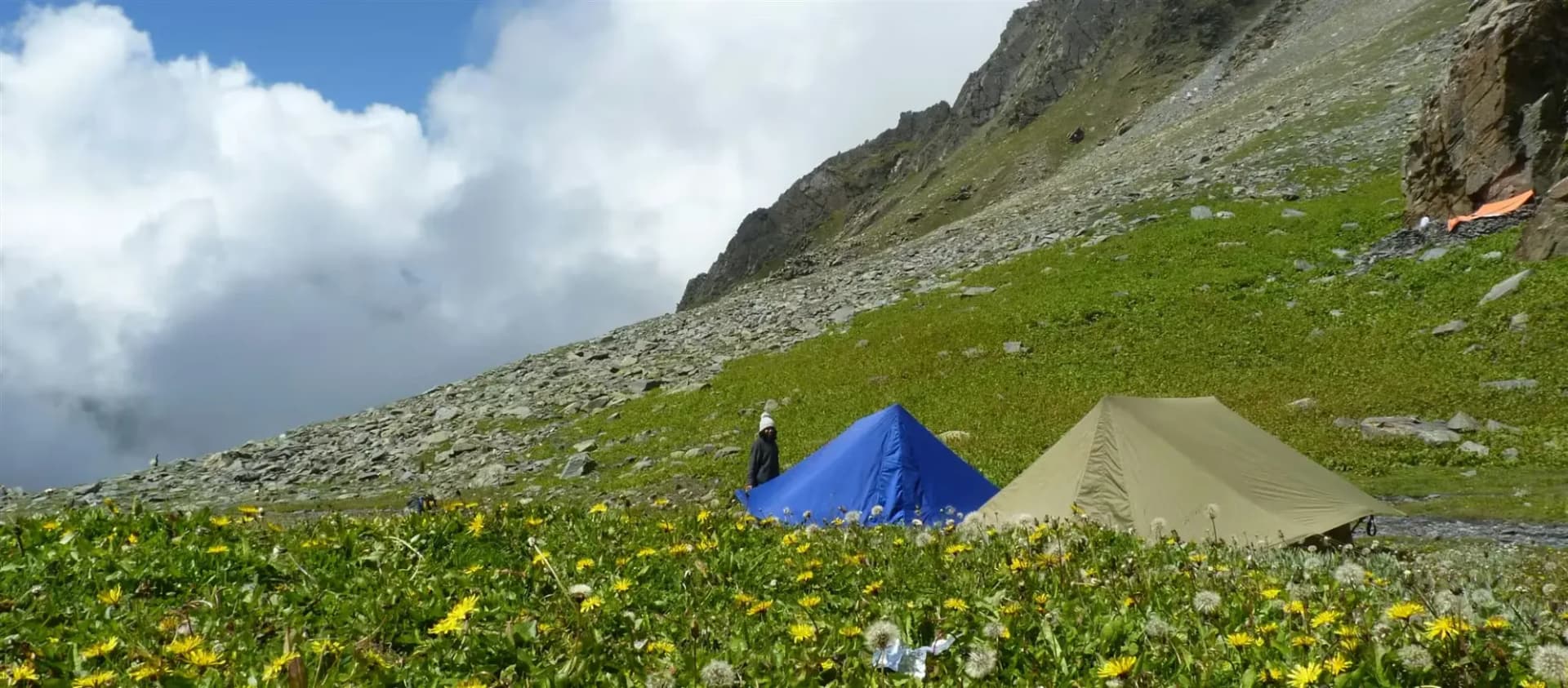
The Darati Pass Trek follows an ancient route connecting the Chamba region with the isolated Pangi Valley across Darati Pass at approximately 15,400 ft. Beginning in forested valleys, the trail climbs through alpine meadows before entering rugged high-altitude terrain marked by scree slopes, rocky basins, and glacial remnants. Historically used by shepherds and local communities, the route remains largely untouched by commercial trekking, offering exceptional solitude and a genuine wilderness experience. Crossing the pass reveals a dramatic transition from the lush landscapes of Chamba to the stark mountain scenery of the upper Chenab basin. Suitable only for experienced trekkers with excellent fitness, Darati Pass is a rewarding expedition for those seeking one of Himachal Pradesh's most remote crossover treks.
Ready to book? Compare verified operators for Darati Pass Trek — transparent pricing, no paid rankings.
Quick Facts
Duration
Max Altitude
Difficulty
Best Time
Trek Distance
Trail Atmosphere
Stargazing
Class 1 Dark Sky
Scent Profile
Silence Level
~5 dB
Vertigo Factor
5 / 10
Primarily a joint & muscle impact and altitude exposure challenge
A demanding expedition dominated by extreme joint & muscle impact.
Iconic Spots
The Sickle Ridge
Getting There
Route to Base
Train to Pathankot
Bus/Taxi to Chamba, then a local connection up the valley to Tisa
Base Village
Tisa / Charda Region
6,000 ft
Last ATM
Chamba Town
Nearest Medical Facility
Tisa (Chamba Block) / Udaipur (Lahaul Block)
Mobile Signal
Drops Day 1. Returns Day 5.
Water Sources
Rivers and glacial streams lower down. Dry push on the summit.
Charging
Zero.
For Drivers
Road Condition
Pathankot to Chamba is okay. The interior Tisa roads are bumpy.
Chamba / Tisa
Trail Culinary & Diet
Don't miss the N/A
Buy specialized diet items at Pathankot
The Content & Remote Hub
Top Vlog Spots
Video Calls
none
Est. 0 Mbps
UPI Reliability
1/10
Guide Wisdom
Caution
Grass is more dangerous than ice. The 60-degree grass slopes on the Chamba side become frictionless death traps if it rains. Wait it out.
Explore In Detail
Day by Day Itinerary
6-day route reaching 15,400ft. Covers 53km of varied terrain.
→ See full itinerary with altitude profileDifficulty & Fitness
Rated challenging. Highly unstructured. The trail is basically a bearing rather than a path. Rock, scree, and permanent snow patches define the upper 4,000 feet.
→ See difficulty breakdown and fitness guideCost & Pricing
Packages range from ₹12,000 – ₹28,000. Inclusions and hidden costs vary by operator tier.
→ See full cost breakdownPermits and Regulations
Standard forest trekking permits from the Chamba/Tisa DFO are mandatory. Police registration at the nearest checkpost is heavily enforced due to the sensitive nature of the Pangi border.
Learn more about how we vet operators and ensure transparency on our why MountRoutes page.
Packing List
High-Angle Traversal Gear
- Heavy-duty trekking boots with aggressive lug patterns (Sneakers will cause lethal slips on wet grass)
- Trekking poles with snow baskets (Essential for probing unstable scree)
- Lightweight mountaineering axe (For cutting steps in late spring passes)
Extreme Isolation Pack
- 4-season tent and -15°C sleeping bag (You camp essentially on rock and ice)
- Water filtration system (Glacial runoff carries heavy grit)
Flora & Fauna
Flora
Fauna
The pass is named 'Darati' (sickle) because of the severely curved, sharp ridge profile that shepherds must walk along.
— Local folklore
Spiritual & Cultural Significance
Shepherds construct small stone cairn temples at the top to give thanks to Shiva.
🕐 Shrine Timings: Always open
Temple Protocols
- •Tie a cloth offering
Frequently Asked Questions
Is Darati harder than Sach Pass?
Yes. While Sach Pass has a motor road and established trekking variants, Darati is completely wild. The slopes are technically steeper and there is almost zero human traffic.
Can I do this trek unguided?
Absolutely not. The trail disappears entirely above the treeline. Without a local who actively knows the shepherd migration times, you will get hopelessly lost in the moraines.
Are there glaciers?
Yes, specifically on the northern (Pangi) descent, there are steep, icy snowfields that require careful navigation and sometimes roped descent depending on the season.
Will I see wildlife?
High probability. The Chamba approach forests are dense Himalayan Brown Bear territory. In Pangi, Ibex and occasionally snow leopards roam the high ridges.
What is the exit logistics like?
You exit at Tindi in the Pangi Valley. From there, you must take a highly rugged 4x4 drive along the Chenab river either west to Killar or east to Lahaul (Keylong).
Is there mobile connectivity?
You lose it completely on Day 1. There is zero connectivity until you hit the road at Tindi on Day 5 or 6.
Is AMS a big risk?
Yes. Gaining 15,400 feet with the aggressive ascent profiles of the Pir Panjal demands disciplined acclimatization and hydration.
Are mules practical here?
Mules can only manage the lowest sections. The summit push and descent require human high-altitude porters.
What happens if we can't cross?
You must turn back to Chamba. There is no alternative path linking the valleys once you are committed.
Why would someone choose this over Sach Pass?
For the absolute solitude. Darati has zero road noise, no tourist traffic, and completely pristine alpine environments.
How technical is the Darati Pass crossing compared to Kugti Pass?
Darati Pass (15,400 ft) is slightly lower than Kugti but has a steeper, narrower gully approach that is highly prone to falling rocks. It requires excellent route-finding and rope management.
Is hiring a local Gaddi guide mandatory for Darati Pass?
Yes, the route is highly remote and undefined. Only experienced local Gaddi shepherd guides know the safe passage through the treacherous rock corridors.
What is the best month to cross Darati Pass?
September is the golden window. The monsoons have washed away loose dust, the crevasses are exposed and stable, and the pass is relatively clear of soft avalanche snow.
What happens in case of sudden bad weather on the pass?
You must immediately retreat to the base camps (Alyas). The narrow pass ridge acts as a wind funnel and can become lethal within minutes during a blizzard.
Are crampons and ice axes required for Darati?
Yes, hard snow slopes on the Chamba approach and steep glacial ice on the Lahaul side make professional microspikes/crampons and ice axes absolute safety essentials.
Other Treks Guides
Still deciding?
Compare routes side-by-side to find the perfect match for your fitness, dates, and budget.
Everything you need to know, in one place. Someone else in your group needs to see this.
Planning Darati Pass Trek?
Get route conditions, operator updates, and season windows before booking.
No spam. Only useful updates.
Ready to walk this route?
You’ve read the guide, now find the perfect local team to take you there. Compare our verified list of operators.
Compare verified operators