
Explore
Intelligence
Essential Planning Guide
Shilla Peak Expedition — Complete Guide (2026)
Vibe & Scenery
The Experience
Introduction
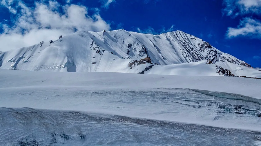
Towering to 7,025 m (23,048 ft), Mount Shilla is the highest peak in the Spiti region and among Himachal Pradesh's greatest mountaineering objectives. Rising above the fossil-rich landscapes near Langza, the mountain dominates the eastern skyline of the Spiti Valley with its immense ice-covered summit and remote glacial basins.
The expedition approaches through the stark high-altitude desert of Spiti, gradually ascending across moraines, scree slopes, and glacier systems before establishing successive high camps. Above base camp, climbers encounter crevassed glaciers, steep snowfields, exposed ridges, and extreme altitude that demand careful acclimatization, efficient logistics, and advanced alpine competence.
From the summit, panoramic views extend across Spiti, Kinnaur, Tibet, and the distant Zanskar Range. For elite mountaineers, Shilla represents one of the highest and most remote expedition objectives in the Indian Himalayas.
Quick Facts
Duration
Max Altitude
Difficulty
Best Time
Trek Distance
Trail Atmosphere
Iconic Spots
Spiti Cold-Desert Plateau
Langza & Kaza Canyons
Shilla Peak Summit (6,132m)
Shilla Jot Pass (5,640m)
Environment
Nature & Culture
Flora & Fauna
Flora
Fauna
Name means "range of death" or "gateway to heaven". Historically erroneously believed to be over 7,000m and the highest peak in India.
— Local folklore
Spiritual & Cultural Significance
Temple Protocols
Technical Details
Challenge & Preparation
Primarily a cardio demand and joint & muscle impact challenge
An elite-level undertaking with extreme cardio demand, joint & muscle impact, and altitude exposure. This route will push every dimension of your physical and mental endurance to the limit.
Personal Readiness
Am I ready?
Planning
Logistics & Trail Intel
Getting There
Nearest Railhead
Chandigarh Railway Station (IXC)
Nearest Airport
Kullu-Manali Airport, Bhuntar (KUU) / Chandigarh (IXC)
Nearest Medical Facility
Kaza CHC
Mobile Signal
No signal on trail
For Drivers
Trail Culinary & Diet
The Content & Remote Hub
Permits and Regulations
Highly regulated mountaineering peak within the restricted Spiti region.
Learn more about how we vet operators and ensure transparency on our why MountRoutes page.
Packing List
Clothing & Footwear
- Down suit/jacket
- Waterproof shell
- Multiple thermals
- Expedition-grade insulated boots
- Mittens/gloves
Technical Gear
- Climbing harness
- Crampons
- Ice axe
- Rescue ropes
- Carabiners
- Climbing helmet
Deep Dives
Explore Further
Editor's Notes
Given the remoteness and technical demands of the Spiti region, a professional mountaineering agency and Inner Line Permits are strictly required.
Explore In Detail
Day by Day Itinerary
7-day route reaching 20,118ft. Covers 157km of varied terrain.
→ See full itinerary with altitude profileDifficulty & Fitness
Rated extreme. Trans-Himalayan Spiti region. High-altitude deserts, deep steep-walled gorges, sedimentary rock faces, and challenging glacial features.
→ See difficulty breakdown and fitness guideCost & Pricing
Packages range from ₹36,000 – ₹61,000. Inclusions and hidden costs vary by operator tier.
→ See full cost breakdownFrequently Asked Questions
How difficult is the Shilla Peak, route?
It is rated as an advanced, highly demanding route. You will be navigating glacier, moraine, scree, forest, snow and reaching a maximum altitude of NaN ft. Prior high-altitude trekking or mountaineering experience is strictly required.
Where does the expedition officially start?
The primary logistical hub and starting point is the base camp. For transit, trekkers usually fly into Kullu-Manali Airport, Bhuntar (KUU) / Chandigarh (IXC) or take a train to Chandigarh Railway Station (IXC) before driving up to the base.
Are permits strictly required?
Yes. Because this route traverses sensitive and high-altitude regions in Himachal Pradesh, official forest permits (and potentially Inner Line Permits) are mandatory. Your expedition operator will typically manage the complex documentation.
What kind of fitness preparation is necessary?
You need peak cardiovascular endurance. We recommend rigorous cardiovascular training and load-bearing hikes. The ability to carry an 8-10kg backpack over steep inclines in thin air is critical for success.
Will there be mobile network connectivity?
Connectivity is extremely limited to non-existent. You may get a faint signal at the base camp, but beyond that, the trail is completely off-grid. Reputable operators carry satellite communicators for emergencies.
What is the risk of Acute Mountain Sickness (AMS)?
At heights reaching NaN ft, the air is incredibly thin, making AMS a severe risk. The itinerary is designed with acclimatization days, but you must stay hydrated and communicate any symptoms like headaches or nausea immediately.
What specialized gear is strictly mandatory?
High-ankle insulated mountaineering boots, a sleeping bag rated to at least -20°C (preferably -40°C for expeditions), and a heavily wind-resistant hardshell jacket are non-negotiable for survival and comfort.
How are emergency evacuations handled in this terrain?
Manual stretcher evacuation to the nearest road-head is the primary and most reliable method. Helicopter rescue is feasible in this region, but it is strictly dependent on clear weather conditions and military clearance.
What are the primary objective hazards on the route?
Beyond sheer exhaustion, trekkers must be mentally prepared for ams risk, crevasses, rockfall, avalanches, whiteout, exposure. Listening to your technical guide and adhering to strict turn-around times is essential for safety.
Route Intelligence
Routes With Similar Character
Routes that share the character of Shilla Peak Expedition.
Friendship Peak Expedition
Both are designed around reaching a high-altitude summit.
Kang Yatse 1 Peak Expedition
Both are designed around reaching a high-altitude summit.
Kang Yatse 2 Peak Expedition
Both are designed around reaching a high-altitude summit.
Still deciding?
Compare routes side-by-side to find the perfect match for your fitness, dates, and budget.
Everything you need to know, in one place. Someone else in your group needs to see this.
Planning Shilla Peak Expedition?
Get route conditions, operator updates, and season windows before booking.
Don't miss out! Follow us for route updates@mountroutes|LinkedIn
No spam. Only useful trek updates.
Ready to walk this route?
You’ve read the guide, now find the perfect local team to take you there. Compare our verified list of operators.
Compare verified operators