We are currently vetting local partners for Shilla Peak Expedition to ensure the highest safety standards. Be the first to know when it's open for booking.
Are you a local operator?
Join our platform to list your verified packages for Shilla Peak Expedition and reach thousands of climbers directly.
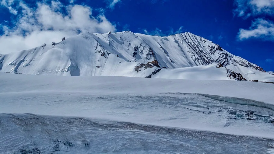
The Shilla Peak Expedition is an elite mountaineering objective to the highest mountain in Spiti, rising above one of the Himalaya's most dramatic cold-desert landscapes.
Expedition Highlights
Spiti Cold-Desert Plateau
The rugged, stark, and vividly colored Trans-Himalayan cold-desert landscapes of Spiti.
Langza & Kaza Canyons
Dramatic sedimentary rock spires, deep river gorges, and towering geological pinnacles.
Shilla Peak Summit (6,132m)
Breathtaking high-altitude summit panorama over the surrounding Kinnaur and Spiti massifs.
Shilla Jot Pass (5,640m)
Challenging high-altitude pass navigation bridging deep glaciated valleys.
It is rated as an advanced, highly demanding route. You will be navigating glacier, moraine, scree, forest, snow and reaching a maximum altitude of NaN ft. Prior high-altitude trekking or mountaineering experience is strictly required.
Where does the expedition officially start?
The primary logistical hub and starting point is the base camp. For transit, trekkers usually fly into Kullu-Manali Airport, Bhuntar (KUU) / Chandigarh (IXC) or take a train to Chandigarh Railway Station (IXC) before driving up to the base.
Are permits strictly required?
Yes. Because this route traverses sensitive and high-altitude regions in Himachal Pradesh, official forest permits (and potentially Inner Line Permits) are mandatory. Your expedition operator will typically manage the complex documentation.
What kind of fitness preparation is necessary?
You need peak cardiovascular endurance. We recommend rigorous cardiovascular training and load-bearing hikes. The ability to carry an 8-10kg backpack over steep inclines in thin air is critical for success.
Will there be mobile network connectivity?
Connectivity is extremely limited to non-existent. You may get a faint signal at the base camp, but beyond that, the trail is completely off-grid. Reputable operators carry satellite communicators for emergencies.
What is the risk of Acute Mountain Sickness (AMS)?
At heights reaching NaN ft, the air is incredibly thin, making AMS a severe risk. The itinerary is designed with acclimatization days, but you must stay hydrated and communicate any symptoms like headaches or nausea immediately.
What specialized gear is strictly mandatory?
High-ankle insulated mountaineering boots, a sleeping bag rated to at least -20°C (preferably -40°C for expeditions), and a heavily wind-resistant hardshell jacket are non-negotiable for survival and comfort.
How are emergency evacuations handled in this terrain?
Manual stretcher evacuation to the nearest road-head is the primary and most reliable method. Helicopter rescue is feasible in this region, but it is strictly dependent on clear weather conditions and military clearance.
What are the primary objective hazards on the route?
Beyond sheer exhaustion, trekkers must be mentally prepared for ams risk, crevasses, rockfall, avalanches, whiteout, exposure. Listening to your technical guide and adhering to strict turn-around times is essential for safety.
How difficult is the Shilla Peak, route?
It is rated as an advanced, highly demanding route. You will be navigating glacier, moraine, scree, forest, snow and reaching a maximum altitude of NaN ft. Prior high-altitude trekking or mountaineering experience is strictly required.
Where does the expedition officially start?
The primary logistical hub and starting point is the base camp. For transit, trekkers usually fly into Kullu-Manali Airport, Bhuntar (KUU) / Chandigarh (IXC) or take a train to Chandigarh Railway Station (IXC) before driving up to the base.
Are permits strictly required?
Yes. Because this route traverses sensitive and high-altitude regions in Himachal Pradesh, official forest permits (and potentially Inner Line Permits) are mandatory. Your expedition operator will typically manage the complex documentation.
What kind of fitness preparation is necessary?
You need peak cardiovascular endurance. We recommend rigorous cardiovascular training and load-bearing hikes. The ability to carry an 8-10kg backpack over steep inclines in thin air is critical for success.
Will there be mobile network connectivity?
Connectivity is extremely limited to non-existent. You may get a faint signal at the base camp, but beyond that, the trail is completely off-grid. Reputable operators carry satellite communicators for emergencies.
What is the risk of Acute Mountain Sickness (AMS)?
At heights reaching NaN ft, the air is incredibly thin, making AMS a severe risk. The itinerary is designed with acclimatization days, but you must stay hydrated and communicate any symptoms like headaches or nausea immediately.
What specialized gear is strictly mandatory?
High-ankle insulated mountaineering boots, a sleeping bag rated to at least -20°C (preferably -40°C for expeditions), and a heavily wind-resistant hardshell jacket are non-negotiable for survival and comfort.
How are emergency evacuations handled in this terrain?
Manual stretcher evacuation to the nearest road-head is the primary and most reliable method. Helicopter rescue is feasible in this region, but it is strictly dependent on clear weather conditions and military clearance.
What are the primary objective hazards on the route?
Beyond sheer exhaustion, trekkers must be mentally prepared for ams risk, crevasses, rockfall, avalanches, whiteout, exposure. Listening to your technical guide and adhering to strict turn-around times is essential for safety.
Are you a local operator?
Join our platform to list your verified packages for this expedition.