Detailed Route
Pin Parvati Pass Expedition Itinerary — Day by Day Route & Camps
An 11-day trans-Himalayan traverse from the lush Parvati Valley to the stark Pin Valley, crossing one of India's most challenging and sacred high-altitude gaps.
Standard RouteThis is the standard mountain pacing for this trek. Specific operators may add an acclimatization day or alter the starting point. Check individual operator schedules for their exact logistics.
Duration
11 Days
Total Distance
110 KM
Max Altitude
17,451 FT
Trek Type
linear
Day by Day Breakdown
Arrive Barshaini / Kasol — Acclimatization
Arrive and acclimatize. Visit Kasol. Expedition briefing and gear check. Rest well.
Staying At
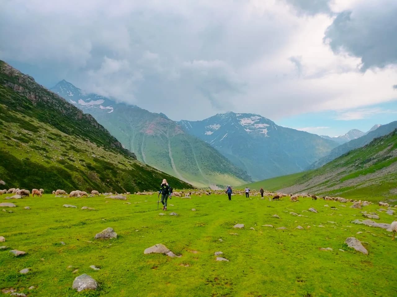
Trek: Barshaini to Kheerganga
Hot spring soak. Acclimatization night. Technical: Same trail as the Kheerganga day-trek. Steep forest climb. Relax in the hot spring tonight — your last warm bath for 8 days.
Key Landmarks
Staying At
Trek: Kheerganga to Tunda Bhuj
Easy day. Conserve energy for the days ahead. Technical: Gentle climb through ancient deodar and birch forests. Trail narrows. River crossings begin — all bridged at this point. Tunda Bhuj is a vast, flat clearing used by Gaddi shepherds.
Key Landmarks
Staying At
Trek: Tunda Bhuj to Thakur Kuan
Last campsite with any shade or vegetation. Technical: You cross the tree line today. The trail transitions from forest to open boulder fields and alpine scrub. Cairn navigation begins. The 'Thakur Kuan' (Thakur's Well) is a natural water source that marks the last greenery. Safety: AMS monitoring begins. 11,500ft requires 4L+ water intake.
Key Landmarks
Staying At
Trek: Thakur Kuan to Odi Thach (Mantalai Base)
Cold, windswept camp. Proper winter gear from tonight. Technical: Walking on lateral moraine. Very slow going — rocks shift underfoot. The Parvati river narrows to a glacial stream. Mantalai Lake (the source of the Parvati) may be visible depending on snow levels. Landscape: Mantalai Lake is sacred — it is the source of the Parvati River and is believed to be the place where Lord Shiva gave Parvati the 'jewel of knowledge' (mani). The name 'Mantalai' means 'lake of the mani'. Safety: Critical AMS zone. Oximeter check at camp. Do not overexert.
Key Landmarks
Staying At
Acclimatization Day at Odi Thach
Critical acclimatization day. Short walk to Mantalai Lake and back (if conditions allow). Hydrate. Rest. Gear check for the glacier crossing.
Staying At
Trek: Odi Thach to Parvati South Base Camp
Expedition-grade camp on glacier moraine. Sub-zero temps (-15°C possible). Technical: You are now on the Parvati South Glacier. Roped walking begins. Crampons and ice axes are mandatory. The terrain is glacial moraine and ice. Crevasses are present — follow the guide's exact footsteps. Zero margin for error. Safety: EXTREME. 14,500ft on a glacier. Full winter expedition mode. Carry Diamox if prescribed. Oxygen saturation must be above 80% to proceed.
Key Landmarks
Staying At
Pass Day: Base to Pin Parvati Pass (17,500ft) & Descent to Pin Base
Celebration camp on the Pin side. You have crossed the Great Himalayan Range. Technical: Start at 2 AM. Headlamp-lit glacier walk for 3 hours. Final 500m to the pass is a near-vertical ice wall (50-60 degree incline) requiring fixed ropes, crampons, and ice axes. The pass crest is narrow — 5 minutes for photos, then descend. The Spiti side descent is steep scree and moraine for 4 hours. 12-hour mega push. Oxygen at 57%. Landscape: Standing at 17,500 ft, you look back at the green Parvati Valley and forward into the brown, treeless desert of Spiti. The transition is instantaneous and surreal. You have just crossed from one world to another. Safety: Turnback Time: 9 AM. After this, the glacier becomes unstable. One of the highest pass crossings in India. This is an expedition, not a trek.
Key Landmarks
Staying At
Descent: Pin Base to Pin Valley Camp
The air feels warmer. The desert landscape of Spiti unfolds. Technical: Steep descent through loose moraine and scree. Pin river is fast and cold. Navigation by cairns.
Key Landmarks
Staying At
Trek: Pin Valley to Mudh Village
Guesthouse in Mudh. Hot meal. First proper roof in 8 days. Technical: Long walk through the Pin Valley. The landscape is completely different — arid, brown, and vast. Reach Mudh village by evening. Landscape: Mudh is the last village in the Pin Valley. It is a traditional Spiti Buddhist settlement with a gompa (monastery). The village economy depends on yak herding and pea cultivation. You are now in the rain-shadow of the Great Himalayan Range.
Key Landmarks
Staying At
Drive: Mudh to Kaza
Drive to Kaza — the heart of Spiti. Expedition concludes. Connect to Manali (12 hours) or Shimla (15 hours).
Staying At
Trek Extensions & Add-ons
Pin Valley Buddhist Circuit
+2 DaysExploration of Kungri and Dhankar monasteries after reach Mud village.
Also on this trek
Ready to book? Compare verified operators for Pin Parvati Pass Expedition — transparent pricing, no paid rankings.
Still deciding?
Compare routes side-by-side to find the perfect match for your fitness, dates, and budget.
Day by day, camp by camp. Send this to your group so everyone's on the same page.
Love this itinerary?
Find operators who follow this exact route with verified acclimatization days.
Find matching operators