Detailed Route
Nandikund Trek Itinerary — Day by Day Route & Camps
A meticulously structured 6-day journey commencing at Rishikesh and completing at Rishikesh. The trail progresses naturally through diverse climate zones, offering proper acclimatization milestones, scenic ridge highlights, and beautiful, high-value campsite locations.
Standard RouteThis is the standard mountain pacing for this trek. Specific operators may add an acclimatization day or alter the starting point. Check individual operator schedules for their exact logistics.
Duration
7 Days
Total Distance
47 KM
Max Altitude
14,268 FT
Trek Type
linear
Permits Required Before You Go
Permit Cost
Where to Get
Ransi Village forest checkpost
Documents
Aadhaar Card
Foreign Nationals
Inner Line Permit required. Apply at Chamoli SDM office.
Foreigner Process
Inner Line Permit from Chamoli SDM. ₹600.
Nearest Embassy Hub
New Delhi
Day by Day Breakdown
Drive to Ransi & Trek to Gaundar
A long drive to Ransi followed by a short trek down to Gaundar village.
Staying At
Reach Madhmaheshwar
Steep ascent to the revered Madmaheshwar temple through dense forests.
Staying At
Reach Kachni Khal
Trek beyond the temple into true alpine wilderness, reaching the high meadows of Kachni Khal.
Staying At
Reach Pandav Sera
Traverse rocky terrain and descend slightly to the mystical Pandav Sera meadows.
Staying At
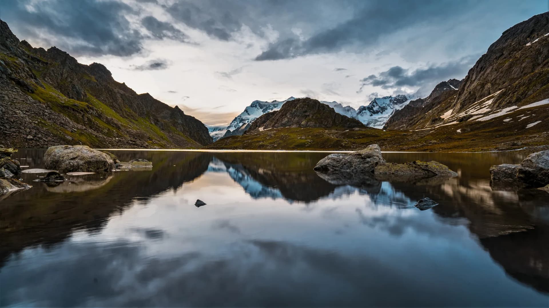
Reach Nandi Kund
Ascend to the sacred high-altitude Nandi Kund lake, surrounded by snow peaks and glacial moraine.
Staying At
Cross Ghiya Vinayak Pass & Descend
Cross the formidable Ghiya Vinayak Pass (approx 17,300 ft) and make a long, steep descent towards the valley.
Staying At
Trek to Roadhead & Drive
Final descent through dense forest to the roadhead (Urgam or Kalpeshwar side) and drive back.
Staying At
Trek Extensions & Add-ons
Nandikund to Rudranath Connection
+4 DaysExpert operators can connect Nandikund to the Rudranath temple via the Ransi valley ridge in a rare 10-day double-objective Panch Kedar expedition.
Also on this trek
Ready to book? Compare verified operators for Nandikund Trek — transparent pricing, no paid rankings.
Still deciding?
Compare routes side-by-side to find the perfect match for your fitness, dates, and budget.
Day by day, camp by camp. Send this to your group so everyone's on the same page.
Love this itinerary?
Find operators who follow this exact route with verified acclimatization days.
Find matching operators