
Explore
Intelligence
Detailed Route
Kanakata Pass Trek Itinerary — Day by Day Route & Camps
A 9-day deep wilderness expedition starting from Kharkiya, passing through Jatoli and Kathalia, to cross the 15,091 ft Kanakata Pass.
Standard RouteThis is the standard mountain pacing for this trek. Specific operators may add an acclimatization day or alter the starting point. Check individual operator schedules for their exact logistics.
Duration
9 Days
Total Distance
85.0 KM
Max Altitude
15,091 FT
Trek Type
circuit
Permits Required Before You Go
Permit Cost
Where to Get
Forest office in Bageshwar or Kapkot
Documents
ID Proof, Passport Size Photos, Medical Fitness Certificate
Foreign Nationals
Foreigners may require additional clearances as the upper reaches approach the inner line areas. Passport and Visa copies mandatory.
Foreigner Process
Requires passport copies and clearance from the Bageshwar Forest Department.
Nearest Embassy Hub
New Delhi
Day by Day Breakdown
Camp Alt
7,250 ft
Day Gain
+5,500 ft
Drive Kathgodam to Kharkiya and Trek to Khati
A long 9-10 hour drive from Kathgodam takes you deep into the Kumaon hills to the roadhead at Kharkiya. From there, it's a short, relatively flat 5km trek to the bustling village of Khati, the last major settlement on the Pindari trail.
Key Landmarks
Staying At
The drive ascends from into the Pindar valley, transitioning into a forested trail toward Khati.
Camp Alt
8,100 ft
Day Gain
+850 ft
Trek Khati to Jatoli
The trail bifurcates from the main Pindari glacier route, descending to cross the river before a steep climb up to Jatoli. Jatoli is a picturesque village and the true gateway to the Sunderdhunga valley.
Key Landmarks
Staying At
The route descends into the Pindar gorge before ascending a steep forested trail toward Jatoli.
Field Notes
KEY ACTIONRiver Crossings
Plan to cross early in the day before snowmelt swells the water levels. Unclip backpack waist belts before crossing.
Camp Alt
10,500 ft
Day Gain
+2,400 ft
Trek Jatoli to Kathalia
A long, arduous day passing through dense oak and rhododendron forests. The trail often features landslide zones and rocky overhangs. Kathalia is a beautiful alpine meadow sitting below the Sunderdhunga glacier.
Key Landmarks
Staying At
The Jatoli settlement leads into a dense forested gorge following the Sunderdhunga river.
Field Notes
KEY ACTIONRiver Crossings
Plan to cross early in the day before snowmelt swells the water levels. Unclip backpack waist belts before crossing.
Camp Alt
10,500 ft
Day Gain
0 ft
Acclimatization / Sunderdhunga Glacier Excursion
A mandatory acclimatization day. Trekkers do a side hike to the snout of the Sunderdhunga glacier and return to Kathalia to sleep low. Vital preparation before hitting the severe altitudes of the pass.
Key Landmarks
Staying At
Crossing the high-altitude pass bridges two distinct watershed systems, shifting the expedition over the glaciated divide and down into a new river basin.
Field Notes
Use Trekking Poles
Trekking poles are highly recommended to save your knees on the descent.
INFOSlower Progress
Progress will be significantly slower and more taxing on your ankles than trail distance suggests.
Camp Alt
12,500 ft
Day Gain
+2,000 ft
Trek Kathalia to Baluni Top / Sunderdhunga Base
The trail turns incredibly steep. Leaving the treeline behind, the route ascends sharply over rocky slabs and alpine grass to reach the high meadows of Baluni Top. Views of Maiktoli are staggering.
Key Landmarks
Staying At
Tree line disappears as the valley broadens into a spectacular high-altitude alpine meadow basin, replacing the dense forests with expansive grazing pastures.
Camp Alt
14,000 ft
Day Gain
+1,500 ft
Trek Baluni Top to Devi Kund & Nag Kund
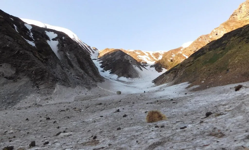
Entering the true high-altitude glacial zone. The trek involves navigating moraine ridges to reach the sacred, icy glacial tarns of Devi Kund and Nag Kund. The terrain is barren rock and ice.
Key Landmarks
Staying At
The rugged alpine terrain opens up to reveal a spectacular high-altitude glacial tarn, serving as a critical hydrological node in the upper watershed.
Field Notes
Use Trekking Poles
Trekking poles are highly recommended to save your knees on the descent.
INFOSlower Progress
Progress will be significantly slower and more taxing on your ankles than trail distance suggests.
Camp Alt
10,500 ft
Day Gain
-3,500 ft
Today's Objective
🏔 Cross Nag Kund To Kanakata Pass
The crux of the expedition. An alpine start is required to cross the steep, rocky slopes leading up to Kanakata Pass. From the 15,091 ft pass, the panoramic views of the Nanda Devi sanctuary wall are unparalleled. A massive, knee-crushing descent back to Kathalia follows.
Key Landmarks
Staying At
The route transitions between basins at Kanakata Pass before dropping back into the forest at Kathalia.
Camp Alt
8,100 ft
Day Gain
-2,400 ft
Trek Kathalia to Jatoli
Retracing steps back through the forests of Sunderdhunga valley. Re-entering civilization at Jatoli village.
Staying At
The Sunderdhunga gorge trail descends through the forest back to the Jatoli settlement.
Camp Alt
1,750 ft
Day Gain
-6,350 ft
Trek Jatoli to Kharkiya and Drive to Kathgodam
A long final day. Trek out through Khati to the roadhead at Kharkiya, followed immediately by the 9-hour drive back to Kathgodam.
Key Landmarks
The high alpine meadows narrow into forested river terraces as tree line vegetation reappears in the lower mountain river corridor.
Trek Extensions & Add-ons
Maiktoli Base Camp
+2 DaysFrom Kathalia, an alternative challenging route leads to the base camp of the massive 6,803m Maiktoli peak.
Plan Your Trek:
Ready to book? Compare verified operators for Kanakata Pass Trek — transparent pricing, no paid rankings.
Still deciding?
Compare routes side-by-side to find the perfect match for your fitness, dates, and budget.
Day by day, camp by camp. Send this to your group so everyone's on the same page.
Step 4: Cost & Logistics
You understand the route.
Now see what services, permits, and logistics actually cost.
View Cost Breakdown