
Explore
Intelligence
Difficulty & Readiness Guide
Is Kanakata Pass Trek Difficult? — Fitness & Altitude Guide
A Challenging/Difficult trek. Extremely steep ascents over moraine and scree above 12,000 ft. Requires high physical endurance and prior high-altitude experience.
The Question
Can I do this trek?
Preparation Required
Advanced
Prior Experience
Required: At least 2-3 moderate Himalayan treks (above 13,000ft).
Expert Verdict
Highly technical trek requiring physical and mental preparation.
Kanakata Pass Trek
Himalayan Placement · Index 64Route Knowledge
Why is it difficult?
Exertion Index
Primary Challenge
Route Identity
Demanding glaciated pass crossing requiring sustained altitude endurance.
Primary Drivers
- Maximum sleeping altitude of 14,000 ft
- 5 consecutive high-output trekking days
- Peak daily distance of 14 km
View Full Route Analysis
Physiological Demand
Steep, punishing ascents and descents that will heavily tax your knees, ankles, and overall joint stability.
Deep wilderness isolation and cumulative fatigue. The mental challenge of enduring days on end in harsh conditions is extreme.
Expect long, exhausting days of sustained climbing at high intensity. Your cardiovascular system will be pushed to its absolute limit.
Significant time spent above 12,000ft. Expect shortness of breath and slower pacing.
Rough, uneven trails with occasional scrambling or minor exposure.
Terrain Breakdown
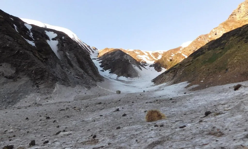
The route transitions from well-trodden village paths to dense forest trails with landslide hazards, eventually becoming a brutal moraine and scree slog above 12,000 ft.
Summit Day Notes
The push from Nag Kund to Kanakata pass is relentlessly steep. The lack of oxygen and the loose rocky surface make every step exhausting.
The Descent
Descending from the 15,091 ft pass back to 10,500 ft at Kathalia in a single day puts immense strain on the knees. Microspikes may be needed if snow is present.
Altitude Profile
The trek involves a sharp altitude gain of over 7,000 ft from Jatoli to the Pass within 4 days.
Run AMS Risk Audit →Trail Performance Data
Max Gradient
50%
Hydration
1.5L per km recommended
Loose Surface Sections
- •Baluni Top to Kanakata Pass
Personal Readiness
Am I ready?
What this route demands
People who feel comfortable on this route can usually:
Who Can Do This Trek?
Min Age
16+
Max Age
55
Western Toilets at Base
Yes
Solo Female Travelers
Safe in guided groups. Solo travel is highly discouraged due to terrain hazards.
Hazard Profile
What goes wrong?
Common Mistakes on Kanakata Pass Trek
Most injuries and failures on this trail can be avoided by making smarter decisions early on.
Underestimating the steepness of the Sunderdhunga valley compared to the easier Pindari trek.
Skipping the acclimatization day at Kathalia.
Attempting the pass crossing too late in the morning, leading to afternoon whiteout conditions.
Safety & Medical Risks
Key Risks
Acute Mountain Sickness (AMS) above Kathalia
Rockfall in the gorge sections between Jatoli and Kathalia
Ankle sprains on the heavy moraine near Devi Kund
AMS (Altitude Sickness)
The rapid ascent from 10,500 ft to 15,000 ft in two days poses a significant risk. Strict monitoring of blood oxygen is required.
Evacuation Route
Manual stretcher carry back to Jatoli/Kharkiya. This can take 2-3 days from the pass.
Solo Trekking
Highly unadvised. The route beyond Kathalia is unmarked and highly dangerous to attempt without local knowledge.
Common Trail Ailments
🏥 Nearest ICU: Haldwani (12+ hours)
Tactical Emergency Hub
> Evacuation is entirely manual until reaching the roadhead at Kharkiya.
Auditability
How is this calculated?
Understand This Route Further
Before attempting this route:
Still deciding?
Compare routes side-by-side to find the perfect match for your fitness, dates, and budget.
Still think it's doable? Share this with your trek mate and see if they agree.
Step 2: Seasonal Safety
You know how demanding this route is.
Now find the safest and most reliable season to attempt it.
Check Best Time to Go