Kanakata Pass Trek — compare operators and pricing

Compare operators for Kanakata Pass Trek

UttarakhandChallenging

Interested in this trek?

We are currently vetting local partners for Kanakata Pass Trek to ensure the highest safety standards. Be the first to know when it's open for booking.

Are you a local operator?

Join our platform to list your verified packages for Kanakata Pass Trek and reach thousands of trekkers directly.

Apply to join

Found the right operator? Share this list with whoever's coming with you.

About Kanakata Pass Trek

9 Days
15,091 FT
Challenging

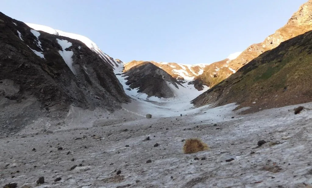
The Kanakata Pass Trek is a challenging expedition beyond the Sunderdhunga Valley into one of Kumaon's least-visited high mountain passes. Reaching approximately 15,091 ft, the route combines glacial valleys, alpine lakes, rocky moraines, and remote wilderness beneath peaks such as Maiktoli and Panwali Dwar. It is intended for experienced trekkers comfortable in demanding terrain.

Trek Highlights

Devi Kund

A high-altitude turquoise glacial tarn surrounded by jagged moraine.

Kanakata Pass Summit

A 360-degree amphitheater of the Nanda Devi sanctuary peaks, including Maiktoli and Panwali Dwar.

View Complete Trek Guide

Common Questions

Is the Kanakata Pass Trek suitable for beginners?
Absolutely not. This is a challenging, high-altitude trek requiring significant prior experience in the Himalayas. The terrain involves steep rock slabs, scree, and potential snow crossings above 14,000 ft.
What is the difference between the Sunderdhunga Trek and Kanakata Pass?
The standard Sunderdhunga trek goes up to Kathalia and the Sunderdhunga glacier snout (approx 10,500 ft). Kanakata Pass is a severe extension from Kathalia, climbing an additional 4,500 vertical feet past Baluni Top and Devi Kund to reach the 15,091 ft pass.
Do I need technical mountaineering gear?
While it is not a technical peak climb, early season (May) or late season (late October) attempts may require microspikes, gaiters, and an ice axe for safely negotiating steep, icy gullies.
Where is the last point of mobile connectivity?
BSNL networks may work intermittently in Khati village. Beyond Khati, there is absolutely no mobile connectivity for the remaining 7 days of the trek.
Can this trek be done during the monsoon?
No. The Sunderdhunga valley is prone to severe landslides, and the glacial streams become uncrossable torrents in July and August. Attempting this in the monsoon is highly dangerous.
Are there teahouses or homestays on the trail?
Homestays are available in Khati and Jatoli. Beyond Jatoli, you must be fully self-sufficient with high-altitude expedition tents and rations.
What happens if someone suffers from AMS?
Immediate descent is the only cure. The terrain makes helicopter evacuation extremely difficult. Trekkers must be prepared to carry down an affected team member via stretcher or mule.
Is a local guide mandatory?
Yes. The trail beyond Kathalia is completely unmarked, frequently washed out by rockfall, and highly deceptive. A local guide from Khati or Jatoli is essential for route finding.
Is the Kanakata Pass Trek suitable for beginners?
Absolutely not. This is a challenging, high-altitude trek requiring significant prior experience in the Himalayas. The terrain involves steep rock slabs, scree, and potential snow crossings above 14,000 ft.
What is the difference between the Sunderdhunga Trek and Kanakata Pass?
The standard Sunderdhunga trek goes up to Kathalia and the Sunderdhunga glacier snout (approx 10,500 ft). Kanakata Pass is a severe extension from Kathalia, climbing an additional 4,500 vertical feet past Baluni Top and Devi Kund to reach the 15,091 ft pass.
Do I need technical mountaineering gear?
While it is not a technical peak climb, early season (May) or late season (late October) attempts may require microspikes, gaiters, and an ice axe for safely negotiating steep, icy gullies.
Where is the last point of mobile connectivity?
BSNL networks may work intermittently in Khati village. Beyond Khati, there is absolutely no mobile connectivity for the remaining 7 days of the trek.
Can this trek be done during the monsoon?
No. The Sunderdhunga valley is prone to severe landslides, and the glacial streams become uncrossable torrents in July and August. Attempting this in the monsoon is highly dangerous.
Are there teahouses or homestays on the trail?
Homestays are available in Khati and Jatoli. Beyond Jatoli, you must be fully self-sufficient with high-altitude expedition tents and rations.
What happens if someone suffers from AMS?
Immediate descent is the only cure. The terrain makes helicopter evacuation extremely difficult. Trekkers must be prepared to carry down an affected team member via stretcher or mule.
Is a local guide mandatory?
Yes. The trail beyond Kathalia is completely unmarked, frequently washed out by rockfall, and highly deceptive. A local guide from Khati or Jatoli is essential for route finding.

Are you a local operator?

Join our platform to list your verified packages for this trek.

Apply to join
MountRoutes Dispatch

Planning Kanakata Pass Trek?

Get route conditions, operator updates, and season windows before booking.

Don't miss out! Follow us for route updates@mountroutes|LinkedIn

No spam. Only useful trek updates.

Explore Collections

Not sure where to go next?

View all