Traverse Safety & Risk
Khatling Glacier Expedition — Safety Guide
Altitude physiology, pass crossing go/no-go criteria, evacuation protocol, and insurance requirements.
Primary Hazards
Crevasse fall on Khatling
Severe AMS at Masar Tal
Rockfall on Mayali descent
AMS Protocol
Very high risk due to rapid gain to Masar Tal (16,200ft).
Altitude Physiology — SpO₂ by Camp
Diamox (Acetazolamide)
Recommended
Expedition Medical Kit
Pass Crossing Protocol
GO Conditions
- ✓ Clear sky at 3 AM
- ✓ Wind below 20km/h
NO-GO Conditions
- ✗ Lenticular clouds on Meru peak
- ✗ Fresh snow > 6 inches
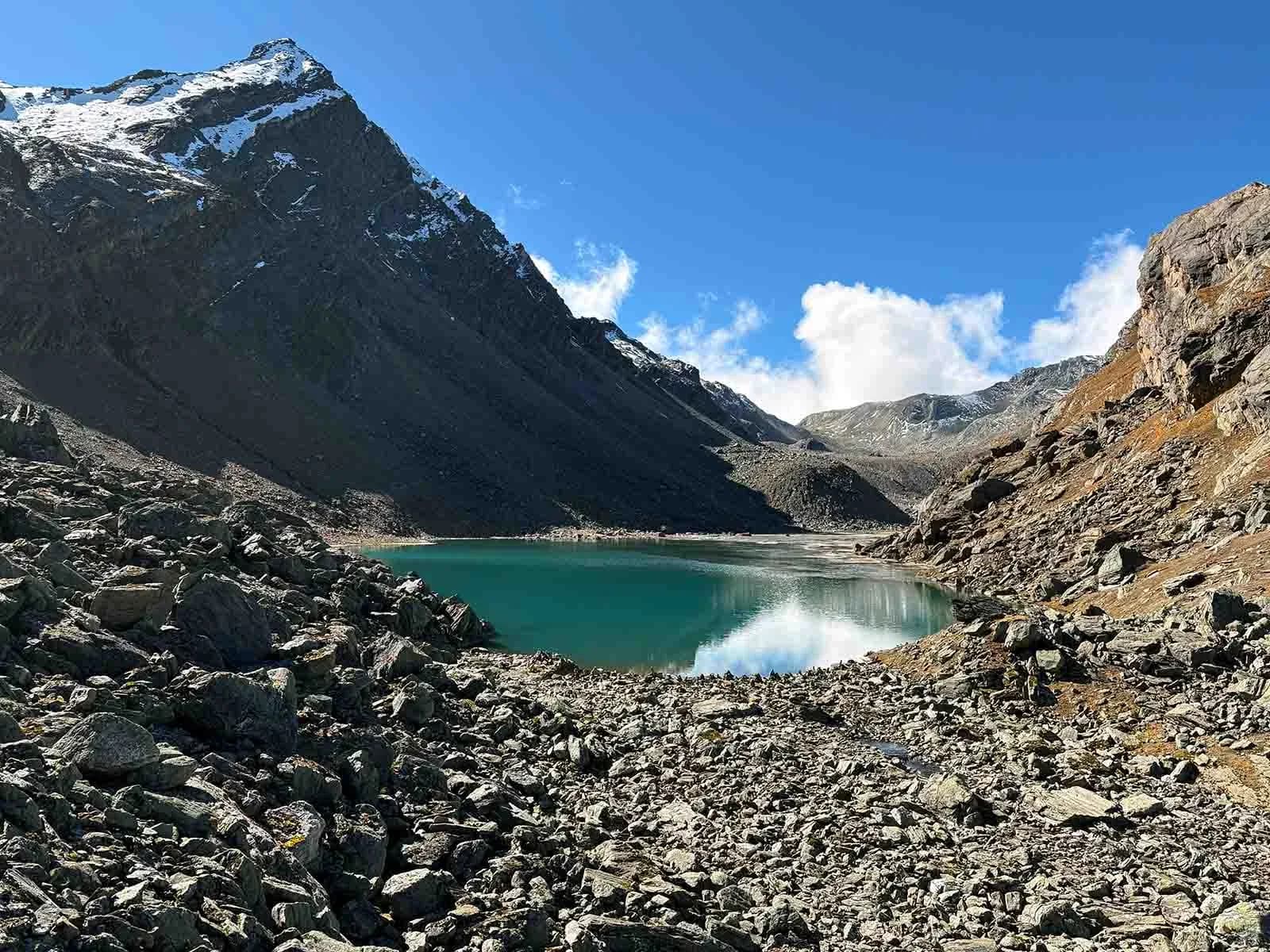
Glacier Hazards — Khatling Glacier
Crevasse Zone
Upper Khatling icefall
Crevasse Zone
Mayali Pass approach
Avalanche Path
Mayali east face
Avalanche Path
Jogin massifs
Bergschrund
Visible at the base of Mayali headwall in September.
Historical Safety Record
We publish verified incident records to help trekkers and operators make informed decisions. Names and personal identifiers are anonymized.
Documented
6
verified incidents
Fatalities
0
none recorded
Near Misses
1
logged
We have analysed 6 documented incidents for this expedition to extract critical safety lessons.
Due to the nature of mountaineering — where most non-fatal incidents go unreported — experts estimate 18+ total historical incidents on this route. Estimated historical fatalities: 2. We present the documented record as-is rather than speculate on undocumented cases.
Year
2022
Snow Blindness
Outcome
Led out by team members
Contributing Cause
UV-protective eyewear not worn on high snowfields
Key Safety Lesson
Always uV radiation on high-altitude snowfields is intense. Wear Category 4 sunglasses constantly.
Year
2022
Lost / Navigation Failure
Outcome
Rescue by external team
Contributing Cause
Contributing factors not fully documented
Key Safety Lesson
Do not blindly follow sheep trails. Always use a calibrated compass and GPS.
Year
2016
Crevasse Fall
Outcome
Rescue by external team
Contributing Cause
Unroped travel on glaciated terrain
Key Safety Lesson
Always the Khatling glacier is heavily crevassed. Unroped travel is extremely dangerous.
Year
2016
River Crossing Incident
Outcome
Rescue by external team
Contributing Cause
Contributing factors not fully documented
Key Safety Lesson
Always glacial melt doubles river volume by afternoon. Cross all major streams before 9 AM.
Year
2015
Fall — Rocky Terrain
Outcome
Medical treatment at base camp
Contributing Cause
Contributing factors not fully documented
Key Safety Lesson
Always global warming is loosening mountain faces. Be hyper-vigilant when crossing below rock walls.
Year
2013
Exhaustion / Overexertion
Outcome
Self-recovered
Contributing Cause
Contributing factors not fully documented
Key Safety Lesson
Always treat your support staff with extreme respect. They are your lifeline.
Source: Public Records / News Reports
Why estimates differ from records: IMF and news sources only capture permitted expeditions and helicopter rescues. Non-fatal near-misses (AMS, frostbite, falls with self-rescue) are almost never filed. Peaks with multi-decade climbing histories compound these gaps significantly.
Emergency Contacts
Evacuation Route
Back to Gangi via Bhilangna valley
Compare Operators on Safety Standards
See which operators carry certified guides, satellite comms, and medical support for Khatling Glacier Expedition.
View OperatorsStill deciding?
Compare routes side-by-side to find the perfect match for your fitness, dates, and budget.
Knowledge Integrity
Help us keep this data ground-truth accurate.
This encyclopedia entry for Khatling Glacier Expedition is curated from a mix of public survey records, first-hand climber accounts, and official permit logs. However, mountains are dynamic. If you have been on this route recently and noticed a change in terrain, water availability, or local regulations, we want to hear from you.
Community Vetted
Last Verified: May 2026
EXPEDITION DATABASE