Detailed Route
Khatling Glacier Expedition Itinerary — Day by Day Route & Camps
10-day traverse from Ghuttu to Kedarnath via the Khatling Glacier and Mayali Pass.
Standard RouteThis is the standard mountain pacing for this trek. Specific operators may add an acclimatization day or alter the starting point. Check individual operator schedules for their exact logistics.
Duration
10 Days
Total Distance
92 KM
Max Altitude
17,388 FT
Trek Type
circuit
Day by Day Breakdown
Drive: Rishikesh to Ghuttu
Last point for basic supplies. Stay in a local lodge.
Key Landmarks
Staying At
Trek: Ghuttu to Reeh
Gradual climb through forest. Reeh is a small settlement.
Key Landmarks
Staying At
Trek: Reeh to Gangi Village
The last village of the valley. Authentic stone architecture.
Key Landmarks
Staying At
Trek: Gangi to Kharsoli
Crossing the Bhilangna river. Deepening wilderness.
Key Landmarks
Staying At
Trek: Kharsoli to Tambakund
Copper-colored rocks. Entry into the glacier zone.
Key Landmarks
Staying At
Trek: Tambakund to Chowki
Navigating the lateral moraine of Khatling. Chowki is a high meadow.
Key Landmarks
Staying At
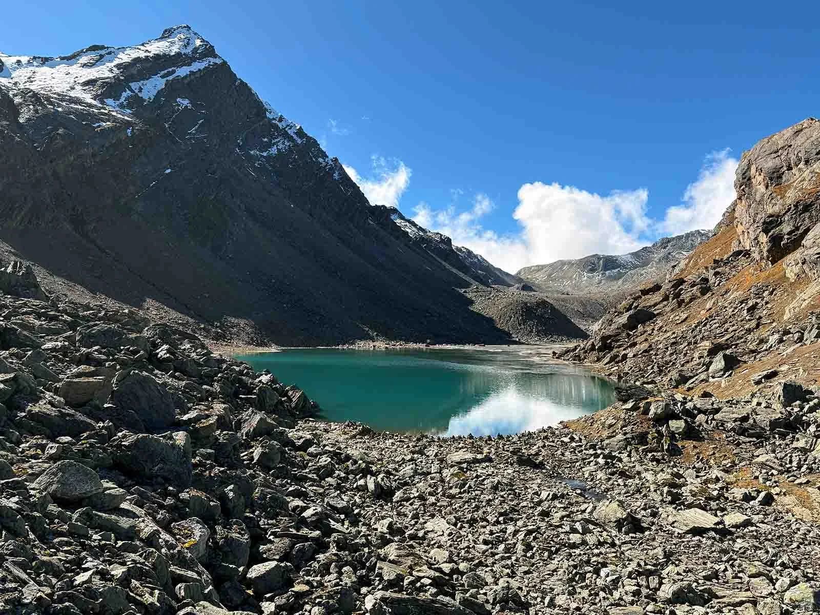
Trek: Chowki to Masar Tal
Steep ascent to the high emerald lake. Exposed sections.
Key Landmarks
Staying At
Trek: Masar Tal to Vasuki Tal via Mayali Pass
Crux day. Crossing the 17,388ft pass. Steep technical descent.
Key Landmarks
Staying At
Trek: Vasuki Tal to Kedarnath & Gaurikund
Visit Kedarnath temple. Long descent to roadhead.
Key Landmarks
Staying At
Drive: Gaurikund to Rishikesh / Dehradun
End of expedition.
Staying At
Also on this trek
Ready to book? Compare verified operators for Khatling Glacier Expedition — transparent pricing, no paid rankings.
Still deciding?
Compare routes side-by-side to find the perfect match for your fitness, dates, and budget.
Day by day, camp by camp. Send this to your group so everyone's on the same page.
Love this itinerary?
Find operators who follow this exact route with verified acclimatization days.
Find matching operators