Difficulty & Readiness Guide
Is Valley of Flowers Trek Difficult? — Fitness & Altitude Guide
Comfortable with 5–6 hours of continuous walking on uneven terrain.
Preparation Required
Advanced
Prior Experience
Required: At least 2-3 moderate Himalayan treks (above 13,000ft).
Score Engine v3
Why This Score?
Stamina
18/100
Based on average nightly altitude gain, highest campsite, and daily distance. Reflects how hard the average day feels.
Spike Day
56/100
Based on max altitude reached, summit day elevation gain, and summit day distance. Reflects the hardest single day.
Why Valley of Flowers Trek Feels Difficult
A demanding expedition dominated by extreme joint & muscle impact.
Physiological Demand
Steep, punishing ascents and descents that will heavily tax your knees, ankles, and overall joint stability.
Challenging daily distances and steady climbs. Good cardiovascular fitness is required.
Significant time spent above 12,000ft. Expect shortness of breath and slower pacing.
Rough, uneven trails with occasional scrambling or minor exposure.
Comfortable pacing with good recovery options.
Crux Section
Day 4 — Oxygen Peak
Highest exposure point at 14,107ft.
Valley of Flowers Trek/ 53
Reality check
Key point
This is not a summit trek — but Hemkund Sahib at 14,107ft is higher than the top of Kedarkantha, Brahmatal, and most treks labelled 'hard'. Do not let the easy overall rating mislead you about Day 4.
Caution
Rain is guaranteed on this trek — the trail is wet most days. Slippery conditions on the Hemkund descent are the most common cause of injury. Pace down, not up.
Tip
Start Hemkund Sahib day by 6 AM. Mornings are clear, afternoons cloud over rapidly at 14,107ft. Late starters get neither the views nor the safety margin.
Terrain Breakdown
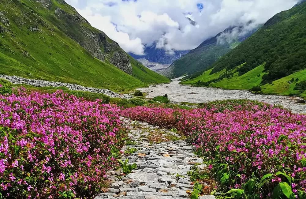
Well-marked, maintained trail throughout. Govindghat to Ghangaria is a continuous uphill on a rocky forest path beside the river — tiring but straightforward. Ghangaria to Valley of Flowers is gentle with one steep section after the iron bridge. Ghangaria to Hemkund Sahib is the hardest section — steep and sustained climb on rocky terrain with no shade.
Summit Day Notes
No summit — this is not a summit trek. Hemkund Sahib day (Day 4) is the hardest day: 3,500ft altitude gain in 6km one way. Start by 6 AM to reach Hemkund in clear morning weather. Weather deteriorates rapidly by afternoon.
The Descent
Descent from Hemkund Sahib is steep and can be slippery in rain. Take it slow. The main Ghangaria–Govindghat descent on Day 5 is long but easy gradient.
Preparation
Comfortable with 5–6 hours of continuous walking on uneven terrain. No prior high-altitude experience strictly needed but helps for Hemkund Sahib day. Focus on endurance cardio — long walks, stair climbing.
Altitude Profile
Govindghat to Ghangaria is the biggest single-day altitude gain — 4,200ft in one day. Rest of the trek operates from Ghangaria base at 10,200ft. Hemkund Sahib at 14,107ft is the highest point — AMS risk on that day is real.
Run AMS Risk Audit →Route Stress Forecast
Highest exposure point at 14,107ft.
Deep 3,907ft descent will test joint stability.
First major altitude jump occurs on Day 2.
*Forecast derived from route geometry and altitude profile. External variables (weather/group) remain the final authority.
Trail Performance Data
Max Gradient
28%
Hydration
0.3L per km recommended
Loose Surface Sections
- •Govindghat to Ghangaria (Rocky portions)
Common Mistakes on Valley of Flowers Trek
Most injuries and failures on this trail can be avoided by making smarter decisions early on.
Rushing through the Valley — most people spend only 2–3 hours inside. Give it at least 4–5 hours
Going too deep into the valley without tracking time — easy to get caught in afternoon rain
Underestimating Hemkund Sahib altitude gain — 14,107ft is higher than any point on most popular treks
Not carrying rain gear — this trek is best in monsoon, rain is guaranteed
Not withdrawing cash at Joshimath — no ATMs at Ghangaria
Safety & Medical Risks
Key Risks
AMS on Hemkund Sahib day — 14,107ft is a significant altitude for many trekkers
Slippery trail conditions in monsoon rain — trail is wet most days
Flash floods on Pushpawati river trail during heavy monsoon rain
Getting caught inside the valley after hours — park closes at 5 PM
AMS (Altitude Sickness)
Govindghat to Ghangaria in one day is a 4,200ft gain — watch for symptoms that evening. Hemkund Sahib at 14,107ft is the real AMS risk point. Acclimatise at Ghangaria for a full day before Hemkund if feeling unwell.
Evacuation Route
Descend to Ghangaria, then to Govindghat. Helicopter available from Govindghat helipad. Palkis (palanquins) available on the main trail for immobile trekkers.
Solo Trekking
This trek is safe for solo trekkers. Trail is well-marked, populated with other trekkers and pilgrims, and has tea shops throughout. No technical sections. Very beginner-friendly except Hemkund Sahib day.
Common Trail Ailments
🏥 Nearest ICU: AIIMS Rishikesh / Max Super Specialty Hospital, Dehradun
Tactical Emergency Hub
> Helicopter service from Ghangaria to Govindghat is the fastest evacuation route.
Who Can Do This Trek?
Min Age
8+
Max Age
75
Western Toilets at Base
Yes
Solo Female Travelers
Very high; bustling pilgrimage and trek route with active police presence.
Expert Verdict
Highly technical trek requiring physical and mental preparation.
Ready to book? Compare verified operators for Valley of Flowers Trek — transparent pricing, no paid rankings.
Want to know which operators carry certified guides and medical support? See operator safety ratings for Valley of Flowers Trek
Also on this trek
Still deciding?
Compare routes side-by-side to find the perfect match for your fitness, dates, and budget.
Still think it's doable? Share this with your trek mate and see if they agree.
Fit for the challenge?
For challenging treks, safety is paramount. Find operators prioritizing medical support and guide expertise.
Compare operator safety scores