
Explore
Intelligence
Detailed Route
Surya Top Trek Itinerary — Day by Day Route & Camps
A well-paced 7-day expedition. Trek through ancient oak forests to reach the massive Dayara meadows, then push higher along the rocky ridges to summit Surya Top for panoramic Himalayan views.
Standard RouteThis is the standard mountain pacing for this trek. Specific operators may add an acclimatization day or alter the starting point. Check individual operator schedules for their exact logistics.
Duration
7 Days
Total Distance
33.0 KM
Max Altitude
12,950 FT
Trek Type
circuit
Permits Required Before You Go
Permit Cost
Where to Get
Uttarkashi DFO / Raithal Checkpost
Documents
Original Aadhar Card / Passport
Foreign Nationals
No special border restrictions. Standard passport registration applies.
Foreigner Process
Standard forest registration. Keep passport copies handy.
Nearest Embassy Hub
New Delhi
Day by Day Breakdown
Camp Alt
7,400 ft
Day Gain
+5,300 ft
Drive to Raithal
A beautiful, winding mountain drive. You leave Dehradun, pass through the hill station of Mussoorie, and follow the Bhagirathi river all the way to Uttarkashi. From there, it's a short drive up to the traditional Garhwali village of Raithal, the base camp for the trek.
Key Landmarks
Staying At
The route follows the river valley. The path breaches the mountain barrier crossing the watershed.
Camp Alt
9,500 ft
Day Gain
+2,100 ft
Reach Pichkiya
The trek begins with a well-marked trail climbing steadily out of Raithal village. You quickly enter a dense, ancient forest of silver oak and rhododendron. The shade is a welcome relief if the sun is out. You will arrive at the small clearing of Pichkiya to set up your first wilderness camp.
Key Landmarks
Staying At
The trail follows the mountain river corridor through a narrow, forested gorge, moving past traditional settlements into increasingly dense dense forested valleys.
Camp Alt
11,000 ft
Day Gain
+1,500 ft
Reach Siyari Bugyal
Today the landscape breaks open. You climb out of the tree line and suddenly step onto the massive, rolling green expanse of the Dayara Bugyal. You will traverse across these famous meadows, leaving the commercial Dayara crowds behind as you push higher up the ridge to the more isolated campsite of Siyari Bugyal.
Key Landmarks
Staying At
The environment transitions into open alpine meadows. The route ascends to an exposed ridge line.
Camp Alt
10,500 ft
Day Gain
-500 ft
Today's Objective
🏔 Summit Summit Surya Top
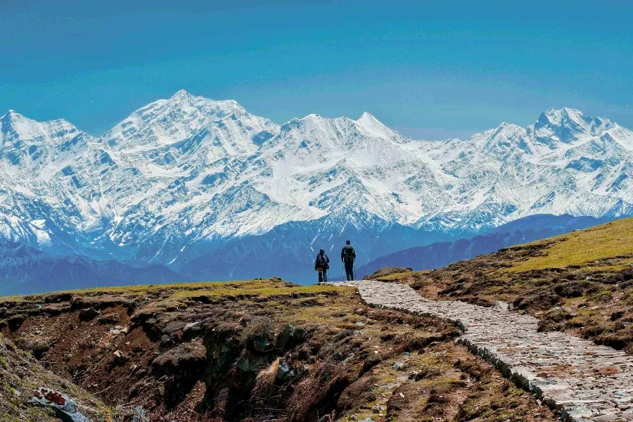
The most challenging and rewarding day. You leave camp early, ascending the steep, rocky ridge towards Surya Top. The soft grass is replaced by loose stones and potentially hard snow. At the summit (12,950 ft), you are treated to a staggering 180-degree panorama of the Gangotri massif. After taking in the views, you descend carefully down the other side of the ridge to the secluded campsite at Devkund.
Key Landmarks
Staying At
The final ascent leaves the upper glacial basin for the exposed summit ridges, offering panoramic views across the watershed divide before descending back to the icefields.
Field Notes
Use Trekking Poles
Trekking poles are highly recommended to save your knees on the descent.
INFOSlower Progress
Progress will be significantly slower and more taxing on your ankles than trail distance suggests.
Camp Alt
9,800 ft
Day Gain
-700 ft
Reach Chilapada
The expedition begins its descent. You leave the high bugyals and plunge back into the thick pine and oak forests. The descent is gentle at first, leading you to the beautiful forest clearing of Chilapada, surrounded by towering trees and running streams.
Key Landmarks
Staying At
The route moves through forested zones. The environment transitions into open alpine meadows. The route follows the river valley.
Field Notes
KEY ACTIONRiver Crossings
Plan to cross early in the day before snowmelt swells the water levels. Unclip backpack waist belts before crossing.
Camp Alt
7,400 ft
Day Gain
-2,400 ft
Trek to Raithal
The final trekking day. You continue descending through the forest on a well-marked trail, eventually breaking out of the trees and arriving back at the terraced fields of Raithal village by early afternoon. Celebrate the completion of the trek in your homestay.
Key Landmarks
Staying At
The high alpine meadows narrow into forested river terraces as tree line vegetation reappears in the lower mountain river corridor.
Camp Alt
2,100 ft
Day Gain
-5,300 ft
Drive to Dehradun
After breakfast in Raithal, board your vehicles for the scenic 8-hour drive back through the Bhagirathi valley, reaching Dehradun by late afternoon to conclude the journey.
Key Landmarks
The mountain valley topography transitions back into the lower foothill river plains.
Trek Extensions & Add-ons
Bakaria Top
+1 DayAnother prominent viewpoint on the Dayara ridge that can be added to the itinerary.
Plan Your Trek:
Ready to book? Compare verified operators for Surya Top Trek — transparent pricing, no paid rankings.
Still deciding?
Compare routes side-by-side to find the perfect match for your fitness, dates, and budget.
Day by day, camp by camp. Send this to your group so everyone's on the same page.
Step 4: Cost & Logistics
You understand the route.
Now see what services, permits, and logistics actually cost.
View Cost Breakdown