
Explore
Intelligence
Essential Planning Guide
Sundardhunga Glacier Trek — Complete Guide (2026)
Vibe & Scenery
The Experience
Introduction
Translating to "Valley of Beautiful Stones," Sunderdhunga is one of Kumaon's finest wilderness trekking destinations. Beginning from Khati village, the route leaves the popular Pindari Glacier trail and enters a quieter valley characterized by dense forests, steep gorges, alpine meadows, and expansive moraines.
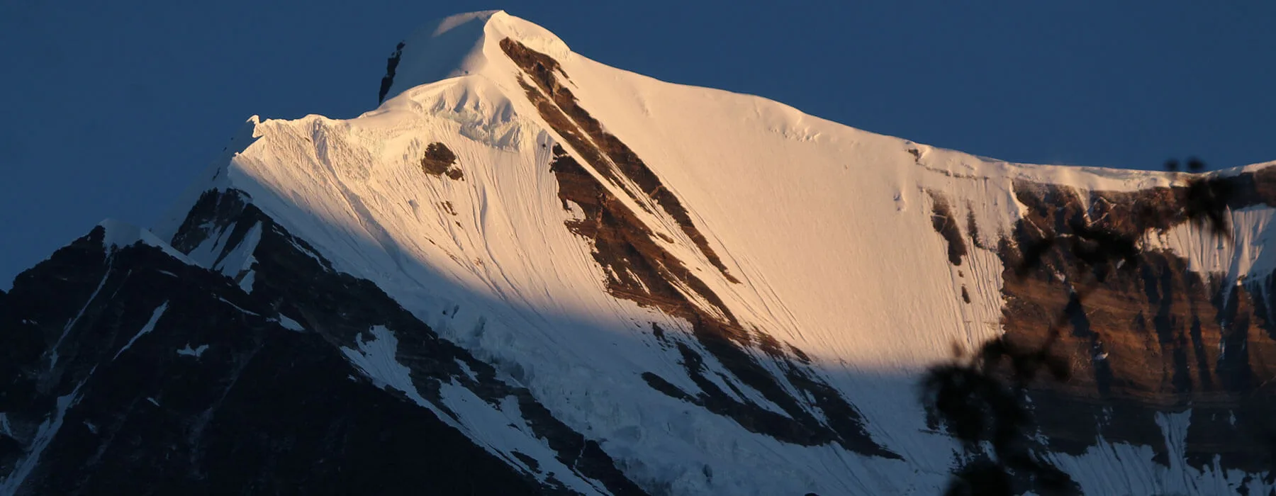
The upper valley provides access to the Maiktoli and Sukhram glacier systems beneath major peaks including Maiktoli, Mrigthuni, Devtoli, and Tharkot. Compared with neighbouring glacier treks, Sunderdhunga remains significantly less visited while offering equally impressive mountain scenery.
With sustained trekking days, wilderness camping, and rough glacial terrain, the route is best suited for trekkers seeking a remote Himalayan glacier experience.
Quick Facts
Duration
Max Altitude
Difficulty
Best Time
Trek Distance
Trail Atmosphere
Stargazing
Class 2 Dark Sky
Scent Profile
Silence Level
~25 dB
Vertigo Factor
3 / 10
Iconic Spots
Mrigthuni Amphitheatre at Dawn from Base Camp
Glacier Terminus at Midday
Environment
Nature & Culture
Flora & Fauna
Flora
Fauna
Kumaoni villagers from Khati call the Sukhram glacier the 'devbhumi glacier' (glacier of the holy land) — the Mrigthuni peak above it is considered a 'deora' (deity-seat) of a local mountain god specific to the Bageshwar district. The Sundardhunga valley is referred to in old Bageshwar panchayat records as 'Sunder Dhunga ki Ghati' — the valley of the beautiful stone — referring to the glacier's characteristic white-and-grey rock coating.
— Local folklore
Spiritual & Cultural Significance
Sacred peaks surrounding the glacier.
🕐 Shrine Timings: N/A
Temple Protocols
Technical Details
Challenge & Preparation
Primarily a cardio demand and cumulative fatigue challenge
A demanding expedition that balances cardio demand and cumulative fatigue.
Personal Readiness
Am I ready?
Planning
Logistics & Trail Intel
Getting There
Route to Base
Kathgodam (railhead) → Almora → Bageshwar → Kapkote → Loharkhet/Song (200 km, 7–8 hrs)
Return vehicle to Bageshwar–Kathgodam
Nearest airport: Pantnagar (170 km)
Kathgodam is the nearest rail station (overnight train from Delhi)
Most trekkers drive from Kathgodam
Base Village
Khati Village (7,117 ft), Bageshwar District, Kumaon
7,117 ft
Nearest Railhead
Kathgodam Railway Station
Nearest Airport
Jolly Grant Airport, Dehradun
Last ATM
Bageshwar town (60 km from Khati). Carry full trek cash from Bageshwar.
Nearest Medical Facility
Bageshwar District Hospital (60 km from Khati, 3+ hrs by return jeep). Loharkhet has a basic dispensary.
Mobile Signal
Absolute dark zone.
Water Sources
Abundant throughout. Sunar stream (Day 2), valley streams (Days 3-6). Moraine meltwater channels (Days 4-5). Glacier melt (base camp area — treat all). No water shortage.
Charging
Khati village homestay (limited electricity). Zero above Khati.
For Drivers
Road Condition
Kathgodam to Bageshwar is mountain highway (good paved). Bageshwar to Song/Loharkhet (40 km) is narrow and rough unpaved in sections. Landslide risk July–August.
Bageshwar town (60 km from Khati)
Trail Culinary & Diet
Don't miss the Khati-style bhatt ki churkani — black soybean curry unique to Kumaon, served with bhatt ki dal and steamed rice at homestays — one of the finest high-protein traditional mountain meals in the Indian Himalaya. Available at Khati only.
Buy specialized diet items at Bageshwar town. Khati village provides excellent local Kumaoni food (dal, rice, aloo ki sabzi, local rajma) at homestays. Carry all specialized nutrition from Bageshwar.
The Content & Remote Hub
Video Calls
none
Est. 5 Mbps
UPI Reliability
2/10
Permits and Regulations
No formal permit required. Outside protected zone boundaries at this access altitude. Register at Khati village chowkidar before departure (essential for SAR network). No open fires in the glacier valley — gas stove mandatory. Carry all waste out.
Learn more about how we vet operators and ensure transparency on our why MountRoutes page.
Packing List
7-Day Wilderness Self-Sufficiency
- All food for 7 days carried from Khati or Bageshwar — zero resupply above Khati
- Gas stove and sufficient fuel for 6 nights cooking at altitude
- Water pump filter — streams abundant but treat all
Glacier Approach
- Microspikes or traction device for glacier moraine approach (not full crampons — moraine walking not ice climbing)
- Trekking poles — moraine terrain is loose and uneven
- Gaiters — dusty moraine material on dry days, muddy on wet days
High Camp
- 4-season tent with full guylines — base camp area (14,200 ft) is fully exposed to valley wind
- Down sleeping bag -15C rated — night temperatures at base camp drop well below 0C
- Layering system for temperature range of 20 degrees between daytime and dawn at base camp
Deep Dives
Explore Further
Editor's Notes
On a fresh moraine boulder field, the difference between a stable rock sequence and an unstable one is imperceptible to a newcomer — both look like an ankle-breaking scramble. Your Khati guide will have walked the Sundardhunga moraine dozens of times and knows specific boulder sequences, bridge points, and the hand-holds on individual rocks. This is not trail knowledge — it is body-memory knowledge of a specific physical landscape. There is no GPS track that replicates it.
Explore In Detail
Day by Day Itinerary
7-day route reaching 14,600ft. Covers 52km of varied terrain.
→ See full itinerary with altitude profileDifficulty & Fitness
Rated challenging. Extension of the valley trek, entering heavy moraine, scree, and glaciated zones.
→ See difficulty breakdown and fitness guideCost & Pricing
Packages range from ₹7,700 - ₹16,100. Inclusions and hidden costs vary by operator tier.
→ See full cost breakdownFrequently Asked Questions
How difficult is the Sundardhunga Glacier Trek?
It is classified as a hard trek. It takes 7 days and reaches a maximum altitude of 14000 ft. Trekkers should have steady cardiovascular endurance.
What is the risk of Acute Mountain Sickness (AMS) on the Sundardhunga Glacier Trek?
Since the trail climbs up to 14000 ft, there is a distinct risk of AMS. Proper hydration, progressive pacing, and gradual acclimatization are highly advised.
When is the absolute best time to do Sundardhunga Glacier Trek?
May–June and September–October are the two primary windows. July–August brings lush lower valley but significant moraine and glacier surface water — manageable but wetter. Avoid November-April (heavy snow above 11,000 ft). October gives the best glacier views and clarity.
Will I get mobile network or internet connectivity during Sundardhunga Glacier Trek?
Connectivity is highly sporadic. The last reliable mobile signal is at Khati village (limited BSNL from hilltop). Zero above trail fork on Day 2.. Expect complete digital isolation on the trail.
Where is the last reliable ATM before starting the Sundardhunga Glacier Trek?
The last active ATM is located at Bageshwar town (60 km from Khati). Carry full trek cash from Bageshwar.. It is strongly recommended to withdraw sufficient cash at major transit hubs before starting.
Is the drinking water safe on the Sundardhunga Glacier Trek trail?
Fresh stream water is abundant, but water treatment is mandatory. Abundant water throughout. All must be treated — moraine meltwater carries glacial flour and possible contamination from snowpack dissolved minerals above. Pump filter preferred at glacier level. Chemical tabs effective in lower valley.
Can I rent trekking gear at Khati Village (7,117 ft), Bageshwar District, Kumaon?
Rental options at Khati Village (7,117 ft), Bageshwar District, Kumaon are extremely limited. It is best to rent or purchase all essential gear in major hubs before reaching the base.
What permits are required for the Sundardhunga Glacier Trek?
No formal permit required. Outside protected zone boundaries at this access altitude. Register at Khati village chowkidar before departure (essential for SAR network). No open fires in the glacier valley — gas stove mandatory. Carry all waste out.
What is the emergency evacuation protocol on the Sundardhunga Glacier Trek?
No helicopter access in Sundardhunga valley or at base camp. Manual carry to Khati required (6–12 hrs from base camp). Jeep from Khati toward Bageshwar hospital (60 km, 3 hrs). AIIMS Haldwani nearest ICU (4+ hrs from Bageshwar). In case of extreme emergencies, helicopter evacuation can be coordinated if weather allows.
Where is the nearest specialized ICU or hospital for Sundardhunga Glacier Trek?
The nearest specialized ICU is AIIMS Haldwani (180 km from Bageshwar, 5+ hrs). Bageshwar hospital (limited facility).. For minor injuries, the nearest primary health center is located at Bageshwar District Hospital (60 km from Khati, 3+ hrs by return jeep). Loharkhet has a basic dispensary..
Is it safe to do the Sundardhunga Glacier Trek as a solo female or solo traveler?
Not recommended. The Sundardhunga moraine navigation above 11,500 ft is not feasible solo without prior visits to establish the stable boulder line. A Khati local guide is essential for safety AND route finding. The local communities are exceptionally welcoming and hospitable, but having a guide is highly recommended.
Are foreign nationals allowed to do the Sundardhunga Glacier Trek?
Yes, foreign nationals are fully permitted with standard tourist permits and passport logging at regional checkpoints.
What kind of food is served during the Sundardhunga Glacier Trek?
We serve highly nutritious, warm vegetarian meals suitable for high altitudes. You will also get to taste Khati-style bhatt ki churkani — black soybean curry unique to Kumaon, served with bhatt ki dal and steamed rice at homestays — one of the finest high-protein traditional mountain meals in the Indian Himalaya. Available at Khati only. on the trail.
Are digital UPI/online payments accepted at the base village of Khati Village (7,117 ft), Bageshwar District, Kumaon?
While some local shops accept UPI at Khati Village (7,117 ft), Bageshwar District, Kumaon, connection is highly unreliable due to network dropouts. Make sure to carry physical cash.
What is the local cultural significance or folklore associated with Sundardhunga Glacier Trek?
Kumaoni villagers from Khati call the Sukhram glacier the 'devbhumi glacier' (glacier of the holy land) — the Mrigthuni peak above it is considered a 'deora' (deity-seat) of a local mountain god specific to the Bageshwar district. The Sundardhunga valley is referred to in old Bageshwar panchayat records as 'Sunder Dhunga ki Ghati' — the valley of the beautiful stone — referring to the glacier's characteristic white-and-grey rock coating.
Still deciding?
Compare routes side-by-side to find the perfect match for your fitness, dates, and budget.
Everything you need to know, in one place. Someone else in your group needs to see this.
Planning Sundardhunga Glacier Trek?
Get route conditions, operator updates, and season windows before booking.
Don't miss out! Follow us for route updates@mountroutes|LinkedIn
No spam. Only useful trek updates.
Ready to walk this route?
You’ve read the guide, now find the perfect local team to take you there. Compare our verified list of operators.
Compare verified operators