
Explore
Intelligence
Difficulty & Readiness Guide
Is Satopanth Tal Trek Difficult? — Fitness & Altitude Guide
Expert level.
The Question
Can I do this trek?
Preparation Required
Advanced
Prior Experience
Required: At least 2-3 moderate Himalayan treks (above 13,000ft).
Expert Verdict
Highly technical trek requiring physical and mental preparation.
Satopanth Tal Trek
Himalayan Placement · Index 52Route Knowledge
Why is it difficult?
Exertion Index
Primary Challenge
Route Identity
Endurance-focused route with significant physical taxation across a trek featuring loose moraine.
Primary Drivers
- Maximum sleeping altitude of 13,300 ft
- Grueling summit push with 1,800 ft of elevation gain
- 4 consecutive high-output trekking days
- Peak daily distance of 15 km
View Full Route Analysis
Physiological Demand
Expect long, exhausting days of sustained climbing at high intensity. Your cardiovascular system will be pushed to its absolute limit.
Multi-day camping requiring mental toughness to handle weather and fatigue debt.
Significant time spent above 12,000ft. Expect shortness of breath and slower pacing.
Well-defined, stable trails with no technical maneuvers required.
Rolling or gradual terrain with minimal harsh impact on joints.
Terrain Breakdown
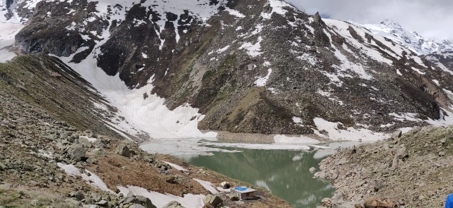
Extreme Moraine. 60% of this trek is walking on loose, shifting boulders of sizes ranging from small footballs to large SUVs. Pathless navigation is required.
Summit Day Notes
Altitude: 14,435ft. The physical exertion of boulder hopping under low oxygen is equivalent to a 17,000ft standard trail trek.
The Descent
Hard on ankles and knees. Shifting boulders are a constant twist-hazard. Use high-ankle boots.
Altitude Profile
10.3k -> 11.5k -> 13.3k -> 14.4k. This is a very steep and risky jump. Hydrate or exit.
Run AMS Risk Audit →Trail Performance Data
Max Gradient
50%
Hydration
0.8L per km recommended
Loose Surface Sections
- •Moraine fields beyond Laxmivan
- •Chakratirth glacial crossing
Personal Readiness
Am I ready?
What this route demands
People who feel comfortable on this route can usually:
Who Can Do This Trek?
Min Age
15+
Max Age
50
Western Toilets at Base
Yes
Solo Female Travelers
High; Mana is a very safe cultural base. Glacial sections require a mandatory technical buddy system.
Hazard Profile
What goes wrong?
Common Mistakes on Satopanth Tal Trek
Most injuries and failures on this trail can be avoided by making smarter decisions early on.
Assuming Badrinath (10k) is safe — people get AMS before starting the trek.
Wearing mesh/light sneakers — the boulders will tear them in 2 days.
Skipping Vasudhara because it's 'touristy' — it's the gateway to the sacred zone.
Drinking too much Tapt Kund water before the trek — can cause lethargy.
Ignoring the guide's cairn markers — you will get lost in the glacier moraine within 10 minutes.
Not accounting for the 12-hour drive fatigue.
Inadequate wind protection — Chakratirtha is a high-speed wind tunnel.
Safety & Medical Risks
Key Risks
Walking on unstable glaciated moraine (loose boulders)
Acute Mountain Sickness (AMS) at 15,000ft
Extreme wind exposure at Chakratirtha
Proximity to international border (Permit compliance)
AMS (Altitude Sickness)
Acclimatization at Badrinath is mandatory. Drink 5L water. Monitor oxygen level at Chakratirtha.
Evacuation Route
Manual stretcher to Mana/Badrinath. Heli-evacuation from Badrinath.
Solo Trekking
NOT RECOMMENDED. The trail is pathless and technical due to the boulders. Permits for solo hikers are often denied.
Common Trail Ailments
🏥 Nearest ICU: AIIMS Rishikesh
Tactical Emergency Hub
> Extremely high glacial danger. Manual carry to Mana (2 days). Heli-evac from Badrinath/Mana is the only viable rapid choice.
Auditability
How is this calculated?
Understand This Route Further
Before attempting this route:
Still deciding?
Compare routes side-by-side to find the perfect match for your fitness, dates, and budget.
Still think it's doable? Share this with your trek mate and see if they agree.
Step 2: Seasonal Safety
You know how demanding this route is.
Now find the safest and most reliable season to attempt it.
Check Best Time to Go