Detailed Route
Sahastra Tal Trek Itinerary — Day by Day Route & Camps
Standard RouteThis is the standard mountain pacing for this trek. Specific operators may add an acclimatization day or alter the starting point. Check individual operator schedules for their exact logistics.
Duration
9 Days
Total Distance
42 KM
Max Altitude
16,404 FT
Trek Type
linear
Permits Required Before You Go
Permit Cost
Where to Get
Uttarkashi / Bhatwari Forest Office
Documents
Aadhar Card, Medical Certificate
Foreigner Process
Standard ID registration at Uttarkashi/Bhatwari forest check posts.
Nearest Embassy Hub
New Delhi
Day by Day Breakdown
Drive from Dehradun to Bhatwari
A scenic 175 km drive tracing the Bhagirathi river. The route passes through the bustling mountain hub of Uttarkashi before arriving at the quiet base village of Bhatwari, where you will settle into a local lodge.
Trek to Gairi
The first day of walking begins with a steep initial climb out of Bhatwari. The trail quickly transitions into dense, ancient pine and oak forests before breaking out into the small, secluded clearing at Gairi.
Trek to Kush Kalyan
A stunning transition day. The treeline suddenly vanishes as you step onto the endless, rolling alpine meadows of Kush Kalyan. Spectacular panoramic views of the Garhwal giants begin to open up in all directions.
Trek to Kyarki
A magnificent but tiring ridge walk across the high meadows. The trail undulates constantly, keeping you well above 10,000 feet the entire day. Expect unobstructed views of Mt. Jaonli and Bandarpoonch.
Trek to Lamb Tal
The terrain becomes noticeably stark and rocky as you leave the lush bugyals behind and approach the high-altitude glacial lake zone. The altitude crosses 14,000 feet, making the air noticeably thinner and colder.
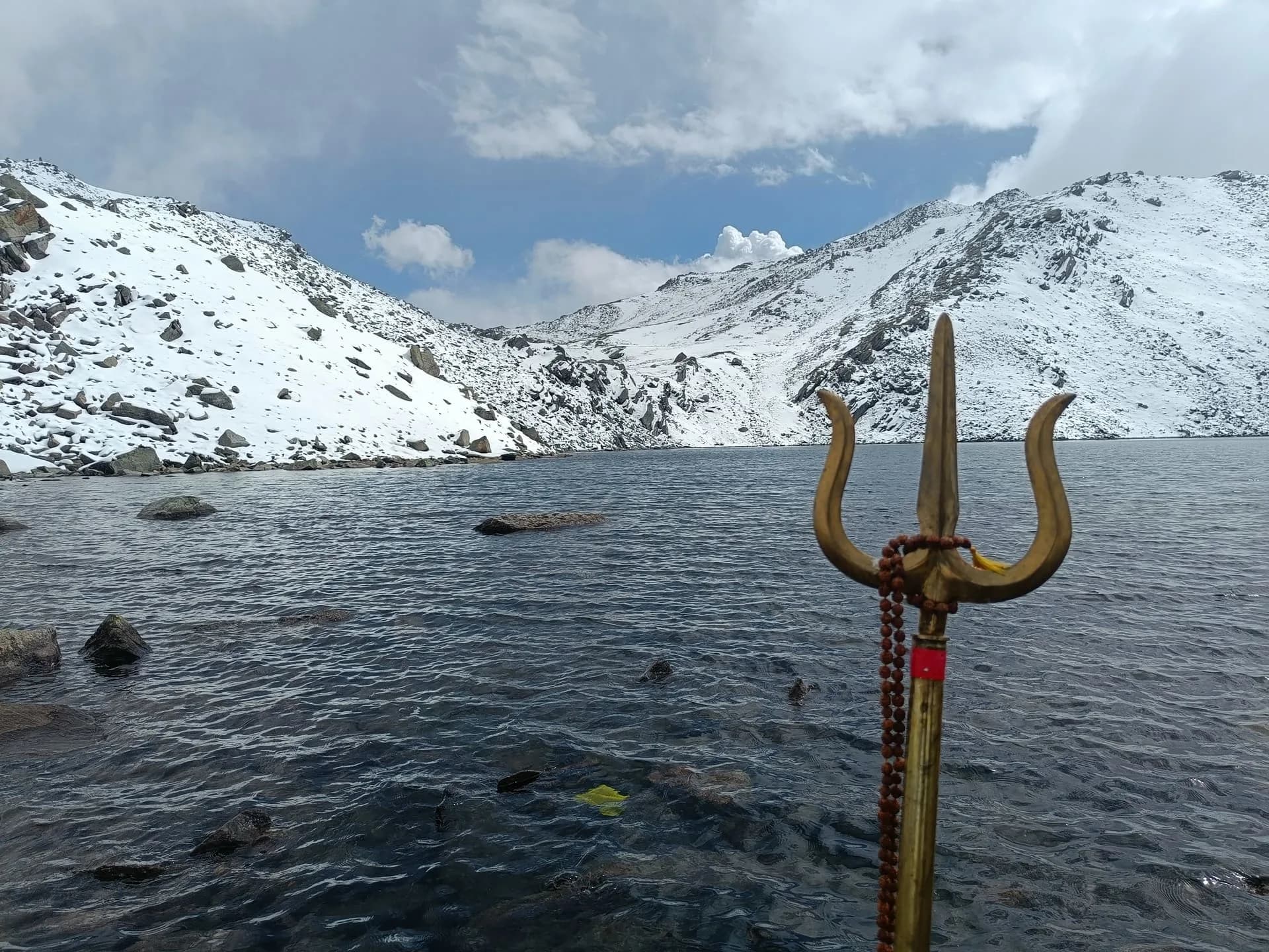
Trek to Sahastra Tal and back
The ultimate summit push. A grueling day navigating massive, unstable boulder moraines to reach the sacred 'Lake of a Thousand Lakes' at a staggering 5,000 meters. After taking in the pristine views, carefully descend back to Lamb Tal.
Trek to Kush Kalyan via Kyari Bugyal
An extremely long 18 km return journey. You will retrace your steps across the high, exposed ridges, gradually descending back to the lush, oxygen-rich meadows of Kush Kalyan.
Trek to Sila village, drive to Bhatwari
A relentless downhill trek dropping nearly 4,000 feet into the valley towards Sila village. Once at the roadhead, a short but bumpy drive takes you back to a warm bed at the lodge in Bhatwari.
Drive from Bhatwari to Dehradun
The expedition concludes with a long drive back down the winding mountain roads from Bhatwari to Dehradun, carrying memories of the high alpine lakes back to civilization.
Trek Extensions & Add-ons
Khatling Glacier Traverse
+4 DaysFor elite mountaineers, the trek can be extended over the Mayali Pass towards the Khatling Glacier and Kedarnath.
Also on this trek
Ready to book? Compare verified operators for Sahastra Tal Trek — transparent pricing, no paid rankings.
Still deciding?
Compare routes side-by-side to find the perfect match for your fitness, dates, and budget.
Day by day, camp by camp. Send this to your group so everyone's on the same page.
Love this itinerary?
Find operators who follow this exact route with verified acclimatization days.
Find matching operators