
Explore
Intelligence
Detailed Route
Rohini Bugyal Trek Itinerary — Day by Day Route & Camps
A 6-day journey starting from Sari, passing the reflective Deoria Tal lake, traversing the ancient forests to Rohini Bugyal, and summiting Chandrashila.
Standard RouteThis is the standard mountain pacing for this trek. Specific operators may add an acclimatization day or alter the starting point. Check individual operator schedules for their exact logistics.
Duration
6 Days
Total Distance
27.0 KM
Max Altitude
13,100 FT
Trek Type
circuit
Permits Required Before You Go
Permit Cost
Where to Get
Forest Check Post in Sari Village or Chopta.
Documents
Aadhar Card / Valid ID, Passport size photos
Foreign Nationals
Standard Indian visa required. Foreigners pay a slightly higher forest entry fee.
Foreigner Process
Standard Indian Visa. Foreigners pay a slightly higher forest entry fee at Sari.
Nearest Embassy Hub
New Delhi
Day by Day Breakdown
Camp Alt
6,600 ft
Day Gain
+5,500 ft
Drive Rishikesh to Sari Village
A beautiful drive along the Alaknanda and Mandakini rivers. You will pass through Devprayag, the confluence of the Bhagirathi and Alaknanda rivers. The final stretch winds up to the picturesque village of Sari, the base camp for the trek.
Key Landmarks
Staying At
The mountain road climbs from the plains into the Mandakini river basin.
Camp Alt
7,999 ft
Day Gain
+1,399 ft
Trek: Sari Village to Deoria Tal
A short, well-laid stone trail climbs steeply from Sari village. Within a few hours, you arrive at the stunning Deoria Tal lake. On a clear day, the lake perfectly reflects the massive Chaukhamba peaks. Spend the afternoon exploring the lake perimeter and relaxing at camp.
Key Landmarks
Staying At
Crossing the high-altitude pass bridges two distinct watershed systems, shifting the expedition over the glaciated divide and down into a new river basin.
Camp Alt
10,800 ft
Day Gain
+2,801 ft
Trek: Deoria Tal to Rohini Bugyal
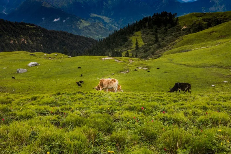
Today, you dive deep into the Kedarnath Wildlife Sanctuary. The trail undulates through dense forests of oak, pine, and rhododendron. You will eventually break through the tree line and enter the vast, high-altitude meadow of Rohini Bugyal. The panoramic views of the Garhwal ranges from here are spectacular.
Key Landmarks
Staying At
The route navigates the dense forest canopy connecting Deoria Tal to the Rohini Bugyal meadow.
Camp Alt
9,500 ft
Day Gain
-1,300 ft
Trek: Rohini Bugyal to Chopta / Baniyakund
The trail descends from the high bugyal, weaving back into the forest and crossing several small streams. You will pass smaller clearings like Bhujgali before emerging onto the Chopta-Ukhimath road. Camp at the sprawling meadows of Chopta or the nearby clearing of Baniyakund, preparing for tomorrow's summit.
Key Landmarks
Staying At
The Rohini Bugyal meadow descends into the forest before ascending toward the Chopta ridge.
Field Notes
KEY ACTIONRiver Crossings
Plan to cross early in the day before snowmelt swells the water levels. Unclip backpack waist belts before crossing.
Camp Alt
9,500 ft
Day Gain
0 ft
Today's Objective
🏔 Summit Chopta To Tungnath To Chandrashila
Start well before dawn. The trail is a paved pilgrim path up to the Tungnath temple, the highest Shiva temple in the world. From Tungnath, the path vanishes into a steep, rocky dirt trail (or snow face) leading to the Chandrashila summit. At 13,100 ft, you are rewarded with a 360-degree view encompassing Nanda Devi, Trishul, Chaukhamba, and Kedar Peak. Descend rapidly back to Chopta.
Key Landmarks
Staying At
Crossing the high-altitude pass bridges two distinct watershed systems, shifting the expedition over the glaciated divide and down into a new river basin.
Camp Alt
1,100 ft
Day Gain
-8,400 ft
Drive Chopta to Rishikesh
After breakfast, board your vehicles for the long, winding descent back to the plains. You will pass through Ukhimath before rejoining the main highway along the Alaknanda River, arriving in Rishikesh by late afternoon.
Key Landmarks
The mountain valley topography transitions back into the lower foothill river plains.
Trek Extensions & Add-ons
Panch Kedar Circuit
+10 DaysTungnath is one of the Panch Kedar. Hardcore pilgrims and trekkers combine this with hikes to Kedarnath, Madhyamaheshwar, Rudranath, and Kalpeshwar.
Plan Your Trek:
Ready to book? Compare verified operators for Rohini Bugyal Trek — transparent pricing, no paid rankings.
Still deciding?
Compare routes side-by-side to find the perfect match for your fitness, dates, and budget.
Day by day, camp by camp. Send this to your group so everyone's on the same page.
Step 4: Cost & Logistics
You understand the route.
Now see what services, permits, and logistics actually cost.
View Cost Breakdown