
Explore
Intelligence
Essential Planning Guide
Pankhu Top Trek — Complete Guide (2026)
Vibe & Scenery
The Experience
Introduction
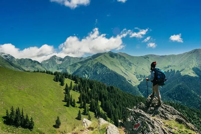
Pankhu Top Trek or Pakhwa Bugyal Trek is one of Kumaon's hidden alpine meadows, offering a peaceful alternative to the state's better-known trekking destinations. Starting from remote villages in Bageshwar district, the trail climbs through forests of oak and rhododendron before emerging onto expansive grasslands overlooking some of Kumaon's highest peaks.
The open bugyals provide exceptional views of Nanda Devi, Nanda Kot, Panchachuli, and neighbouring Himalayan ranges. Unlike popular meadow treks that attract large seasonal crowds, Pakhwa Bugyal remains relatively untouched, allowing trekkers to experience quiet campsites and traditional mountain landscapes.
The route is well suited to trekkers seeking solitude rather than technical challenges. Its combination of forest trails, broad alpine pastures, and classic Kumaon mountain panoramas makes Pakhwa Bugyal one of the region's most underrated meadow treks.
Quick Facts
Duration
Max Altitude
Difficulty
Best Time
Trek Distance
Trail Atmosphere
Stargazing
Class 2 Dark Sky
Scent Profile
Silence Level
~20 dB
Vertigo Factor
2 / 10
Iconic Spots
Birmuwa Kothi Forest
Pakhwa Bugyal Panorama
Environment
Nature & Culture
Flora & Fauna
Flora
Fauna
The remote villages of Kumaon hold deep animistic and Hindu traditions. Local deities (Bhumiya Devtas) are worshipped before entering the high bugyals.
— Local folklore
Spiritual & Cultural Significance
The views of Nanda Devi hold immense spiritual significance, as she is the patron goddess of the Kumaon and Garhwal regions.
🕐 Shrine Timings: N/A
Temple Protocols
- •Maintain respect for local customs when staying in Jhuni village.
Festivals & Dates
Technical Details
Challenge & Preparation
Primarily a cumulative fatigue challenge
A capable trekker's route that balances cumulative fatigue and cardio demand.
Personal Readiness
Am I ready?
Planning
Logistics & Trail Intel
Getting There
Route to Base
Take the overnight Ranikhet Express or Kathgodam Shatabdi from New Delhi to Kathgodam
From there, it is a 9-hour drive via Almora and Bageshwar
Base Village
Tharsali
6,500 ft
Last ATM
Bageshwar / Kapkot. Do not rely on finding ATMs closer to the trailhead.
Nearest Medical Facility
District Hospital Bageshwar.
Mobile Signal
Dead zone beyond Jhuni.
Water Sources
Good availability from streams up to Birmuwa Kothi. Scarce at Pankhu Top itself.
Charging
Last chance to charge is at the Jhuni village homestays (subject to power cuts).
For Drivers
Road Condition
Good highways up to Bageshwar. From Kapkot onwards, the mountain roads are narrow, winding, and prone to monsoon damage.
Kapkot
Trail Culinary & Diet
Don't miss the Bhatt ki Churkani (a traditional, highly nutritious Kumaoni black bean stew).
Buy specialized diet items at Kathgodam / Haldwani. Buy all specialty snacks before entering the mountains.
The Content & Remote Hub
Top Vlog Spots
Video Calls
none
UPI Reliability
1/10
Permits and Regulations
As a remote Kumaoni trek, formal high-altitude trekking permits are generally handled locally at the Bageshwar or Kapkot forest offices. Trekkers must register with the local authorities. Strict 'Leave No Trace' policies apply; the Bugyal is an ecologically sensitive alpine zone and all plastic waste must be carried back to Kathgodam.
Learn more about how we vet operators and ensure transparency on our why MountRoutes page.
Packing List
Trekking Clothing
- Medium-weight down jacket (evenings at Birmuwa Kothi get freezing)
- Waterproof/Windproof hardshell outer layer
- 2 pairs of quick-dry trekking pants (convertible preferred)
- 3 moisture-wicking synthetic or merino baselayers
- Light fleece mid-layer
- Warm woolen cap and a sun hat
- 3 pairs of cushioned trekking socks
Footwear & Gear
- Waterproof trekking boots with strong ankle support and deep lugs
- 2 anti-shock trekking poles (essential for the steep descent from the Top)
- 40L-50L backpack with a sturdy rain cover
- Lightweight camp sandals for the evening
- Four-season sleeping bag (if not provided by your operator)
Health & Utilities
- High-lumen headlamp with spare batteries
- Category 3 or 4 UV Polarized sunglasses
- Comprehensive First Aid Kit (painkillers, blister tape, crepe bandage)
- High SPF Sunscreen (50+) and zinc oxide lip balm
- 2 reusable 1-liter water bottles
- Heavy-duty power bank (no electricity past Jhuni)
Deep Dives
Explore Further
Editor's Notes
Explore In Detail
Day by Day Itinerary
6-day route reaching 10,826ft. Covers 34.0km of varied terrain.
→ See full itinerary with altitude profileDifficulty & Fitness
Rated moderate. The trail is a mix of well-trodden village paths and raw, steep forest tracks. The bugyal itself is soft alpine grass, but getting there requires navigating root-heavy, steep dirt trails.
→ See difficulty breakdown and fitness guideCost & Pricing
Packages range from ₹8,500 – ₹13,000. Inclusions and hidden costs vary by operator tier.
→ See full cost breakdownFrequently Asked Questions
Is the Pankhu Bugyal Trek crowded?
Not at all. It is one of the most offbeat treks in the Kumaon region. You will likely only encounter local shepherds and perhaps one or two other small trekking groups.
What is the maximum altitude reached?
The trek reaches its highest point at Pankhu Top, which sits at approximately 10,826 feet (3,300 meters).
Are there tea houses or commercial lodges on the trail?
No. You can find basic homestays in Jhuni village, but beyond that (at Birmuwa Kothi and Pankhu Top), you must rely entirely on expedition-style camping with your own tents and rations.
How difficult is the climb to Pankhu Top?
The trek is graded Easy-to-Moderate overall, but the specific section from Jhuni to Birmuwa Kothi involves a steep, continuous ascent through dense forest that will test your stamina.
Is there a risk of altitude sickness (AMS)?
Because the maximum altitude stays below 11,000 feet, the risk of severe AMS is relatively low compared to higher Garhwal treks. However, mild headaches and breathlessness are common.
Is water available on the trail?
Water is available from mountain streams up to Birmuwa Kothi. However, at the very top of the Bugyal, water sources are scarce, so you must carry enough from the lower camps.
Will my mobile phone work?
You will lose reliable network connectivity after crossing Bageshwar/Kapkot. Expect a complete digital detox from Jhuni onwards.
Can I do this trek without a guide?
It is highly discouraged. The trails are heavily forested, unmapped on digital GPS, and intersect with confusing shepherd paths. A local guide from Tharsali or Jhuni is essential for navigation and safety.
Still deciding?
Compare routes side-by-side to find the perfect match for your fitness, dates, and budget.
Everything you need to know, in one place. Someone else in your group needs to see this.
Planning Pankhu Top Trek?
Get route conditions, operator updates, and season windows before booking.
Don't miss out! Follow us for route updates@mountroutes|LinkedIn
No spam. Only useful trek updates.
Ready to walk this route?
You’ve read the guide, now find the perfect local team to take you there. Compare our verified list of operators.
Compare verified operators