Pankhu Top Trek — compare operators and pricing

Compare operators for Pankhu Top Trek

UttarakhandModerate

Interested in this trek?

We are currently vetting local partners for Pankhu Top Trek to ensure the highest safety standards. Be the first to know when it's open for booking.

Are you a local operator?

Join our platform to list your verified packages for Pankhu Top Trek and reach thousands of trekkers directly.

Apply to join

Found the right operator? Share this list with whoever's coming with you.

About Pankhu Top Trek

6 Days
10,826 FT
Moderate

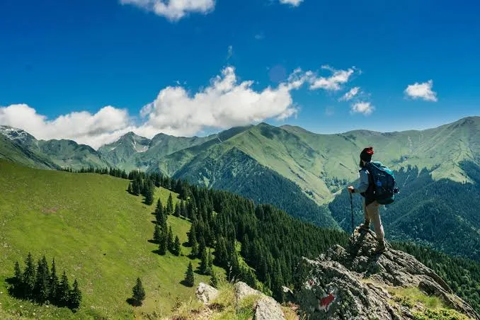
The Pakhwa Bugyal Trek explores one of Kumaon's least-visited alpine meadows in the Bageshwar district of Uttarakhand. Climbing through oak and rhododendron forests to broad bugyals at around 10,826 ft, the trek rewards visitors with sweeping views of Nanda Devi, Nanda Kot, and the Panchachuli range while remaining largely untouched by mass tourism.

Trek Highlights

Birmuwa Kothi Forest

Walking through ancient, moss-draped oak trees that look straight out of a fantasy novel.

Pakhwa Bugyal Panorama

The dramatic reveal of the Nanda Devi and Panchachuli ranges as you step out of the tree line onto the massive green meadow.

View Complete Trek Guide

Common Questions

Is the Pankhu Bugyal Trek crowded?
Not at all. It is one of the most offbeat treks in the Kumaon region. You will likely only encounter local shepherds and perhaps one or two other small trekking groups.
What is the maximum altitude reached?
The trek reaches its highest point at Pankhu Top, which sits at approximately 10,826 feet (3,300 meters).
Are there tea houses or commercial lodges on the trail?
No. You can find basic homestays in Jhuni village, but beyond that (at Birmuwa Kothi and Pankhu Top), you must rely entirely on expedition-style camping with your own tents and rations.
How difficult is the climb to Pankhu Top?
The trek is graded Easy-to-Moderate overall, but the specific section from Jhuni to Birmuwa Kothi involves a steep, continuous ascent through dense forest that will test your stamina.
Is there a risk of altitude sickness (AMS)?
Because the maximum altitude stays below 11,000 feet, the risk of severe AMS is relatively low compared to higher Garhwal treks. However, mild headaches and breathlessness are common.
Is water available on the trail?
Water is available from mountain streams up to Birmuwa Kothi. However, at the very top of the Bugyal, water sources are scarce, so you must carry enough from the lower camps.
Will my mobile phone work?
You will lose reliable network connectivity after crossing Bageshwar/Kapkot. Expect a complete digital detox from Jhuni onwards.
Can I do this trek without a guide?
It is highly discouraged. The trails are heavily forested, unmapped on digital GPS, and intersect with confusing shepherd paths. A local guide from Tharsali or Jhuni is essential for navigation and safety.
Is the Pankhu Bugyal Trek crowded?
Not at all. It is one of the most offbeat treks in the Kumaon region. You will likely only encounter local shepherds and perhaps one or two other small trekking groups.
What is the maximum altitude reached?
The trek reaches its highest point at Pankhu Top, which sits at approximately 10,826 feet (3,300 meters).
Are there tea houses or commercial lodges on the trail?
No. You can find basic homestays in Jhuni village, but beyond that (at Birmuwa Kothi and Pankhu Top), you must rely entirely on expedition-style camping with your own tents and rations.
How difficult is the climb to Pankhu Top?
The trek is graded Easy-to-Moderate overall, but the specific section from Jhuni to Birmuwa Kothi involves a steep, continuous ascent through dense forest that will test your stamina.
Is there a risk of altitude sickness (AMS)?
Because the maximum altitude stays below 11,000 feet, the risk of severe AMS is relatively low compared to higher Garhwal treks. However, mild headaches and breathlessness are common.
Is water available on the trail?
Water is available from mountain streams up to Birmuwa Kothi. However, at the very top of the Bugyal, water sources are scarce, so you must carry enough from the lower camps.
Will my mobile phone work?
You will lose reliable network connectivity after crossing Bageshwar/Kapkot. Expect a complete digital detox from Jhuni onwards.
Can I do this trek without a guide?
It is highly discouraged. The trails are heavily forested, unmapped on digital GPS, and intersect with confusing shepherd paths. A local guide from Tharsali or Jhuni is essential for navigation and safety.

Are you a local operator?

Join our platform to list your verified packages for this trek.

Apply to join
MountRoutes Dispatch

Planning Pankhu Top Trek?

Get route conditions, operator updates, and season windows before booking.

Don't miss out! Follow us for route updates@mountroutes|LinkedIn

No spam. Only useful trek updates.

Explore Collections

Not sure where to go next?

View all