
Explore
Intelligence
Detailed Route
Pangarchulla Peak Trek Itinerary — Day by Day Route & Camps
A 6-day immersive expedition traversing diverse Himalayan landscapes and alpine altitudes.
Standard RouteThis is the standard mountain pacing for this trek. Specific operators may add an acclimatization day or alter the starting point. Check individual operator schedules for their exact logistics.
Duration
6 Days
Total Distance
40 KM
Max Altitude
15,069 FT
Trek Type
circuit
Day by Day Breakdown
Camp Alt
6,150 ft
Day Gain
+5,000 ft
Drive: Rishikesh to Joshimath
Hotel stay. Evening briefing by the climbing leader. Technical: A massive 10-hour drive through the Alaknanda highway. Final 20km from Helang to Joshimath is subject to construction delays. Hydration must start here. Landscape: Joshimath is the winter seat of Badrinath and the tactical hub for all major expeditions in the Nanda Devi region. From here, the peaks of Mt. Kamet and Dronagiri are often visible. Safety: Final reliable medical store and ATM are here. Check your specialized peak gear (gaiters/spikes) tonight.
Key Landmarks
The journey follows the Alaknanda valley, transitioning from the broader plains into the steep-sided topography approaching the high country.
Camp Alt
9,300 ft
Day Gain
+3,150 ft
Drive to Dhak & Trek to Gulling Top
First night in tents. Open views of Dronagiri and Hathi Parvat. Technical: Trek starts with a dusty climb from Dhak. Trail is well-defined but exposed for the first 3km. Significant dust levels. Landscape: Dhak and Tugasi are ancient villages that survive on terrace farming. This region is a vital buffer zone for the Nanda Devi National Park. Safety: Oximeter check in Guling. You are moving towards 10k ft. Hydrate with 4L water today.
Key Landmarks
Staying At
The trail follows the mountain river corridor through a narrow, forested gorge, moving past traditional settlements into increasingly dense dense forested valleys.
Camp Alt
11,100 ft
Day Gain
+1,800 ft
Reach Khullara
Summit camp. Final technical briefing. Early dinner at 5 PM. 2 AM wakeup call. Technical: Consistent steep climb through dense forest. Khullara is a massive alpine meadow, often under 2-3ft of snow in winter. Landscape: Khullara is the heart of the alpine transition. From here, you can see the route to Kuari Pass and the looming ridge of Pangarchulla. Safety: Hypothermia risk. Khullara is highly exposed to northern winds. Layer up immediately upon arrival.
Key Landmarks
Staying At
Crossing the high-altitude pass bridges two distinct watershed systems, shifting the expedition over the glaciated divide and down into a new river basin.
Camp Alt
11,100 ft
Day Gain
0 ft
Today's Objective
🏔 Summit Pangarchulla Peak
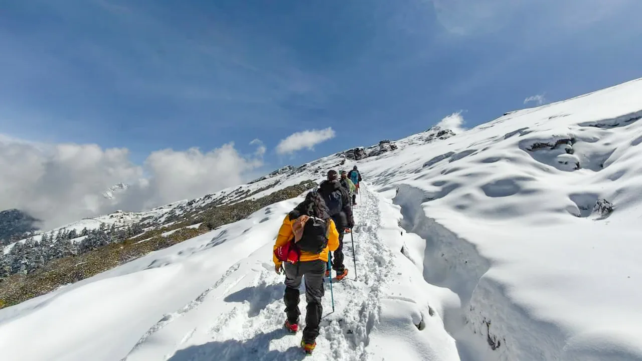
Exhausting return to Khullara. Technical: Extremely demanding summit push. Start by 3:00 AM. Crux is the final 2km on the sharp ridge. Requires microspikes and ice-axes in spring. Landscape: From the summit, the view of the Nanda Devi Sanctuary is unparalleled. Mt. Chaukhamba and Trishul feel close enough to touch. Safety: Turnback Time: 10:30 AM. Snow on the ridge becomes unstable after solar heating. Slips on the ridge are hazardous.
Key Landmarks
Staying At
The Khullara meadow broadens into a barren snow ridge leading to the Pangarchulla summit.
Field Notes
Use Trekking Poles
Trekking poles are highly recommended to save your knees on the descent.
INFOSlower Progress
Progress will be significantly slower and more taxing on your ankles than trail distance suggests.
Camp Alt
6,150 ft
Day Gain
-4,950 ft
Trek to Auli & Drive to Joshimath
Lodge stay in Joshimath. Traditional Garhwali dinner. Technical: Long descent through Auli. Entering Auli gives you a view of the world-famous ski slopes. Hard on the knees. Landscape: Auli is the premiere winter sports destination of India. Transitioning from the raw summit to Auli is a jarring cultural experience. Safety: Knee Strain Alert. Use two trekking poles and maintain a rhythmic pace.
Key Landmarks
The alpine meadow descends sharply back into the forested settlement of Auli.
Camp Alt
1,150 ft
Day Gain
-5,000 ft
Drive: Joshimath to Rishikesh
Reach Rishikesh by 7:00 PM.
The mountain valley topography transitions back into the lower foothill river plains.
Trek Extensions & Add-ons
Kuari Pass Crossover
+1 DayCombine the peak climb with a traverse over the historic Kuari Pass for a complete regional loop.
Plan Your Trek:
Ready to book? Compare verified operators for Pangarchulla Peak Trek — transparent pricing, no paid rankings.
Still deciding?
Compare routes side-by-side to find the perfect match for your fitness, dates, and budget.
Day by day, camp by camp. Send this to your group so everyone's on the same page.
Step 4: Cost & Logistics
You understand the route.
Now see what services, permits, and logistics actually cost.
View Cost Breakdown