
Explore
Intelligence
Essential Planning Guide
Panch Kedar Trek — Complete Guide (2026)
Vibe & Scenery
The Experience
Introduction
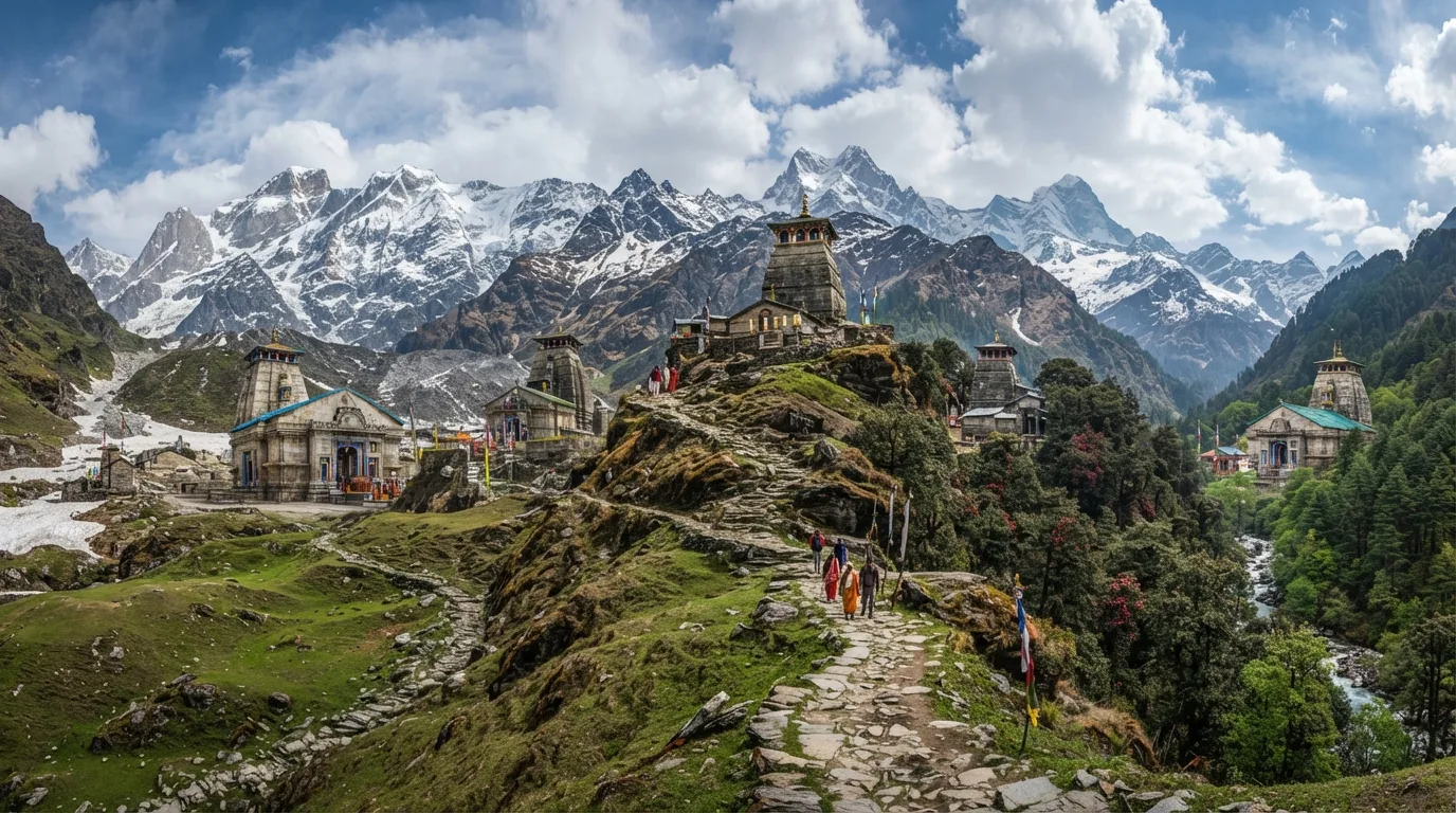
The Panch Kedar Trek is not a single trail but a remarkable pilgrimage circuit connecting the five sacred temples dedicated to Lord Shiva across the Garhwal Himalayas. According to Hindu tradition, these shrines mark the places where different parts of Shiva's divine form appeared after the Mahabharata.
The journey combines road travel with demanding mountain treks, gradually linking Kedarnath, Madhmaheshwar, Tungnath, Rudranath, and Kalpeshwar through several Himalayan valleys. Each temple offers a distinct landscape and experience—from the bustling pilgrimage route to Kedarnath to the peaceful forests surrounding Kalpeshwar and the remote alpine meadows leading to Rudranath.
Completing all five shrines requires stamina, careful planning, and the ability to sustain repeated ascents over many days. Beyond its religious significance, the Panch Kedar circuit is one of Garhwal's finest long-distance journeys, combining sacred heritage with spectacular Himalayan landscapes.
Quick Facts
Duration
Max Altitude
Difficulty
Best Time
Trek Distance
Trail Atmosphere
Stargazing
Class 2 Dark Sky
Scent Profile
Silence Level
~40 dB
Vertigo Factor
4 / 10
Iconic Spots
Kedarnath Temple at Dawn
Chandrashila Summit
Panar Bugyal
Environment
Nature & Culture
Flora & Fauna
Flora
Fauna
The legend traces back to the Mahabharata. The Pandavas sought Lord Shiva to atone for the sins of war. Shiva disguised himself as a bull and dove into the ground at Kedarnath. His body parts reappeared at five places: Hump (Kedarnath), Navel (Madhmaheshwar), Arms (Tungnath), Face (Rudranath), and Hair (Kalpeshwar).
— Local folklore
Spiritual & Cultural Significance
One of the most sacred pilgrimage circuits in Hinduism, verifying the epic of the Mahabharata and the worship of Lord Shiva.
🕐 Shrine Timings: Usually 6 AM to 8 PM, closed briefly in the afternoon.
Temple Protocols
- •Strictly vegetarian zone. No alcohol or meat allowed anywhere on the circuit.
- •Remove shoes before entering temple premises.
- •Photography inside the sanctum sanctorum is banned.
Festivals & Dates
Technical Details
Challenge & Preparation
Primarily a joint & muscle impact and cardio demand challenge
A demanding expedition with extreme joint & muscle impact, cardio demand, and cumulative fatigue. This route will push every dimension of your physical and mental endurance to the limit.
Personal Readiness
Am I ready?
Planning
Logistics & Trail Intel
Getting There
Route to Base
Fly to Dehradun (Jolly Grant) or take a train to Haridwar/Rishikesh
The circuit starts and ends here
Base Village
Rishikesh (Hub) -> Sonprayag, Ransi, Chopta, Sagar, Urgam
1,100 ft
Last ATM
Guptkashi, Ukhimath, Gopeshwar. Carry massive amounts of cash; digital payments fail on trails.
Nearest Medical Facility
Six Sigma Medical Camp (Kedarnath) / District Hospital Gopeshwar
Mobile Signal
Drops heavily in the valleys of Madhmaheshwar and the ridges of Rudranath.
Water Sources
Water points/dhabas are abundant on Kedarnath and Tungnath. Carry 2 liters for the forest sections of Rudranath and Madhmaheshwar.
Charging
Available in base villages and most guesthouses. Kedarnath has power, but frequent cuts. Power bank mandatory.
For Drivers
Road Condition
The Char Dham highway (All Weather Road) is excellent up to the base towns, but connecting roads to Ransi and Sagar are narrow and broken.
Guptkashi, Gopeshwar, Joshimath.
Trail Culinary & Diet
Don't miss the Mandua ki Roti (Finger millet bread) and Gehat ki Dal.
Buy specialized diet items at Rishikesh
The Content & Remote Hub
No DronesStrictly banned near Kedarnath and all temple premises due to religious sensitivity and helicopter airspace. Confiscation is guaranteed.Top Vlog Spots
Video Calls
low
Est. 10 Mbps
UPI Reliability
6/10
Base WiFi Available
Permits and Regulations
Registration for the Char Dham/Panch Kedar Yatra on the Uttarakhand Tourism portal is mandatory. Biometric registration checks are enforced heavily at Sonprayag (for Kedarnath). Forest department entry fees are collected at the trailheads for Tungnath (Chopta) and Rudranath (Sagar). Drones are strictly prohibited near the temples and require special SDM clearance. Medical fitness certificates are required for the Kedarnath segment.
Learn more about how we vet operators and ensure transparency on our why MountRoutes page.
Packing List
Layering & Clothing
- Heavy down jacket rated to -5°C (crucial for Kedarnath and Rudranath)
- Waterproof/Windproof hardshell jacket and pants (Monsoon protection)
- 3 thermal base layers (synthetic or merino wool)
- 2 fleece mid-layers
- Quick-dry trekking pants (2 pairs)
- Woolen trekking socks (5 pairs)
- Waterproof gloves and woolen inner liners
Footwear & Terrain Gear
- Waterproof trekking boots with Vibram sole (mandatory for Rudranath mud)
- Camp sandals or lightweight shoes
- Water-resistant high-ankle gaiters
- 2 anti-shock trekking poles (essential for brutal descents)
- Microspikes (if trekking in early May or late October)
Safety & Survival
- Headlamp with spare batteries
- High-quality sleeping bag rated to -10°C
- UV400 Polarized Sunglasses
- High SPF Sunscreen (50+) and Lip Balm
- Personal First-Aid Kit with Diamox, ORS, and muscle relaxants
- Water purification tablets
Deep Dives
Explore Further
Editor's Notes
Explore In Detail
Day by Day Itinerary
11-day route reaching 13,100ft. Covers 130.0km of varied terrain.
→ See full itinerary with altitude profileDifficulty & Fitness
Rated challenging. The trail oscillates wildly between paved, heavily trafficked pilgrim paths (Kedarnath, Tungnath) and raw, punishing alpine trails (Rudranath, Madhmaheshwar). Expect dense mud in forests and exposed rock on ridges.
→ See difficulty breakdown and fitness guideCost & Pricing
Packages range from ₹35,000 – ₹55,000. Inclusions and hidden costs vary by operator tier.
→ See full cost breakdownFrequently Asked Questions
What is the hardest part of the Panch Kedar trek?
Rudranath is unanimously considered the toughest. The ascent from Sagar village to Panar Bugyal and onto Rudranath involves a punishing 20km climb gaining over 6,000 feet in altitude through dense forests and steep, exposed ridges.
Are the temples open all year round?
No. Only Kalpeshwar is open year-round. Kedarnath, Tungnath, Rudranath, and Madhmaheshwar close for the winter around the week of Diwali (late October/early November) and reopen in late April or May.
Can I do this as a continuous walk without using cars?
A true 100% walking traverse is an extreme, unsupported alpine route taking 25+ days across high passes like Mahapanth Col. This commercial itinerary uses vehicles between base villages (e.g., Gaurikund, Ransi, Chopta, Sagar) to complete the circuit in 14 days.
Is it safe to trek during the monsoon (July-August)?
It is highly dangerous. The Garhwal region is notoriously prone to massive landslides, cloudbursts, and road washouts during the monsoon. The Kedarnath route becomes especially hazardous. We strictly advise against trekking in July and August.
Are there ATMs and mobile networks on the trail?
ATMs are only available in major hubs like Guptkashi, Ukhimath, and Gopeshwar. Mobile network (Jio/Airtel) works well at Kedarnath and Tungnath, but Rudranath and Madhmaheshwar are almost complete dead zones.
Do I need to carry my own tent and food?
If trekking with a registered operator, tents and food are provided. However, there are basic 'dhabas' and guesthouses (ashrams) near all the shrines. Rudranath has very limited stone-hut accommodations.
What is the altitude of the highest temple?
Tungnath is the highest of the Panch Kedar temples at 12,073 ft (3,680 m). However, the trek to Chandrashila peak just above it goes up to 13,100 ft (4,000 m).
Is Diamox necessary for this trek?
While altitudes do not exceed 13,000 ft, the rapid ascents to Kedarnath and Tungnath can trigger Acute Mountain Sickness (AMS). It is recommended to carry Diamox and consult a physician before the trek.
Still deciding?
Compare routes side-by-side to find the perfect match for your fitness, dates, and budget.
Everything you need to know, in one place. Someone else in your group needs to see this.
Planning Panch Kedar Trek?
Get route conditions, operator updates, and season windows before booking.
Don't miss out! Follow us for route updates@mountroutes|LinkedIn
No spam. Only useful trek updates.
Ready to walk this route?
You’ve read the guide, now find the perfect local team to take you there. Compare our verified list of operators.
Compare verified operators