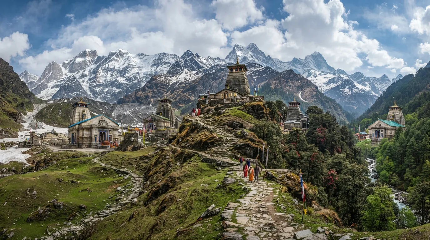
Panch Kedar Trek — compare operators and pricing

Compare operators for Panch Kedar Trek

UttarakhandChallenging

Interested in this trek?

We are currently vetting local partners for Panch Kedar Trek to ensure the highest safety standards. Be the first to know when it's open for booking.

Are you a local operator?

Join our platform to list your verified packages for Panch Kedar Trek and reach thousands of trekkers directly.

Apply to join

Found the right operator? Share this list with whoever's coming with you.

About Panch Kedar Trek

11 Days
13,100 FT
Challenging

The Panch Kedar Trek is a multi-stage pilgrimage through the Garhwal Himalayas linking the five sacred temples of Lord Shiva—Kedarnath, Madhmaheshwar, Tungnath, Rudranath, and Kalpeshwar. Combining mountain trekking with road transfers across multiple valleys, the journey explores some of Uttarakhand's most revered shrines while traversing forests, alpine meadows, and high mountain trails. It is one of India's most rewarding spiritual trekking circuits.

Trek Highlights

Kedarnath Temple at Dawn

The ancient stone temple backed by the massive snow-clad Kedarnath peak.

Chandrashila Summit

A 360-degree panorama of the Garhwal giants: Nanda Devi, Trishul, and Chaukhamba.

Panar Bugyal

Endless rolling green meadows on the way to Rudranath, looking directly at the Chaukhamba massif.

View Complete Trek Guide

Common Questions

What is the hardest part of the Panch Kedar trek?
Rudranath is unanimously considered the toughest. The ascent from Sagar village to Panar Bugyal and onto Rudranath involves a punishing 20km climb gaining over 6,000 feet in altitude through dense forests and steep, exposed ridges.
Are the temples open all year round?
No. Only Kalpeshwar is open year-round. Kedarnath, Tungnath, Rudranath, and Madhmaheshwar close for the winter around the week of Diwali (late October/early November) and reopen in late April or May.
Can I do this as a continuous walk without using cars?
A true 100% walking traverse is an extreme, unsupported alpine route taking 25+ days across high passes like Mahapanth Col. This commercial itinerary uses vehicles between base villages (e.g., Gaurikund, Ransi, Chopta, Sagar) to complete the circuit in 14 days.
Is it safe to trek during the monsoon (July-August)?
It is highly dangerous. The Garhwal region is notoriously prone to massive landslides, cloudbursts, and road washouts during the monsoon. The Kedarnath route becomes especially hazardous. We strictly advise against trekking in July and August.
Are there ATMs and mobile networks on the trail?
ATMs are only available in major hubs like Guptkashi, Ukhimath, and Gopeshwar. Mobile network (Jio/Airtel) works well at Kedarnath and Tungnath, but Rudranath and Madhmaheshwar are almost complete dead zones.
Do I need to carry my own tent and food?
If trekking with a registered operator, tents and food are provided. However, there are basic 'dhabas' and guesthouses (ashrams) near all the shrines. Rudranath has very limited stone-hut accommodations.
What is the altitude of the highest temple?
Tungnath is the highest of the Panch Kedar temples at 12,073 ft (3,680 m). However, the trek to Chandrashila peak just above it goes up to 13,100 ft (4,000 m).
Is Diamox necessary for this trek?
While altitudes do not exceed 13,000 ft, the rapid ascents to Kedarnath and Tungnath can trigger Acute Mountain Sickness (AMS). It is recommended to carry Diamox and consult a physician before the trek.
What is the hardest part of the Panch Kedar trek?
Rudranath is unanimously considered the toughest. The ascent from Sagar village to Panar Bugyal and onto Rudranath involves a punishing 20km climb gaining over 6,000 feet in altitude through dense forests and steep, exposed ridges.
Are the temples open all year round?
No. Only Kalpeshwar is open year-round. Kedarnath, Tungnath, Rudranath, and Madhmaheshwar close for the winter around the week of Diwali (late October/early November) and reopen in late April or May.
Can I do this as a continuous walk without using cars?
A true 100% walking traverse is an extreme, unsupported alpine route taking 25+ days across high passes like Mahapanth Col. This commercial itinerary uses vehicles between base villages (e.g., Gaurikund, Ransi, Chopta, Sagar) to complete the circuit in 14 days.
Is it safe to trek during the monsoon (July-August)?
It is highly dangerous. The Garhwal region is notoriously prone to massive landslides, cloudbursts, and road washouts during the monsoon. The Kedarnath route becomes especially hazardous. We strictly advise against trekking in July and August.
Are there ATMs and mobile networks on the trail?
ATMs are only available in major hubs like Guptkashi, Ukhimath, and Gopeshwar. Mobile network (Jio/Airtel) works well at Kedarnath and Tungnath, but Rudranath and Madhmaheshwar are almost complete dead zones.
Do I need to carry my own tent and food?
If trekking with a registered operator, tents and food are provided. However, there are basic 'dhabas' and guesthouses (ashrams) near all the shrines. Rudranath has very limited stone-hut accommodations.
What is the altitude of the highest temple?
Tungnath is the highest of the Panch Kedar temples at 12,073 ft (3,680 m). However, the trek to Chandrashila peak just above it goes up to 13,100 ft (4,000 m).
Is Diamox necessary for this trek?
While altitudes do not exceed 13,000 ft, the rapid ascents to Kedarnath and Tungnath can trigger Acute Mountain Sickness (AMS). It is recommended to carry Diamox and consult a physician before the trek.

Are you a local operator?

Join our platform to list your verified packages for this trek.

Apply to join
MountRoutes Dispatch

Planning Panch Kedar Trek?

Get route conditions, operator updates, and season windows before booking.

Don't miss out! Follow us for route updates@mountroutes|LinkedIn

No spam. Only useful trek updates.

Explore Collections

Not sure where to go next?

View all