
Explore
Intelligence
Detailed Route
Mayali Pass Trek Itinerary — Day by Day Route & Camps
A brutal 10-day crossover. Start in the isolated Bhilangana valley, survive the freezing heights of the Khatling Glacier, cross the Mayali Pass, and descend into the sacred Kedarnath sanctuary.
Standard RouteThis is the standard mountain pacing for this trek. Specific operators may add an acclimatization day or alter the starting point. Check individual operator schedules for their exact logistics.
Duration
10 Days
Total Distance
90.0 KM
Max Altitude
17,388 FT
Trek Type
circuit
Permits Required Before You Go
Permit Cost
Where to Get
Ghuttu Police Post / DFO Office
Documents
Original Aadhar Card / Passport, Medical Fitness Certificate (Signed by MBBS)
Foreign Nationals
Foreigners require additional clearances due to the high-altitude expedition nature. Process via a registered agency weeks in advance.
Foreigner Process
Expedition-level clearance required from Uttarkashi authorities. Process via a registered mountaineering agency well in advance.
Nearest Embassy Hub
New Delhi
Day by Day Breakdown
Camp Alt
5,000 ft
Day Gain
+2,900 ft
Drive to Ghuttu
Drive from Dehradun past the massive Tehri Dam reservoir, following the Bhilangana River deep into the Garhwal Himalayas. You will arrive at the small town of Ghuttu, the administrative starting point of the trek, where you will stay in a local guest house and finalize permits.
Key Landmarks
Staying At
The motorable road navigates deeper into the mountain river corridor, where the landscape transitions from lower foothills into the steep, dense forested valleys.
Camp Alt
7,000 ft
Day Gain
+2,000 ft
Reach Reeh
The expedition begins. The trail leaves Ghuttu, immediately ascending through a mix of terraced agricultural fields and dense pine forests. It is a steady, hot climb. You will camp at the small meadow clearing of Reeh.
Key Landmarks
Staying At
The route moves through forested zones. The environment transitions into open alpine meadows.
Camp Alt
8,500 ft
Day Gain
+1,500 ft
Reach Gangi
The trail continues to follow the Bhilangana river gorge. You will arrive at Gangi, one of the most isolated villages in the region. It is the last permanent settlement on the route. The wooden architecture and traditional Garhwali lifestyle here are perfectly preserved.
Key Landmarks
Staying At
The trail follows the mountain river corridor through a narrow, forested gorge, moving past traditional settlements into increasingly dense dense forested valleys.
Field Notes
KEY ACTIONRiver Crossings
Plan to cross early in the day before snowmelt swells the water levels. Unclip backpack waist belts before crossing.
Camp Alt
9,500 ft
Day Gain
+1,000 ft
Reach Kharsoli
You leave civilization entirely. The trail becomes narrower and more challenging, passing through dense oak and birch forests. You will cross several landslide-prone zones. The camp at Kharsoli is located at the confluence of the Bhilangana river and a glacial nallah (stream).
Key Landmarks
Staying At
The route moves through forested zones. The route follows the river valley. The path breaches the mountain barrier crossing the watershed.
Field Notes
KEY ACTIONRiver Crossings
Plan to cross early in the day before snowmelt swells the water levels. Unclip backpack waist belts before crossing.
Use Trekking Poles
Trekking poles are highly recommended to save your knees on the descent.
INFOSlower Progress
Progress will be significantly slower and more taxing on your ankles than trail distance suggests.
Camp Alt
12,000 ft
Day Gain
+2,500 ft
Reach Chowki
The landscape changes dramatically. The forests disappear, giving way to open alpine meadows (bugyals). The massive snout of the Khatling Glacier finally comes into view, surrounded by jagged peaks. The Chowki campsite is a sprawling green meadow right at the edge of the glacial moraine.
Key Landmarks
Staying At
The route moves through forested zones. The environment transitions into open alpine meadows. The valley transitions into a glacial basin.
Field Notes
Use Trekking Poles
Trekking poles are highly recommended to save your knees on the descent.
INFOSlower Progress
Progress will be significantly slower and more taxing on your ankles than trail distance suggests.
Camp Alt
12,000 ft
Day Gain
0 ft
Today's Objective
☕ Acclimatization & Recovery
A mandatory rest day. You will take a short acclimatization walk towards the snout of the Khatling Glacier to view the ice caves where the Bhilangana river is born, then return to camp to rest. This is vital before pushing into the extreme altitudes.
Key Landmarks
Staying At
The valley transitions into a glacial basin. The route follows the river valley.
Field Notes
KEY ACTIONRiver Crossings
Plan to cross early in the day before snowmelt swells the water levels. Unclip backpack waist belts before crossing.
Use Trekking Poles
Trekking poles are highly recommended to save your knees on the descent.
INFOSlower Progress
Progress will be significantly slower and more taxing on your ankles than trail distance suggests.
Camp Alt
15,000 ft
Day Gain
+3,000 ft
Reach Masar Tal
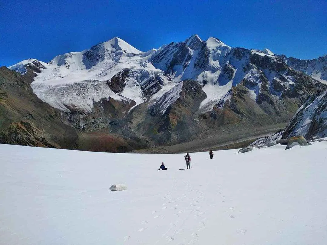
The technical phase begins. You leave the meadows and step onto the Khatling Glacier. Navigating the moraine and ice requires extreme care. The final push to Masar Tal is a brutally steep climb over loose rocks. The lake sits in a frozen bowl at 15,000 ft, surrounded by towering peaks. The night here will be bitterly cold.
Key Landmarks
Staying At
The environment transitions into open alpine meadows. The valley transitions into a glacial basin.
Field Notes
Use Trekking Poles
Trekking poles are highly recommended to save your knees on the descent.
INFOSlower Progress
Progress will be significantly slower and more taxing on your ankles than trail distance suggests.
Camp Alt
14,200 ft
Day Gain
-800 ft
Today's Objective
🏔 Cross Cross Mayali Pass
The ultimate test. You start before dawn, climbing a near-vertical ice wall to reach Masar Top. From there, you rope up and traverse a massive snowfield heavily scarred with hidden crevasses to finally breach the Mayali Pass (17,388 ft). The view of Mt. Thalay Sagar and Kedar Dome is legendary. The descent is incredibly steep and treacherous, dropping sharply to the beautiful, sacred lake of Vasuki Tal.
Key Landmarks
Staying At
Crossing the high-altitude pass bridges two distinct watershed systems, shifting the expedition over the glaciated divide and down into a new river basin.
Field Notes
KEY ACTIONRoped Travel
Requires roped glacier travel.
KEY ACTIONStart Early
Start before sunrise to ensure snow bridges remain solid.
KEY ACTIONHarness Gear
Harness-compatible gear is mandatory.
Use Trekking Poles
Trekking poles are highly recommended to save your knees on the descent.
INFOPacing Delays
Slower pacing expected due to bottlenecking on fixed lines.
Camp Alt
11,750 ft
Day Gain
-2,450 ft
Reach Kedarnath
You leave the frozen isolation of Vasuki Tal, hiking up a short ridge before beginning the long, sweeping descent into the Mandakini valley. The towering Kedar Dome stands guard as you descend. Suddenly, you merge onto the paved pilgrim trail and arrive at the holy Kedarnath Temple, ending the true wilderness portion of the expedition.
Key Landmarks
Staying At
The high alpine meadows narrow into forested river terraces as tree line vegetation reappears in the lower Mandakini valley.
Field Notes
Use Trekking Poles
Trekking poles are highly recommended to save your knees on the descent.
INFOSlower Progress
Progress will be significantly slower and more taxing on your ankles than trail distance suggests.
Camp Alt
2,100 ft
Day Gain
-9,650 ft
Trek to Gaurikund & Drive to Dehradun
Join the pilgrims for the 14km descent on the paved trail to Gaurikund. From Gaurikund, board your vehicles for the long, exhausting drive back down through the Mandakini and Alaknanda valleys, reaching Dehradun by late night to conclude the expedition.
Key Landmarks
The rugged alpine terrain opens up to reveal a spectacular high-altitude glacial tarn, serving as a critical hydrological node in the upper watershed.
Trek Extensions & Add-ons
Audens Col Traverse
+5 DaysFor elite mountaineers, the Mayali Pass is often combined with the even deadlier Auden's Col, linking Gangotri directly to Kedarnath via Khatling.
Plan Your Trek:
Ready to book? Compare verified operators for Mayali Pass Trek — transparent pricing, no paid rankings.
Still deciding?
Compare routes side-by-side to find the perfect match for your fitness, dates, and budget.
Day by day, camp by camp. Send this to your group so everyone's on the same page.
Step 4: Cost & Logistics
You understand the route.
Now see what services, permits, and logistics actually cost.
View Cost Breakdown