
Explore
Intelligence
Essential Planning Guide
Mayali Pass Trek — Complete Guide (2026)
Vibe & Scenery
The Experience
Introduction
Mayali Pass is among the highest and most demanding trekking passes in the Garhwal Himalayas. Historically used as a seasonal link between the Gangotri and Kedarnath regions, the route today is attempted primarily as an expedition-grade crossover.
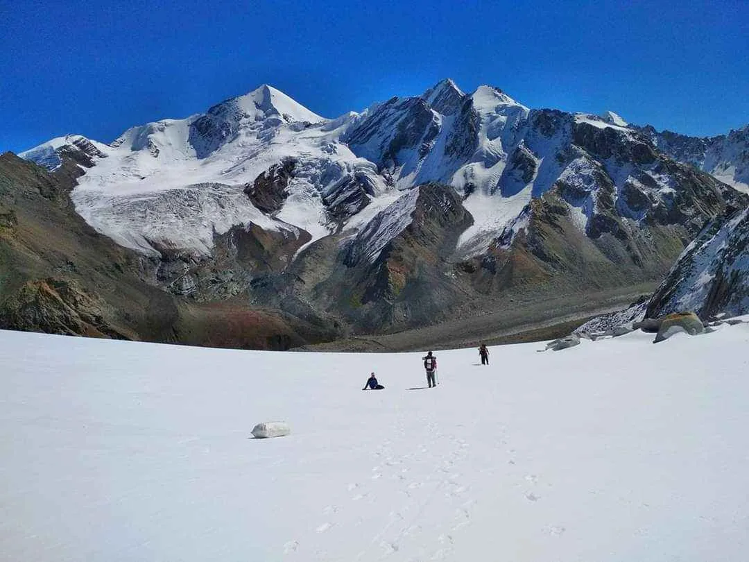
The journey traverses the Khatling Glacier before climbing steep snow and moraine slopes to the 17,388 ft pass. Along the way, trekkers camp beside remote alpine lakes including Masar Tal and Vasuki Tal while surrounded by some of Garhwal's most dramatic glaciated terrain.
High altitude, glacier travel, unpredictable weather, and long expedition days make Mayali Pass suitable only for experienced teams with appropriate equipment and mountain judgement.
Quick Facts
Duration
Max Altitude
Difficulty
Best Time
Trek Distance
Trail Atmosphere
Stargazing
Class 1 Dark Sky
Scent Profile
Silence Level
~10 dB
Vertigo Factor
5 / 10
Iconic Spots
Mayali Pass Viewpoint
Masar Tal
Khatling Glacier Snout
Environment
Nature & Culture
Flora & Fauna
Flora
Fauna
The route is believed to be the path taken by the Pandavas on their journey to heaven, making the lakes (Masar and Vasuki) deeply sacred.
— Local folklore
Spiritual & Cultural Significance
Ending the trek at Kedarnath, one of the 12 Jyotirlingas, makes this a profoundly spiritual journey for Hindu trekkers.
🕐 Shrine Timings: Kedarnath Temple is open from May to November.
Temple Protocols
- •Strict vegetarianism is expected on the route.
- •Remove shoes before entering the Kedarnath temple.
Festivals & Dates
Technical Details
Challenge & Preparation
Primarily a cardio demand and cumulative fatigue challenge
A demanding expedition with extreme cardio demand, cumulative fatigue, and joint & muscle impact. This route will push every dimension of your physical and mental endurance to the limit.
Personal Readiness
Am I ready?
Planning
Logistics & Trail Intel
Getting There
Route to Base
Arrive in Dehradun
Drive 7 hours to Ghuttu
The trek ends at Gaurikund, from where it is an 8-hour drive back to Dehradun
Base Village
Ghuttu (Start) / Gaurikund (End)
5,000 ft
Last ATM
Dehradun / Tehri
Nearest Medical Facility
Kedarnath (End) has an emergency medical camp during the Yatra season. Ghuttu (Start) has basic PHC.
Mobile Signal
Total blackout from Day 2 to Day 8.
Water Sources
Glacial streams and high-altitude lakes. Must be heavily purified.
Charging
Total blackout from Day 2 to Day 8.
For Drivers
Road Condition
The drive to Ghuttu is winding and prone to landslides during the monsoon. The return from Gaurikund is heavily trafficked by pilgrims.
Tehri / Rudraprayag
Trail Culinary & Diet
Don't miss the Simple Khichdi at high camps for easy digestion
Buy specialized diet items at Dehradun
The Content & Remote Hub
Top Vlog Spots
Video Calls
none
Est. 0 Mbps
UPI Reliability
1/10
Permits and Regulations
Standard forest permits are required from the DFO Uttarkashi. Because this route crosses high-altitude glaciers, operators must strictly register the entire team manifesto with the local police at Ghuttu before departure.
Learn more about how we vet operators and ensure transparency on our why MountRoutes page.
Packing List
High-Altitude & Technical Clothing
- Expedition down jacket (-15°C rating)
- Gore-Tex windproof and waterproof outer shell
- Heavyweight thermal base layers (2 sets)
- Waterproof trekking trousers
- Fleece mid-layers
Glacier Footwear
- Rigid mountaineering boots (crampon compatible)
- Merino wool trekking socks (x4 pairs)
- Microspikes / Crampons (Mandatory for Mayali Pass)
- Heavy-duty waterproof gaiters
Expedition Survival Gear
- 4-season sleeping bag (-15°C comfort)
- High-altitude UV Category 4 sunglasses (Snow blindness is a severe risk)
- Trekking poles with snow baskets
- Ice Axe (For the guide team/lead trekkers)
Health & Miscellaneous
- Diamox (Acetazolamide) for AMS prevention
- Military-grade water purification tablets
- High SPF 50+ sunscreen and zinc lip balm
- Headlamp with lithium batteries
Deep Dives
Explore Further
Editor's Notes
Explore In Detail
Day by Day Itinerary
10-day route reaching 17,388ft. Covers 90.0km of varied terrain.
→ See full itinerary with altitude profileDifficulty & Fitness
Rated challenging. The terrain transitions from dense forest to alpine meadows, and ultimately to aggressive glacial ice, deep crevasses, and near-vertical rock scrambles.
→ See difficulty breakdown and fitness guideCost & Pricing
Packages range from 35,000 - 45,000 INR. Inclusions and hidden costs vary by operator tier.
→ See full cost breakdownFrequently Asked Questions
Is the Mayali Pass trek technical?
Yes. It borders on a mountaineering expedition. You must rope up to cross the crevassed sections of the Khatling Glacier, and the final 1,000 ft ascent to the pass involves steep ice and rock scrambling.
How dangerous is the Khatling Glacier?
The glacier is highly active and heavily crevassed. You cannot walk on it independently. You must follow the exact footsteps of your guide, and in late season, roping up is mandatory.
Can I do this if I've only done treks like Roopkund or Goechala?
Yes, but it is a massive step up. Goechala stops at 15,000 ft. Mayali Pass pushes you to 17,388 ft and introduces true glacier traverse mechanics. You must be in absolute peak physical condition.
What happens if I get altitude sickness at the pass?
Evacuation from Masar Tal or the pass is incredibly difficult. If you show severe symptoms of AMS at Chowki or Masar Tal, you must descend immediately back towards Gangi. Crossing the pass with AMS is fatal.
Will my phone work?
You will have network at Ghuttu (Start) and Kedarnath (End). For the 7 days in between, expect a total blackout.
Are there river crossings?
Yes. The streams feeding into the Bhilangana river are glacial and freezing. They must be crossed early in the morning before the sun melts the ice.
How cold does it get at Masar Tal?
Even in September, temperatures at Masar Tal (15,000 ft) regularly drop to -10°C at night. The lake itself is often partially frozen.
Is it crowded at the end?
Yes. You will spend 9 days in total isolation, and on Day 9, you will suddenly merge with thousands of pilgrims at the Kedarnath temple. The contrast is extreme.
Still deciding?
Compare routes side-by-side to find the perfect match for your fitness, dates, and budget.
Everything you need to know, in one place. Someone else in your group needs to see this.
Planning Mayali Pass Trek?
Get route conditions, operator updates, and season windows before booking.
Don't miss out! Follow us for route updates@mountroutes|LinkedIn
No spam. Only useful trek updates.
Ready to walk this route?
You’ve read the guide, now find the perfect local team to take you there. Compare our verified list of operators.
Compare verified operators