
Explore
Intelligence
Essential Planning Guide
Jalsu Pass Trek — Complete Guide (2026)
Vibe & Scenery
The Experience
Introduction
For generations, Jalsu Pass served as an important seasonal route for Gaddi shepherds moving their flocks between the Kangra and Chamba valleys. Today, the trail remains one of the Dhauladhar range's most rewarding moderate crossovers, preserving both its cultural heritage and natural beauty.
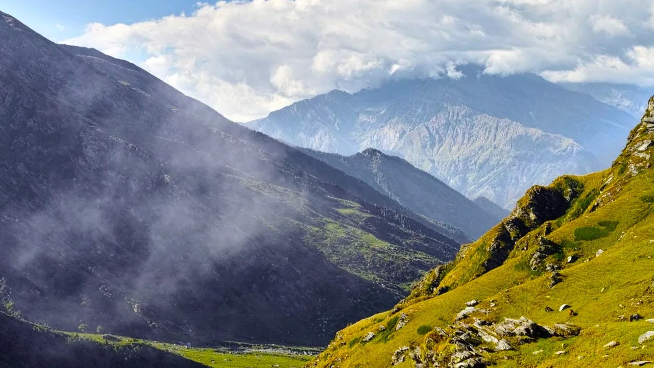
The route winds through dense forests before emerging onto expansive alpine grazing meadows known locally as gots. Gentle gradients compared with many Himalayan passes make the trek accessible to reasonably fit hikers while still delivering impressive mountain scenery.
Panoramic views of the Dhauladhar and Pir Panjal ranges, traditional shepherd camps, and quiet mountain landscapes define the experience throughout the journey.
Quick Facts
Duration
Max Altitude
Difficulty
Best Time
Trek Distance
Trail Atmosphere
Stargazing
Class 2 Dark Sky
Scent Profile
Silence Level
~25 dB
Vertigo Factor
2 / 10
Iconic Spots
Yara Got
Jalsu Pass Summit
Surai Village
Environment
Nature & Culture
Flora & Fauna
Flora
Fauna
The pass and the meadows are deeply connected to the Gaddi mythology and their reverence for Lord Shiva, who is believed to reside in the nearby Manimahesh peak.
— Local folklore
Spiritual & Cultural Significance
The route is deeply entwined with the Gaddi pastoral culture, an indigenous semi-nomadic tribe devoted to Lord Shiva.
🕐 Shrine Timings: N/A
Temple Protocols
- •Respect the local shepherds and their flocks.
- •Do not disturb the temporary stone shrines built at the pass.
Festivals & Dates
Technical Details
Challenge & Preparation
Primarily a cardio demand challenge
A capable trekker's route that balances cardio demand and cumulative fatigue.
Personal Readiness
Am I ready?
Planning
Logistics & Trail Intel
Getting There
Route to Base
Take a train to Pathankot or fly to Kangra (Gaggal)
From Pathankot or Kangra, take a bus or taxi to Baijnath, and then a local vehicle to Utrala
Base Village
Utrala (via Baijnath)
4,500 ft
Last ATM
Baijnath (Kangra side) and Holi/Chamba (Chamba side).
Nearest Medical Facility
Baijnath Civil Hospital (Start). Holi PHC / Chamba District Hospital (End).
Mobile Signal
Total blackout in the upper meadows.
Water Sources
Abundant streams throughout the trek on both sides of the pass. Purify all water, as these are heavy grazing areas for sheep.
Charging
Total blackout between Utrala and Nayagran.
For Drivers
Road Condition
The approach to Baijnath/Utrala is on good state highways. The exit from Nayagran/Holi is a winding, sometimes rough mountain road.
Baijnath (Start) / Holi (End)
Trail Culinary & Diet
Don't miss the Kadhi Chawal at the shepherd dhabas
Buy specialized diet items at Baijnath / Dharamshala
The Content & Remote Hub
Top Vlog Spots
Video Calls
base_village_only
Est. 5 Mbps
UPI Reliability
3/10
Base WiFi Available
Permits and Regulations
No special border permits are required. However, it is standard practice to inform the local police station in Baijnath before departing. Ensure you carry a valid ID.
Learn more about how we vet operators and ensure transparency on our why MountRoutes page.
Packing List
Core Clothing Layers
- Fleece jacket (for chilly evenings at the Gots)
- Waterproof/Windproof outer shell
- Trekking pants (quick-dry, x2)
- Thermal base layers (for high camps)
Footwear & Protection
- Mid to high-ankle trekking boots (broken in)
- Merino wool socks (x3 pairs)
- Camp sandals/shoes
- Lightweight gaiters (helpful in pre-monsoon mud/snow)
Head & Hands
- Wide-brimmed sun hat
- UV protection sunglasses
- Lightweight fleece gloves
- Warm beanie for the pass crossing day
Gear & Accessories
- 40-50 litre backpack with rain cover
- Trekking poles (essential for the descent into Chamba)
- Three-season sleeping bag (if trekking independently)
- Basic first aid kit with blister tape
- Hydration bladder or 2x 1L water bottles
Deep Dives
Explore Further
Editor's Notes
Explore In Detail
Day by Day Itinerary
5-day route reaching 11,500ft. Covers 45.0km of varied terrain.
→ See full itinerary with altitude profileDifficulty & Fitness
Rated moderate. The trail is predominantly well-trodden dirt paths and grassy meadows (Gots). It avoids the sheer rock and boulder fields found on higher Dhauladhar passes.
→ See difficulty breakdown and fitness guideCost & Pricing
Packages range from 8,000 - 12,000 INR. Inclusions and hidden costs vary by operator tier.
→ See full cost breakdownFrequently Asked Questions
Is this trek suitable for beginners?
Yes, it is one of the best crossover treks for fit beginners. While it covers a long distance (approx. 40-45 km total), the gradient is much more gradual compared to other Dhauladhar passes.
Which side should I start from, Kangra or Chamba?
Most trekkers prefer starting from the Kangra side (Utrala/Baijnath) because the ascent is slightly more gradual, allowing for better acclimatization before crossing over into the steeper Chamba descent.
Will I see snow on this trek?
If you trek in late May or early June, you will likely encounter residual snow patches near the pass. By September and October, the trail is completely devoid of snow.
Are there places to stay along the trail?
During the summer months, local Gaddi shepherds set up temporary tea-houses (dhabas) at the major meadows (Parai, Yara Got) where basic food and floor space are available. However, carrying your own tent is highly recommended.
How do I return to my starting point?
The trek is a traverse. You will end in the Chamba valley (Holi/Nayagran). From there, you must take a bus or taxi back to Pathankot or Kangra, which is a long 7-8 hour drive.
Is there mobile connectivity?
You will have a signal at Utrala (Kangra side) and Holi (Chamba side). The middle 2-3 days across the pass have zero connectivity.
What is the risk of AMS?
Low to Moderate. The pass tops out at around 11,500 ft, and the camps are usually below 10,000 ft. However, staying hydrated is still critical.
Are there any dangerous river crossings?
There are several stream crossings, particularly on the Kangra ascent, but they are generally bridged by logs or are shallow enough to rock-hop. Heavy monsoon rains can make them dangerous.
Still deciding?
Compare routes side-by-side to find the perfect match for your fitness, dates, and budget.
Everything you need to know, in one place. Someone else in your group needs to see this.
Planning Jalsu Pass Trek?
Get route conditions, operator updates, and season windows before booking.
Don't miss out! Follow us for route updates@mountroutes|LinkedIn
No spam. Only useful trek updates.
Ready to walk this route?
You’ve read the guide, now find the perfect local team to take you there. Compare our verified list of operators.
Compare verified operators