Jalsu Pass Trek — compare operators and pricing

Compare operators for Jalsu Pass Trek

Himachal PradeshModerate

Interested in this trek?

We are currently vetting local partners for Jalsu Pass Trek to ensure the highest safety standards. Be the first to know when it's open for booking.

Are you a local operator?

Join our platform to list your verified packages for Jalsu Pass Trek and reach thousands of trekkers directly.

Apply to join

Found the right operator? Share this list with whoever's coming with you.

About Jalsu Pass Trek

5 Days
11,500 FT
Moderate

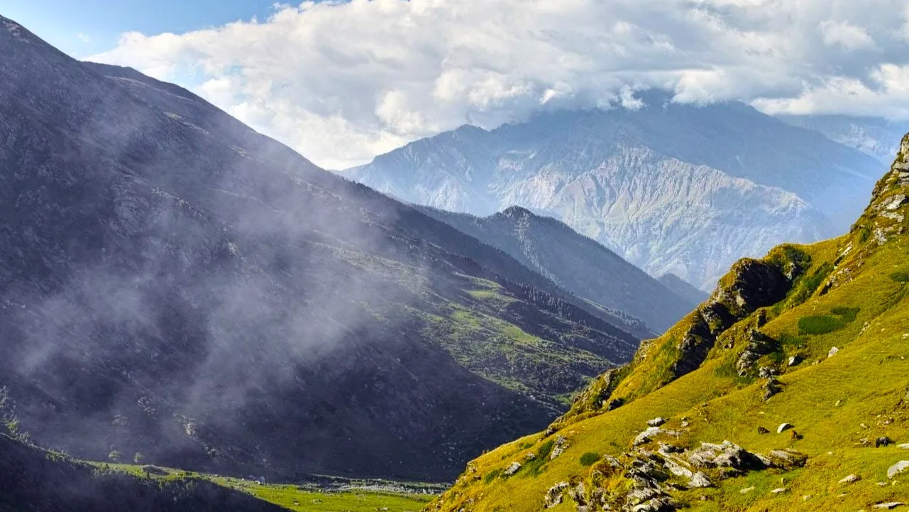
The Jalsu Pass Trek follows an ancient shepherd route across the Dhauladhar range, linking the Kangra and Chamba valleys. Traversing forests, alpine meadows, and traditional grazing grounds, the trek combines moderate mountain walking with rich Gaddi pastoral heritage and beautiful Himalayan scenery.

Trek Highlights

Yara Got

A vast, rolling alpine meadow providing a spectacular campsite right below the final ascent to the pass.

Jalsu Pass Summit

The dramatic saddle point offering a clear transition from the Kangra plains to the deep, rugged valleys of Chamba.

Surai Village

A traditional Chamba village with distinct wooden architecture and ancient cedar forests.

View Complete Trek Guide

Common Questions

Is this trek suitable for beginners?
Yes, it is one of the best crossover treks for fit beginners. While it covers a long distance (approx. 40-45 km total), the gradient is much more gradual compared to other Dhauladhar passes.
Which side should I start from, Kangra or Chamba?
Most trekkers prefer starting from the Kangra side (Utrala/Baijnath) because the ascent is slightly more gradual, allowing for better acclimatization before crossing over into the steeper Chamba descent.
Will I see snow on this trek?
If you trek in late May or early June, you will likely encounter residual snow patches near the pass. By September and October, the trail is completely devoid of snow.
Are there places to stay along the trail?
During the summer months, local Gaddi shepherds set up temporary tea-houses (dhabas) at the major meadows (Parai, Yara Got) where basic food and floor space are available. However, carrying your own tent is highly recommended.
How do I return to my starting point?
The trek is a traverse. You will end in the Chamba valley (Holi/Nayagran). From there, you must take a bus or taxi back to Pathankot or Kangra, which is a long 7-8 hour drive.
Is there mobile connectivity?
You will have a signal at Utrala (Kangra side) and Holi (Chamba side). The middle 2-3 days across the pass have zero connectivity.
What is the risk of AMS?
Low to Moderate. The pass tops out at around 11,500 ft, and the camps are usually below 10,000 ft. However, staying hydrated is still critical.
Are there any dangerous river crossings?
There are several stream crossings, particularly on the Kangra ascent, but they are generally bridged by logs or are shallow enough to rock-hop. Heavy monsoon rains can make them dangerous.
Is this trek suitable for beginners?
Yes, it is one of the best crossover treks for fit beginners. While it covers a long distance (approx. 40-45 km total), the gradient is much more gradual compared to other Dhauladhar passes.
Which side should I start from, Kangra or Chamba?
Most trekkers prefer starting from the Kangra side (Utrala/Baijnath) because the ascent is slightly more gradual, allowing for better acclimatization before crossing over into the steeper Chamba descent.
Will I see snow on this trek?
If you trek in late May or early June, you will likely encounter residual snow patches near the pass. By September and October, the trail is completely devoid of snow.
Are there places to stay along the trail?
During the summer months, local Gaddi shepherds set up temporary tea-houses (dhabas) at the major meadows (Parai, Yara Got) where basic food and floor space are available. However, carrying your own tent is highly recommended.
How do I return to my starting point?
The trek is a traverse. You will end in the Chamba valley (Holi/Nayagran). From there, you must take a bus or taxi back to Pathankot or Kangra, which is a long 7-8 hour drive.
Is there mobile connectivity?
You will have a signal at Utrala (Kangra side) and Holi (Chamba side). The middle 2-3 days across the pass have zero connectivity.
What is the risk of AMS?
Low to Moderate. The pass tops out at around 11,500 ft, and the camps are usually below 10,000 ft. However, staying hydrated is still critical.
Are there any dangerous river crossings?
There are several stream crossings, particularly on the Kangra ascent, but they are generally bridged by logs or are shallow enough to rock-hop. Heavy monsoon rains can make them dangerous.

Are you a local operator?

Join our platform to list your verified packages for this trek.

Apply to join
MountRoutes Dispatch

Planning Jalsu Pass Trek?

Get route conditions, operator updates, and season windows before booking.

Don't miss out! Follow us for route updates@mountroutes|LinkedIn

No spam. Only useful trek updates.

Explore Collections

Not sure where to go next?

View all