Detailed Route
Gidara Bugyal Trek Itinerary — Day by Day Route & Camps
Standard RouteThis is the standard mountain pacing for this trek. Specific operators may add an acclimatization day or alter the starting point. Check individual operator schedules for their exact logistics.
Duration
7 Days
Total Distance
38 KM
Max Altitude
13,900 FT
Trek Type
linear
Permits Required Before You Go
Permit Cost
Where to Get
Uttarkashi DFO
Documents
Aadhar Card, Medical Auto-declaration
Foreign Nationals
Standard passport copies. Permit process slightly extended.
Foreigner Process
Standard forest checkpost logging.
Nearest Embassy Hub
New Delhi
Day by Day Breakdown
Drive Dehradun to Bhangeli via Raithal
Drive 8 hours following the Bhagirathi river past Uttarkashi. Disembark at the roadhead and undertake a brutally steep, 3km heart-pounding climb just to reach the remote cliff-side village of Bhangeli.
Key Landmarks
Staying At
Trek Bhangeli to Rikla
Enter a deeply shaded, ancient woodland mixing oak, pine, and rhododendron. The climb is consistently steep. Rikla is a small clearing still enclosed completely by the forest.
Key Landmarks
Staying At
Trek Rikla to Dokrani
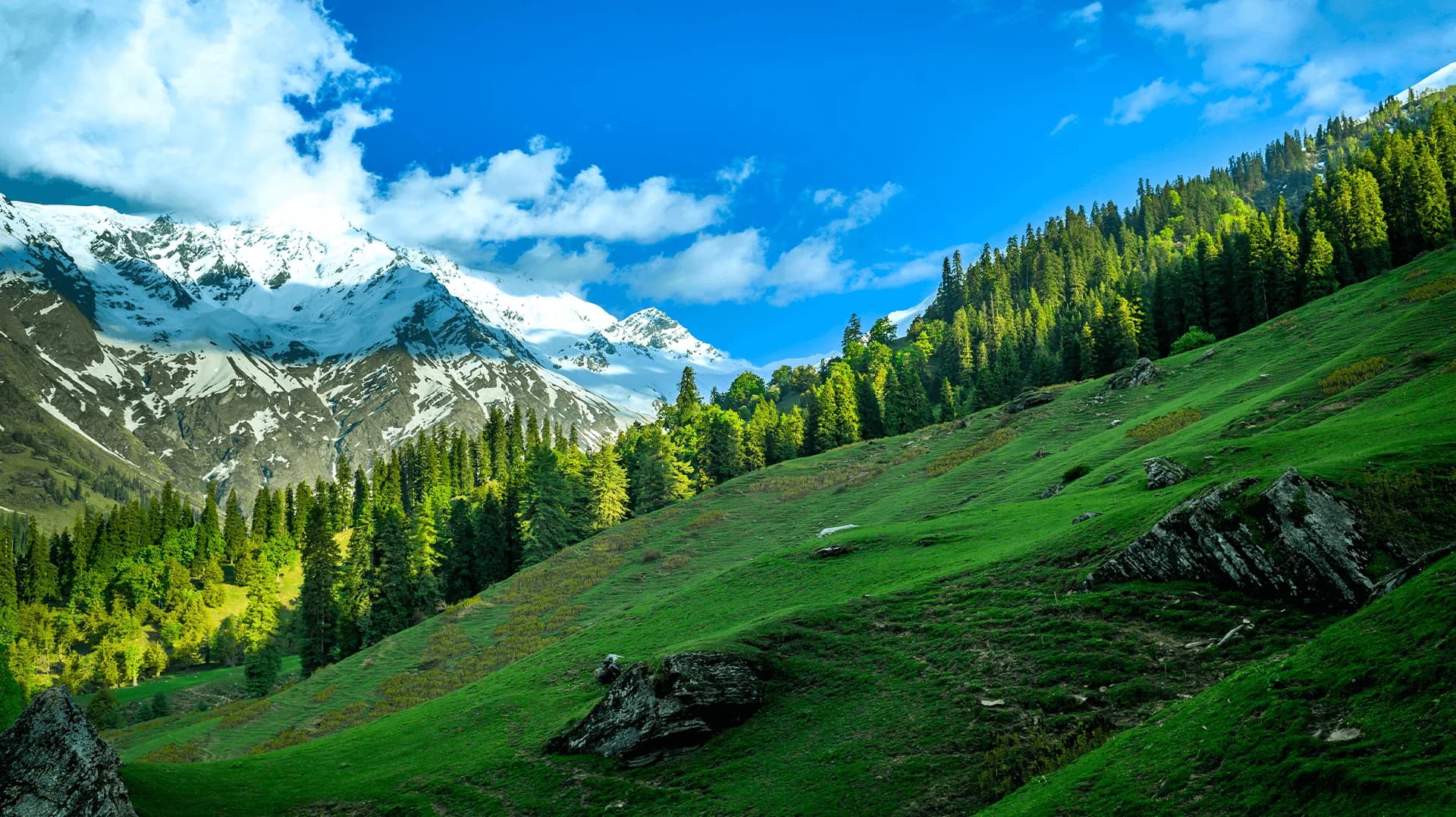
A magical day. You ascend past the timberline, the trees shrinking into dwarf rhododendrons, and suddenly burst out onto the lower edges of the immense Gidara meadows. Gangotri peaks dominate the horizon.
Key Landmarks
Staying At
Ascent to Gidara Top & Traverse to Thalot
The apex day. A grueling zig-zag climb up the steepest grass flanks to crest Gidara Top (13,900 ft). Traverse miles of high rolling green mounds dropping abruptly into deep valleys. Descend slightly to camp at Thalot.
Key Landmarks
Staying At
Explore Gidara Bugyal and Descend to Jeemara
Spend the morning exploring the lesser-known western ridges of the bugyal. By afternoon, begin the long drop back toward the tree line, camping at the lush forest edge of Jeemara.
Key Landmarks
Staying At
Trek Jeemara to Bhangeli
A massive, knee-jarring descent. The trail drops violently back through the oak forests, retracing steps to the dramatic cliff-side village of Bhangeli.
Key Landmarks
Staying At
Drive Bhangeli to Dehradun
Descend the final 3km from the village to the roadside. Board vehicles for the long winding drive back down to the heat of the Dehradun plains.
Key Landmarks
Trek Extensions & Add-ons
Bakal Top Extension
+1 DayAn exploratory side-hike pushing higher onto the neighboring Bakal ridges for deeper views into the Gangotri glacier system.
Also on this trek
Ready to book? Compare verified operators for Gidara Bugyal Trek — transparent pricing, no paid rankings.
Still deciding?
Compare routes side-by-side to find the perfect match for your fitness, dates, and budget.
Day by day, camp by camp. Send this to your group so everyone's on the same page.
Love this itinerary?
Find operators who follow this exact route with verified acclimatization days.
Find matching operators