
Explore
Intelligence
Essential Planning Guide
Dharansi Pass Trek — Complete Guide (2026)
Vibe & Scenery
The Experience
Introduction
The Dharansi Pass Trek follows the historic approach from Lata village into the Nanda Devi Biosphere Reserve, ascending through ancient oak and rhododendron forests to the alpine meadows of Lata Kharak before traversing high ridges toward Dharansi Pass at approximately 16,125 ft.
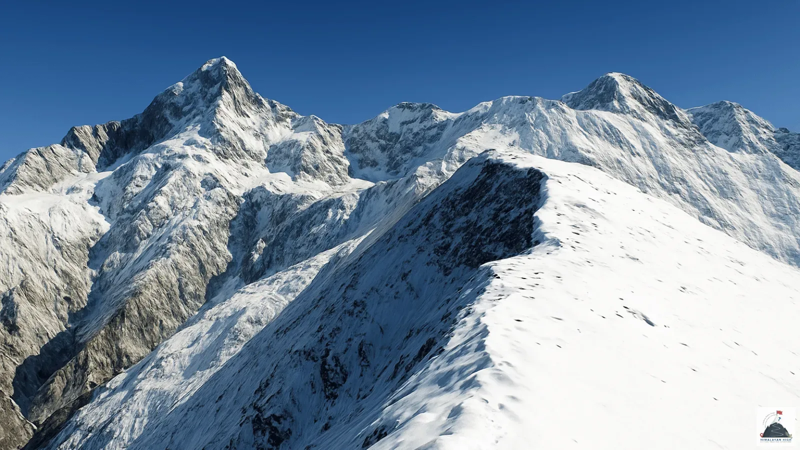
The route offers exceptional views of Nanda Devi, Dunagiri, Changabang, Hathi Parbat, Trishul, and surrounding Himalayan giants while passing through one of India's most protected mountain landscapes. Due to the ecological sensitivity of the reserve, access is tightly controlled through a permit system and limited visitor quotas.
Suitable only for experienced trekkers, Dharansi Pass combines wilderness, conservation history, and world-class mountain scenery in one of the Himalayas' most exclusive trekking destinations.
Quick Facts
Duration
Max Altitude
Difficulty
Best Time
Trek Distance
Trail Atmosphere
Stargazing
Class 2 Dark Sky
Scent Profile
Silence Level
~25 dB
Vertigo Factor
3 / 10
Iconic Spots
Dharansi Pass — Valley of Flowers Aerial Perspective
Hemkund Sahib Lake (14,100 ft)
Valley of Flowers Meadow (August Bloom)
Environment
Nature & Culture
Flora & Fauna
Flora
Fauna
In Garhwali folk tradition, the Dharansi pass ridge is where the Flower Goddess (the deity of the Valley below) descends each June from the high snow peaks and spreads the valley bloom — the pass is called her 'seasonal gateway' (dharansi = doorway/threshold in the local usage). Local Mana village porters will not name her directly near the pass.
— Local folklore
Spiritual & Cultural Significance
Nanda Devi is the patron goddess of Uttarakhand. The entire sanctuary is considered sacred.
🕐 Shrine Timings: Nanda Devi temple in Lata village is open in the mornings.
Temple Protocols
Technical Details
Challenge & Preparation
Primarily a joint & muscle impact and altitude exposure challenge
A demanding expedition with extreme joint & muscle impact and altitude exposure.
Personal Readiness
Am I ready?
Planning
Logistics & Trail Intel
Getting There
Route to Base
Haridwar/Rishikesh → Joshimath (9 hrs by bus or taxi) → Lata Village roadhead (28 km, 1 hr)
Base Village
Lata Village (via Joshimath)
10,200 ft
Nearest Railhead
Rishikesh Railway Station
Nearest Airport
Jolly Grant Airport, Dehradun
Last ATM
Joshimath town. Carry full trek cash from Joshimath — Govindghat has no reliable ATM.
Nearest Medical Facility
Joshimath District Hospital (1 hr from Lata Village by road).
Mobile Signal
No network beyond Lata village.
Water Sources
Abundant throughout. Bhyundar Ganga on approach days 1–2. High camp snowmelt (treat all). Bhyundar creek on descent days 6–7. No water shortage on this route.
Charging
Ghangaria guesthouses (AC power available, charge all devices on Days 1–3). Zero above the inner zone gate on Day 4 onward.
For Drivers
Road Condition
Rishikesh to Joshimath (250 km, 9 hrs) is a mountain highway with landslide-prone sections particularly in July–August monsoon. Joshimath to Govindghat (20 km, 30 min) is good road. Govindghat to Ghangaria is 14 km on foot only (or helicopter).
Joshimath (last petrol pump before Govindghat)
Trail Culinary & Diet
Don't miss the Hemkund Sahib Gurdwara langar — free communal meal at 14,100 ft. Dal, sabzi, and roti served to all pilgrims regardless of faith. Possibly the world's most extraordinary altitude dining experience.
Buy specialized diet items at Joshimath town (nearest market with any dietary variety). Ghangaria dhabas serve simple vegetarian food only. All 4-day wilderness food from Day 4 must be carried from Joshimath or Ghangaria.
The Content & Remote Hub
No DronesStrictly prohibited. Nanda Devi National Park is a highly protected UNESCO World Heritage site.Video Calls
none
Est. 5 Mbps
UPI Reliability
2/10
Permits and Regulations
Nanda Devi Sanctuary National Park permit (₹150/day, obtained at Joshimath or Lata Village checkpoint) mandatory for all visitors. Additional Nanda Devi Biosphere inner zone permit required for the Dharansi ridge access (obtained at Forest Department office, Lata Village). Forest Department–authorized guide mandatory — private guides from outside the registered pool are not permitted inside the inner zone. Zero open fires, zero plastic waste — exit waste-weighing protocol enforced.
Learn more about how we vet operators and ensure transparency on our why MountRoutes page.
Packing List
High Pass Essentials
- Crampons — snowfield on the Dharansi approach (30–35 degree angle) is firm and icy in June–July
- Trekking poles — particularly important on both steep ascent and the descent loose-terrain Bhyundar side
- Windproof jacket and insulation layer — the exposed ridge at 16,800 ft has consistent cold channeled wind even in August
Inner Sanctuary Protocol
- All food in sealed plastic-free carry bags — waste weighed on exit at Forest Department checkpoint
- Gas stove mandatory — no open fires anywhere in Nanda Devi Biosphere inner zone
- Sanctuary permit documents in separate waterproof sleeve — inspected at trail boundary gate
Photography / Wildlife
- Binoculars — Monal Pheasant, Brown Bear, Himalayan Griffon active in the upper rim zone
- Wide-angle lens for the pass panorama — a single frame from the col shows Valley of Flowers below + Nanda Devi above
- Tripod for dawn Valley of Flowers aerial photography from the pass
Deep Dives
Explore Further
Editor's Notes
Your guide will wake you at 3:30am on Day 5. The reason: a specific 20-minute window between 7:00am and 7:20am at the Dharansi col when the morning light falls at the perfect angle to illuminate both the Nanda Devi Sanctuary below (in full August bloom) and the Nanda Devi massif behind simultaneously — before the sun angle shifts and before afternoon clouds build from the southwest. Missing this window by sleeping in is the single most common regret on this trek.
Explore In Detail
Day by Day Itinerary
7-day route reaching 16,800ft. Covers 84km of varied terrain.
→ See full itinerary with altitude profileDifficulty & Fitness
Rated challenging. Extremely rugged. Involves navigating the outer wall of the Nanda Devi Sanctuary, with narrow ledges and steep drops.
→ See difficulty breakdown and fitness guideCost & Pricing
Packages range from ₹18,000 – ₹35,000. Inclusions and hidden costs vary by operator tier.
→ See full cost breakdownFrequently Asked Questions
How difficult is the Dharansi Pass Trek?
It is classified as a extreme trek. It takes 7 days and reaches a maximum altitude of 16800 ft. Trekkers should have steady cardiovascular endurance.
What is the risk of Acute Mountain Sickness (AMS) on the Dharansi Pass Trek?
Since the trail climbs up to 16800 ft, there is a distinct risk of AMS. Proper hydration, progressive pacing, and gradual acclimatization are highly advised.
When is the absolute best time to do Dharansi Pass Trek?
Best window is August–September — valley at full bloom, snowfield on pass manageable. July is possible but the snowfield is at its most demanding. June is early season with deep snow. October gives crystal clarity but the Valley flowers are past peak. Avoid November–May (park closed or deep snow on pass).
Will I get mobile network or internet connectivity during Dharansi Pass Trek?
Connectivity is highly sporadic. The last reliable mobile signal is at Lata Village has limited BSNL signal (voice calls only, intermittent). Complete blackout above the inner zone boundary gate on Day 4.. Expect complete digital isolation on the trail.
Where is the last reliable ATM before starting the Dharansi Pass Trek?
The last active ATM is located at Joshimath town. Carry full trek cash from Joshimath — Joshimath has no reliable ATM.. It is strongly recommended to withdraw sufficient cash at major transit hubs before starting.
Is the drinking water safe on the Dharansi Pass Trek trail?
Fresh stream water is abundant, but water treatment is mandatory. All stream water must be treated — Giardia risk from upstream grazing (pilgrim routes). Bhyundar creek on descent side cleaner but treat as precaution. Pump filter preferred over chemical tabs at altitude (tabs less effective below 10C).
Can I rent trekking gear at Lata Village (Nanda Devi Sanctuary base village)?
Rental options at Lata Village (Valley of Flowers / Hemkund base village) are extremely limited. It is best to rent or purchase all essential gear in major hubs before reaching the base.
What permits are required for the Dharansi Pass Trek?
Valley of Flowers National Park permit (₹150/day, obtained at Joshimath or Lata Village checkpoint) mandatory for all visitors. Additional Nanda Devi Biosphere inner zone permit required for the Dharansi ridge access (obtained at Forest Department office, Lata Village). Forest Department–authorized guide mandatory — private guides from outside the registered pool are not permitted inside the inner zone. Zero open fires, zero plastic waste — exit waste-weighing protocol enforced.
What is the emergency evacuation protocol on the Dharansi Pass Trek?
Helicopter from Joshimath helipad — 14 km on foot from Lata Village. From high camp: patient retrace to Lata Village (6–8 hrs manual) + chopper from Joshimath. From Bhyundar descent side (Day 6+): continue to Joshimath road (1 day faster than retracing). Joshimath hospital 3 hrs by road from Joshimath. AIIMS Rishikesh 9+ hrs. In case of extreme emergencies, helicopter evacuation can be coordinated if weather allows.
Where is the nearest specialized ICU or hospital for Dharansi Pass Trek?
The nearest specialized ICU is AIIMS Rishikesh (280 km, 9+ hrs from Joshimath). Joshimath District Hospital (limited facility, 30 mins from Joshimath by road — no ICU).. For minor injuries, the nearest primary health center is located at Lata Village seasonal medical post (staffed May–October, basic first aid only). Joshimath District Hospital (3 hrs from Joshimath by road — limited ICU)..
Is it safe to do the Dharansi Pass Trek as a solo female or solo traveler?
Illegal without a Forest Department–authorized guide in the inner zone. Beyond legality: the upper sanctuary trail is unmarked, the snowfield requires rope management in early season, and the Bhyundar descent has complex creek crossings that are disorienting in cloud. A competent guide is both legally mandatory and genuinely critical for safety. The local communities are exceptionally welcoming and hospitable, but having a guide is highly recommended.
Are foreign nationals allowed to do the Dharansi Pass Trek?
Yes, but foreign nationals require specialized inner line permits and a registered local agency/guide to join.
What kind of food is served during the Dharansi Pass Trek?
We serve highly nutritious, warm vegetarian meals suitable for high altitudes. You will also get to taste Hemkund Sahib Gurdwara langar — free communal meal at 14,100 ft. Dal, sabzi, and roti served to all pilgrims regardless of faith. Possibly the world's most extraordinary altitude dining experience. on the trail.
Are digital UPI/online payments accepted at the base village of Lata Village (Nanda Devi Sanctuary base village)?
While some local shops accept UPI at Lata Village (Valley of Flowers / Hemkund base village), connection is highly unreliable due to network dropouts. Make sure to carry physical cash.
What is the local cultural significance or folklore associated with Dharansi Pass Trek?
In Garhwali folk tradition, the Dharansi pass ridge is where the Flower Goddess (the deity of the Valley below) descends each June from the high snow peaks and spreads the valley bloom — the pass is called her 'seasonal gateway' (dharansi = doorway/threshold in the local usage). Local Mana village porters will not name her directly near the pass.
Still deciding?
Compare routes side-by-side to find the perfect match for your fitness, dates, and budget.
Everything you need to know, in one place. Someone else in your group needs to see this.
Planning Dharansi Pass Trek?
Get route conditions, operator updates, and season windows before booking.
Don't miss out! Follow us for route updates@mountroutes|LinkedIn
No spam. Only useful trek updates.
Ready to walk this route?
You’ve read the guide, now find the perfect local team to take you there. Compare our verified list of operators.
Compare verified operators