Detailed Route
Ali & Bedni Bugyal Trek Itinerary — Day by Day Route & Camps
A classic meadow trek starting from Lohajung, passing through Didna village to reach the twin Bugyals.
Standard RouteThis is the standard mountain pacing for this trek. Specific operators may add an acclimatization day or alter the starting point. Check individual operator schedules for their exact logistics.
Duration
6 Days
Total Distance
38 KM
Max Altitude
11,500 FT
Trek Type
linear
Permits Required Before You Go
Permit Cost
Where to Get
Lohajung Forest Office
Documents
Aadhar Card, Medical declaration
Foreign Nationals
Standard tracking. No harsh restrictions.
Foreigner Process
Standard registration.
Nearest Embassy Hub
New Delhi
Day by Day Breakdown
Drive Kathgodam to Lohajung
A classic, long 10-hour drive through the Kumaon and Garhwal hills to reach the central trekking hub of Lohajung. The basecamp is well-equipped.
Key Landmarks
Staying At
Trek: Lohajung to Didna Village
The trek starts by descending from Lohajung down to the Neel Ganga river, crossing a bridge, and ascending moderately through mixed forests to reach the remote, picturesque Didina village.
Key Landmarks
Staying At
Trek Didina to Ali Bugyal / Tolpani
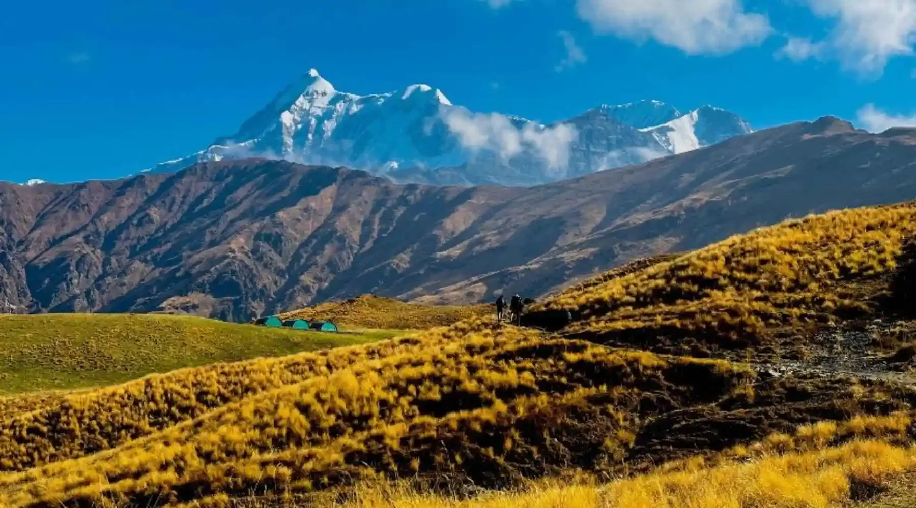
The hardest climbing day. A brutal, near-vertical ascent through incredibly dense, dark oak forests. After 4-5 hours, you violently break through the tree line directly onto the staggering expanse of Ali Bugyal.
Key Landmarks
Staying At
Trek Ali Bugyal to Bedni Bugyal & Gehroli Patal
The apex day. A glorious, relatively flat walk from Ali Bugyal, over a ridge, to Bedni Bugyal. You spend hours walking directly towards the massive western face of Mt. Trishul. After visiting the Bedni Kund reflection lake, descend rapidly back into the tree line to camp at Gehroli Patal.
Key Landmarks
Staying At
Trek Gehroli Patal to Wan, Drive to Lohajung
A knee-jarring, steep descent from Gehroli Patal through ancient, massive Cypress trees down to the Neel Ganga river, then a short climb into Wan village. From Wan, board local jeeps for a 1-hour fast drive back to Lohajung.
Key Landmarks
Staying At
Drive Lohajung to Kathgodam
The long, winding drive back to the railway station, concluding the trek.
Key Landmarks
Trek Extensions & Add-ons
Roopkund Attempt
+3 DaysIf physically prepared, continue from Bedni up to Bhagwabasa and attempt the 15,700 ft ascent to the skeleton lake.
Also on this trek
Ready to book? Compare verified operators for Ali & Bedni Bugyal Trek — transparent pricing, no paid rankings.
Still deciding?
Compare routes side-by-side to find the perfect match for your fitness, dates, and budget.
Day by day, camp by camp. Send this to your group so everyone's on the same page.
Love this itinerary?
Find operators who follow this exact route with verified acclimatization days.
Find matching operators