Detailed Route
Kang Yatse 2 Peak Expedition Itinerary — Day by Day Route & Camps
11-day expedition through the iconic Markha Valley in Hemis National Park to the KY2 summit.
Standard RouteThis is the standard mountain pacing for this trek. Specific operators may add an acclimatization day or alter the starting point. Check individual operator schedules for their exact logistics.
Duration
11 Days
Total Distance
90 KM
Max Altitude
20,505 FT
Trek Type
Standard
Permits Required Before You Go
Permit Cost
Foreigner Process
Expedition visa setup required if going via recognized bodies, though basic IMF peak fees act as a blanket cover for most commercial teams.
Nearest Embassy Hub
New Delhi
Day by Day Breakdown
Arrive in Leh & Acclimatize
Do not exert. Altitude is already 3,500m. Rest mandatory.
Key Landmarks
Leh Acclimatization Walk
Short walk to Namgyal Tsemo monastery. SpO2 monitoring begins.
Drive to Chilling & Trek to Skiu
Drive ~2hrs to Chilling, then trek along the Zanskar River into the Markha Valley.
Key Landmarks
Reach Markha Village
Through the iconic canyon of the Markha Valley. Multiple stream crossings.
Key Landmarks
Reach Thachungtse
Landscape opens into wide alpine meadows. Kang Yatse first visible.
Key Landmarks
Reach Nimaling
Arrival at the high plateau at 4,700m. Short altitude hike in the afternoon.
Key Landmarks
Reach Kang Yatse II Base Camp
Approach the base of the peak. Technical gear briefing at camp.
Acclimatization & Technical Training
Crampon, ice-axe, and rope handling training on snow slopes above camp.
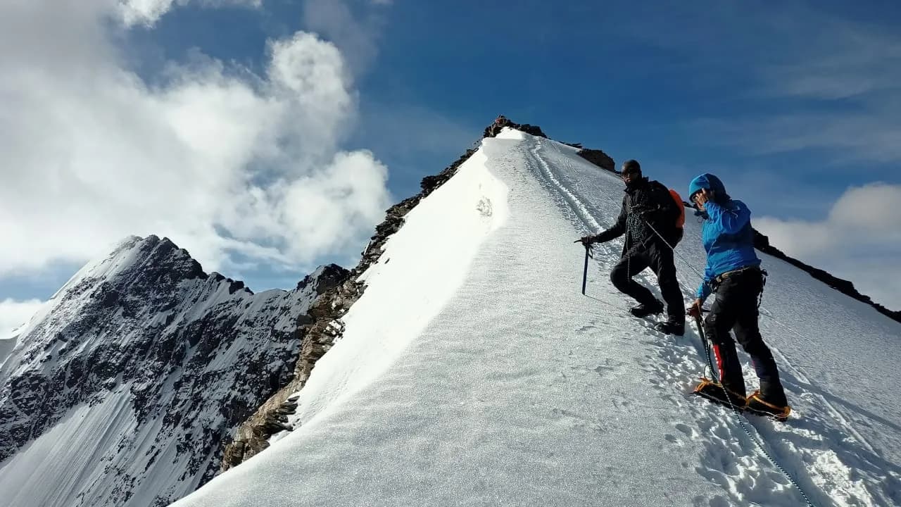
Summit Push & Return to Base Camp
Alpine start at 3 AM. Steep snow slope leads to the NW ridge. Summit at ~20,505ft. Return to Base Camp by afternoon.
Key Landmarks
Cross Kongmaru La & Drive to Leh
Descend via Kongmaru La (5,100m) or retrace Markha Valley. Drive to Leh.
Key Landmarks
Departure
End of expedition.
Trek Extensions & Add-ons
Suraj Tal Exploration
+0 DayOn Day 3, walk down to the nearby Suraj Tal, a stunning emerald green glacial lake right on the highway.
Also on this trek
Ready to book? Compare verified operators for Kang Yatse 2 Peak Expedition — transparent pricing, no paid rankings.
Still deciding?
Compare routes side-by-side to find the perfect match for your fitness, dates, and budget.
Day by day, camp by camp. Send this to your group so everyone's on the same page.
Love this itinerary?
Find operators who follow this exact route with verified acclimatization days.
Find matching operators