Essential Planning Guide
Kang La Pass Expedition — Complete Guide (2026)
Introduction
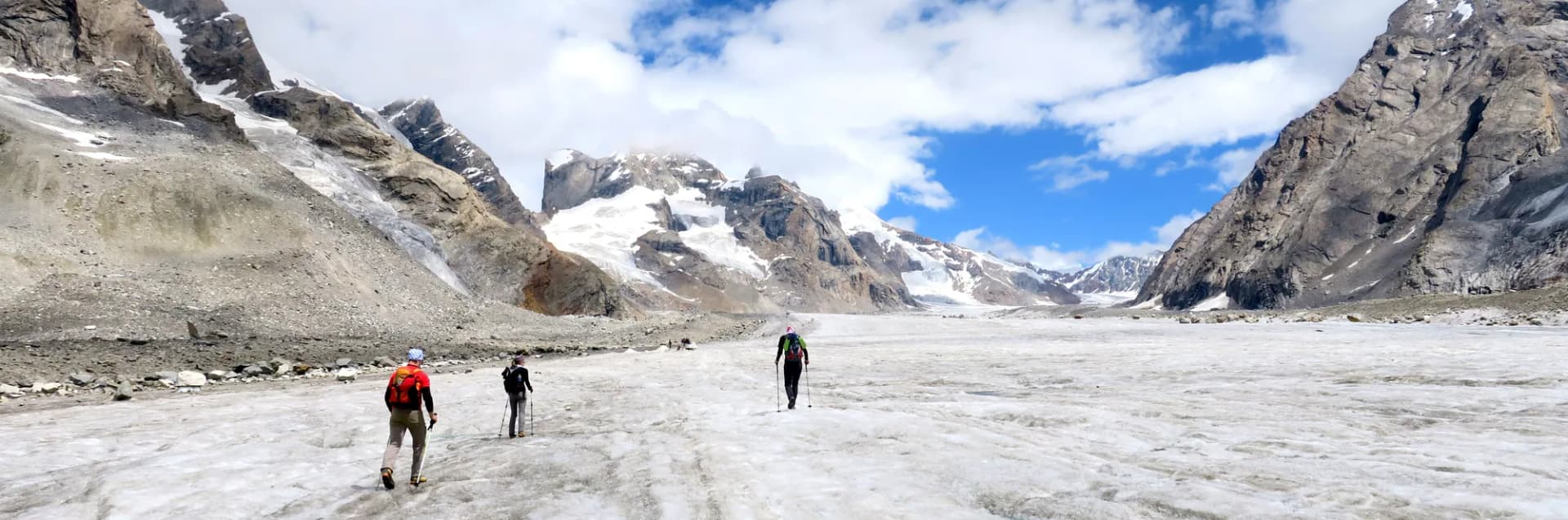
The Kang La (approximately 18,200 ft) is one of the highest trekking passes in Himachal Pradesh and among the most demanding trans-Himalayan crossovers available to non-mountaineers. It connects the Spiti valley's Pin valley tributary to the Lahaul valley's Tipling area — a crossing that has been used by nomadic shepherds and traders for centuries as the high summer route for inter-valley movement of livestock. The approach through the Pin valley from the Kaza side passes through some of the most raw and geological landscapes in the Indian Himalaya: bone-dry Spitian desert mountains, pin-striped stratified rock faces, and the extraordinary Pin River flowing in an impossible shade of turquoise through the brown lunar valley. The pass itself at 18,200 ft is a challenging technical high-altitude crossing that requires acclimatization, basic mountaineering awareness, and a competent guide with prior Kang La experience. The north face descent into Lahaul enters a completely different world — the greener, more vegetated Tipling valley with its traditional Lahauli Buddhist villages — completing the trans-Himalayan civilizational shift. This is one of the defining Himachal high-altitude expeditions.
Ready to book? Compare verified operators for Kang La Pass Expedition — transparent pricing, no paid rankings.
Quick Facts
Duration
Max Altitude
Difficulty
Best Time
Trek Distance
Trail Atmosphere
Stargazing
Class 1 Dark Sky
Scent Profile
Silence Level
~0 dB
Vertigo Factor
5 / 10
Primarily a joint & muscle impact and altitude exposure challenge
A demanding expedition with extreme joint & muscle impact, altitude exposure, and cumulative fatigue. This route will push every dimension of your physical and mental endurance to the limit.
Iconic Spots
Kang La Col (18,200 ft) Sunrise
Pin River Turquoise Canyon
Getting There
Route to Base
Fly to Kullu (Bhuntar) then drive Manali → Rohtang → Kaza (12+ hrs)
Or Shimla → Nako → Kaza (14 hrs)
June-October only
Base Village
Kaza, Spiti Valley (start) / Manali or Keylong (finish)
12,500 ft
Nearest Railhead
Jammu Tawi (JAT)
Nearest Airport
Kushok Bakula Rimpochee Airport, Leh (IXL)
Last ATM
Kaza (one basic ATM — carry substantial cash before entering Pin valley)
Nearest Medical Facility
Kaza CHC (before start) / Keylong (after). Emergency: Manali hospital.
Mobile Signal
Kaza and Mud (limited). Zero from Day 3-7.
Water Sources
Pin river on approach. Glacier melt streams. Carry reserves for summit day.
Charging
Kaza guesthouse only.
For Drivers
Road Condition
Spiti road is extreme — narrow, high passes, regular closures. SUV or shared jeep mandatory.
Kaza
Trail Culinary & Diet
Don't miss the Spitian tsampa (roasted barley porridge) at Mud village guesthouse before departure
Buy specialized diet items at Kaza (limited variety). Manali before travel for full expedition food prep.
The Content & Remote Hub
Top Vlog Spots
Video Calls
none
Est. 0 Mbps
UPI Reliability
1/10
The Snow Leopard Zone
Key point
The upper Pin valley approaching Kang La is a documented Snow Leopard regular territory. In August, local guides know specific rock formations above the high camp where fresh kills or tracks have been seen. A pre-dawn observation session from the high camp on Day 4 is the best global probability for a Snow Leopard daytime sighting.
Explore In Detail
Day by Day Itinerary
8-day route reaching 17,940ft. Covers 80km of varied terrain.
→ See full itinerary with altitude profileDifficulty & Fitness
Rated challenging. Pin valley desert trail, high moraine, glacier, 18,200 ft col traverse, Lahaul descent.
→ See difficulty breakdown and fitness guideCost & Pricing
Packages range from ₹35,000 to ₹60,000. Inclusions and hidden costs vary by operator tier.
→ See full cost breakdownPermits and Regulations
Pin Valley National Park entry permit (from DFO Kaza). Registration at Kaza SDM office. Satellite device mandatory. All 8-day self-sufficiency required inside the park.
Learn more about how we vet operators and ensure transparency on our why MountRoutes page.
Packing List
18,000 ft Pass Crossing
- 12-point crampons (mandatory — permanent glacier on approach from Pin valley side)
- Ice axe (self-arrest capability required on steep approach sections)
- 50m climbing rope for team roping on exposed sections near the col
8-Day Expedition Supplies
- 8-day complete food self-sufficiency (no resupply between Kaza and Tipling)
- Satellite phone or PLB (mandatory — no cellular signal for 7 days)
- Double-layer insulated mountaineering boots rated to -25C
Altitude Management
- Portable pulse oximeter (monitor blood oxygen from Day 3 onwards)
- Diamox (acetazolamide) — consult doctor for correct dosage
- Dexamethasone injection in first aid kit (for severe AMS emergency)
Flora & Fauna
Flora
Fauna
The Kang La is called 'the white king's pass' in Spitian Tibetan Buddhist tradition — a crossing so high it is believed to be inhabited by mountain deities who test travelers for worthiness.
— Local folklore
Spiritual & Cultural Significance
The Kang La is a sacred high pass in Spitian Buddhist tradition. The Key Monastery at Kaza conducts blessings for pass-crossing travelers — strongly recommended.
🕐 Shrine Timings: Key Monastery — 6am to 6pm.
Temple Protocols
- •Receive Key Monastery blessing before departure
- •Clockwise circumambulation of chortens on approach
Frequently Asked Questions
Is Kang La technically a pass or a mountaineering peak?
Kang La is a trekking pass — it is crossed, not climbed. However, at 18,200 ft with glacier sections, it sits at the edge of what non-mountaineers can safely attempt.
What prior experience is recommended?
Prior completion of a 16,000 ft+ high pass trek (Hampta Pass level) with acclimatization. Prior glacier travel is strongly preferred.
Is Pin valley famous for anything else?
Yes — Pin valley is famous for the Snow Leopard. It is one of India's most reliable Snow Leopard viewing areas, though sightings are never guaranteed. The Pin Valley National Park (PVNP) is contiguous with Spiti valley.
Do I need permits for Pin Valley?
Pin Valley National Park entry permit required from the DFO office in Kaza. The pass crossing into Lahaul may require additional SDM registration at Kaza.
How cold is the pass at summit?
Even in August, the Kang La col at 18,200 ft can see temperatures of -10C to -18C at 4am when you need to cross. Wind chill below -25C is possible.
What is the glacier approach like?
The final 1,000-1,500 ft to the Kang La col is a sustained glacier/snowfield climb at 30-35 degrees. Crampons and ice axe are non-negotiable.
Can I see the Kang La from Kaza?
Not directly — it is in the inner Pin valley system. The approach from Kaza takes 2-3 days of trekking before the pass is visible.
How do I exit Lahaul after crossing?
Trek to Tipling village in Lahaul, then travel to the nearest motorable road and onward to Manali (or Keylong) by vehicle.
Is a guide absolutely essential?
Yes. The glacier approach and the descent on the Lahaul side are both navigationally complex. A Kaza/Spiti-based guide with specific Kang La experience is essential.
What time of year is best?
July-August only. June has unstable glacier. September risks autumn snow on the approach, which at 18,000 ft creates lethal conditions.
Other Expeditions Guides
Still deciding?
Compare routes side-by-side to find the perfect match for your fitness, dates, and budget.
Everything you need to know, in one place. Someone else in your group needs to see this.
Planning Kang La Pass Expedition?
Get route conditions, operator updates, and season windows before booking.
No spam. Only useful updates.
Ready to walk this route?
You’ve read the guide, now find the perfect local team to take you there. Compare our verified list of operators.
Compare verified operators